
Ahmar Mountains
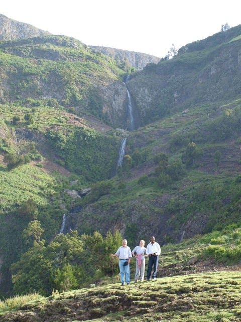
The Ahmar Mountains are a distinct mountain range located within the Ethiopian Highlands. Geographically, they are situated in the eastern part of the Oromia Region of Ethiopia. They lie in proximity to significant towns, being approximately 11 kilometers (7 miles) south of Dire Dawa and 12 kilometers (7 miles) from Jijiga by road.
The Ahmar Mountains are a significant mountain range within the Ethiopian Highlands, situated in the eastern Oromia Region of Ethiopia. These mountains are characterized by their semi-desert ecology and notable rock formations, playing a crucial role as the origin for important rivers like the Jubba and Shabelle.
Key Facts
- ›Located in the eastern Oromia Region of Ethiopia.
- ›Part of the Ethiopian Highlands.
- ›Average elevation of 2,965 meters (9,728 ft).
- ›Features a semi-desert ecology.
- ›Source of the Jubba and Shabelle rivers.
- ›Mentioned by explorer Richard F. Burton in 1854.
Ethiopia
Semi-Desert
Jubba River, Shabelle River
About Ahmar Mountains
The Ahmar Mountains
The Ahmar Mountains are a notable mountain range situated within the Ethiopian Highlands, specifically in the eastern Oromia Region of Ethiopia. This range is characterized by its semi-desert ecology and the presence of numerous rock formations. A significant aspect of the Ahmar Mountains is their role as the origin point for major rivers, including the Jubba and the Shabelle.
Geography and Climate
The average elevation of the Ahmar Mountains stands at 2,965 meters (9,728 ft) above sea level. This considerable height influences the local climate, with higher elevations experiencing temperatures that are, on average, 10 °C (50 °F) cooler than lower areas, both during the day and at night. Nighttime temperatures typically drop to around 10–12 °C (50–53 °F). The ecological zone is classified as semi-desert.
Historical Mentions
The Ahmar Mountains have a place in historical exploration narratives. The British explorer Richard F. Burton documented the range in his journals. In January 1854, Burton's party traveled along the northern base of the Ahmar Mountains as part of their expedition towards the city of Harar.
Source: Wikipedia ↗
Frequently Asked Questions
Where are the Ahmar Mountains located?
The Ahmar Mountains are situated in the eastern Oromia Region of Ethiopia, as part of the larger Ethiopian Highlands. They lie approximately 11 km south of Dire Dawa and 12 km from Jijiga by road.
What is the average elevation of the Ahmar Mountains?
The Ahmar Mountains have an average elevation of 2,965 meters (9,728 ft) above sea level. This elevation significantly influences the temperature within the range.
What is the climate and ecology of the Ahmar Mountains?
The ecology of the Ahmar Mountains is described as semi-desert. Elevation is the primary factor determining temperature, with higher areas being considerably cooler.
Which major rivers originate in the Ahmar Mountains?
Two significant rivers, the Jubba and the Shabelle, have their origins within the Ahmar Mountains. These rivers are vital water sources for the surrounding regions.
Has the Ahmar Mountains been noted by historical explorers?
Yes, the Ahmar Mountains were mentioned by the British explorer Richard F. Burton. His party traveled along the northern base of the range in January 1854 on their journey to Harar.