
Grassy Cove
Grassy Cove is a significant karst formation located in Cumberland County, Tennessee, recognized as a National Natural Landmark. This enclosed valley showcases extensive limestone dissolution features, including numerous caves and underground streams, and holds historical importance as a resource for saltpeter during wartime and as an early settlement area.
Key Facts
- ›Grassy Cove is a large sinkhole with a watershed area of approximately 33.18 km² and a sinkhole area of about 13.31 km².
- ›Its depth is recorded at approximately 39.97 meters (131.1 ft), and its major axis spans 7.67 km (4.77 MI).
- ›The valley is drained by underground streams, with Grassy Cove Creek flowing into MILL Cave and eventually reemerging at the head of the Sequatchie Valley.
- ›Grassy Cove Saltpeter Cave is the sixteenth longest cave in Tennessee and one of the 100 longest in the United States.
- ›Early settlers arrived in 1801, establishing one of the first congregations in the Cumberland Plateau region.
- ›The caves within Grassy Cove were a crucial source of saltpeter for gunpowder during the War of 1812 and the CIVIL War.

National Natural Landmark Designation, Extensive Karst Formations, Numerous Caves, Underground Drainage Systems, Saltpeter Mining History
Freshwater
About Grassy Cove
Grassy Cove is a notable enclosed valley situated in Cumberland County, Tennessee, renowned for its extensive karst formations. Recognized as a National Natural Landmark, this geological area showcases the powerful effects of limestone dissolution, resulting in a landscape dotted with numerous caves and a complex underground drainage system. The valley's formation is rooted in ancient geological processes, beginning with the uplift of an anticline during the Paleozoic era, followed by erosion that exposed soluble limestone layers during the Mesozoic era.
Geology and Hydrology
The valley is naturally contained by the surrounding mountains: Brady Mountain to the west, Bear Den Mountain to the east, and Black Mountain to the north, with Hinch Mountain, the county's highest point, to the south. Grassy Cove sits at an elevation of over 1,500 feet, significantly higher than the adjacent Sequatchie Valley. Its drainage is entirely subterranean; the main waterway, Grassy Cove Creek, flows northward before disappearing into Mill Cave. Dye tracing has revealed that this water travels south through a cave network, eventually resurfacing at Devilstep Hollow Cave, where it forms the headwaters of the Sequatchie River. The sinkhole itself is substantial, with a watershed area of approximately 33.18 km², a sinkhole area of 13.31 km², and a depth of nearly 40 meters (131.1 ft).
Historical Significance
Grassy Cove played a crucial role in American history, particularly during periods of conflict. The caves within the cove served as an invaluable source of saltpeter, a key ingredient in gunpowder, during both the War of 1812 and the American Civil War. Early settlers, who began arriving in 1801, found the valley floor cleared and covered in high grass, which led to its distinctive name. These early inhabitants established the Grassy Cove United Methodist Church, one of the first congregations in the Cumberland Plateau region. Artifacts found by early farmers suggest the presence of Native American inhabitants during prehistoric times. Legends also persist, such as the tale of a petrified Confederate soldier found in a cave after the Civil War, whose story is intertwined with local folklore and the history of the Grassy Cove Methodist Cemetery.
Modern Access and Exploration
Today, Grassy Cove is traversed by Tennessee State Route 68, providing its primary road access. The Justin P. Wilson Cumberland Trail State Park includes a 15-mile "Grassy Cove Segment" that offers hiking opportunities along the crests of Black Mountain and Brady Mountain, allowing visitors to experience the natural beauty and geological features of the area. The extensive cave systems, including the notable Grassy Cove Saltpeter Cave, continue to be a focus for speleological research and exploration.
Source: Wikipedia ↗
Frequently Asked Questions
What is Grassy Cove?
Grassy Cove is an enclosed valley in Cumberland County, Tennessee, characterized by its significant karst formations, including numerous caves and underground drainage systems. It is recognized as a National Natural Landmark due to its geological importance.
Where is Grassy Cove located?
Grassy Cove is situated atop the Cumberland Plateau in Tennessee. It lies approximately 5 miles (8.0 km) east of Crossville and 5 miles (8.0 km) west of the Walden Ridge escarpment. Tennessee State Route 68 provides the main road access.
What is the geology of Grassy Cove?
Grassy Cove is a large sinkhole formed by the dissolution of soluble Mississippian-aged limestone layers. It is part of an anticline that was uplifted during the Paleozoic era. The valley is surrounded by mountains and drains entirely through underground streams.
What is the historical significance of Grassy Cove?
Historically, Grassy Cove's caves were vital sources of saltpeter for gunpowder manufacturing during the War of 1812 and the Civil War. It was also an early settlement area, with the first settlers arriving in 1801.
Are there any notable caves in Grassy Cove?
Yes, Grassy Cove is home to several significant caves. Grassy Cove Saltpeter Cave is the sixteenth longest cave in Tennessee and one of the 100 longest in the United States. Other caves include Mill Cave, Windlass Cave, Bristow Cave, and Kelly Saltpetre Cave.
What is the connection between Grassy Cove and the Sequatchie Valley?
Grassy Cove is geologically related to the Sequatchie Valley, both being formed by limestone dissolution. Grassy Cove is essentially a sinkhole that has not yet fully coalesced with the larger Sequatchie Valley. Grassy Cove Creek's underground flow eventually emerges at the head of the Sequatchie Valley.
Related Sinkholes

Big Basin Prairie Preserve
The Big Basin Prairie Preserve in Kansas encompasses a significant sinkhole system, most notably the mile-wide Big Basin and the water-filled St. Jacob's Well. These geological features, formed by sinkhole activity, are historically notable as resting places for the Northern Cheyenne and landmarks for cattle drives. The preserve is a designated National Natural Landmark, managed to protect its unique landscape and wildlife.
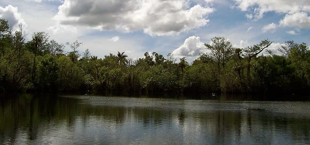
Deep Lake (Florida)
Deep Lake is a natural sinkhole located within Florida's Big Cypress National Preserve. It is geologically significant as the deepest lake south of Lake Okeechobee and one of the deepest in the entire state, forming the namesake for the surrounding community and a nearby swamp strand.

Devil's Millhopper Geological State Park
Devil's Millhopper Geological State Park features a massive sinkhole in Florida, notable for its exposed limestone layers and the unique ecological environments it supports. The sinkhole's formation through limestone dissolution has created a dramatic geological record, making it a significant site for scientific study and public appreciation of karst topography.