
Fish River Canyon
River Canyon·Namibia·Fish River·gneiss
The Fish River Canyon, located in southern Namibia, is the largest canyon in Africa and the second most visited tourist attraction in the country. This immense geological feature was primarily formed by river erosion over millions of years, with its current deep, meandering system shaped by continental drift and subsequent uplift of the African continent. It is renowned for its dramatic scale, challenging hiking trail, and the stark beauty of its arid landscape.
Key Facts
- ›It is approximately 160 kilometers (100 MI) long, up to 27 km wide, and nearly 550 meters deep.
- ›The canyon's formation involved initial erosion along a north-south graben followed by deeper carving into metamorphic rocks after continental separation and continental uplift.
- ›The Fish River, the longest interior river in Namibia, flows intermittently, typically flooding in late summer and forming pools for the rest of the year.
- ›The Fish River Canyon hiking trail is an 88-kilometer trek usually completed in 5 days.
- ›Permits for hiking are strictly regulated and only issued between May 1 and September 15 due to flood risks and extreme summer heat.
- ›The canyon is part of the ǀAi-ǀAis/Richtersveld Transfrontier Park, with some areas privately owned.

Visrivier Canyon, Visrivier Kuil, Fischfluss Canyon
River Erosion, Tectonic Activity, Continental Drift, Glaciation
Gigantic Ravine, Chain of Long Narrow Pools, Hot Springs Resort of ǀAi-ǀAis, Upper and Lower Canyon Sections, Sulphur Springs, Three Sisters, Barble Pools, German Soldier's Grave
Hardy Drought-Resistant Plants
About Fish River Canyon
The Fish River Canyon, also known by its Afrikaans names Visrivier Canyon or Visrivier Kuil and German name Fischfluss Canyon, is a colossal natural wonder located in the southern reaches of Namibia. It holds the distinction of being the largest canyon on the African continent and is the second most frequented tourist destination within Namibia. The canyon presents a breathtakingly vast ravine, stretching approximately 160 kilometers (100 miles) in length, with widths reaching up to 27 kilometers and depths nearing 550 meters.
Geological Formation
The genesis of the Fish River Canyon is a story etched in deep time, primarily sculpted by the erosive power of the Fish River, which is the longest interior river in Namibia. The landscape it traverses is a plateau characterized by dry, stony terrain sparsely adorned with resilient, drought-resistant flora. The river itself flows intermittently, typically swelling with floods in the late summer months, while at other times of the year, it recedes into a series of long, narrow pools. Geologically, the canyon's formation was a multi-stage process. Initial erosion occurred along a north-south graben, a lowered area formed by plate tectonics approximately 650 million years ago. This facilitated the ancient Fish River's flow and the eventual erosion of a flat plain, forming the upper canyon. Further deepening occurred during a period of glaciation around 300 million years ago, part of the Karoo Ice Age. A significant shift took place about 60 million years ago with the separation of South America and Africa due to continental drift. This event caused Africa to rise substantially, increasing the gradient of the Fish River. This enhanced gradient empowered the river to carve the lower canyon into the formidable, hard gneisses, establishing the deeply twisting and meandering system that defines the canyon today.
The Hiking Experience
One of the most compelling reasons for visiting the Fish River Canyon is its renowned 88-kilometer hiking trail, which is considered one of the premier hiking routes in Southern Africa. The sheer scale and ruggedness of the terrain attract adventurers from across the globe. This trek typically takes about five days to complete, leading hikers through the heart of the canyon to the ǀAi-ǀAis hot springs resort. The trail is largely unmarked, allowing hikers considerable freedom to navigate and determine their own pace, though they must be entirely self-sufficient, carrying all necessary provisions and supplies. Open fires are prohibited along the trail. Due to the potential for extreme weather, including flash floods, and the intense summer heat (which can reach 48°C), permits for hiking are exclusively issued between May 1 and September 15. A permit is mandatory for groups, requiring a minimum of three and a maximum of 30 participants, with all hikers needing to be over 12 years of age and possess a medical fitness certificate.
Tourism and Access
Public access to the canyon's most scenic viewpoints is available near Hobas, a campsite located about 70 kilometers north of ǀAi-ǀAis. This section of the canyon is integrated into the ǀAi-ǀAis/Richtersveld Transfrontier Park, a protected area, while other portions are under private ownership. Hobas serves as a hub, housing offices for the Ministry of Environment and Tourism and Namibia Wildlife Resorts, along with a small shop offering basic necessities and curios. Camping facilities are available at Hobas. The trail concludes at ǀAi-ǀAis, offering more extensive accommodation options, including hotel rooms, chalets, and camping grounds. A shuttle service connects Hobas and ǀAi-ǀAis, which should be booked in advance.
Trail Running and Events
Beyond hiking, the Fish River Canyon has also become a venue for challenging trail running events. Documented running attempts began in the early 1990s, with significant achievements in completing the trail in considerably shorter times than hiking. This has evolved into the annual Fish River Canyon Ultra Marathon, which commenced in 2011. This demanding race follows much of the hiking trail, often involving a steep descent from the canyon rim to the river level and then traversing the riverbed to ǀAi-ǀAis. Competitors must be self-sufficient, carrying all their food and survival gear. The extreme heat and rugged terrain make it one of the toughest environments for endurance athletes, a sentiment echoed by many participants who describe it as one of the most beautiful yet harshest places they have experienced.
Source: Wikipedia ↗
Frequently Asked Questions
How was the Fish River Canyon formed?
The canyon's formation began with plate movement creating a graben, allowing an ancient river to erode a flat plain. Later, continental drift and the subsequent uplift of Africa increased the river's gradient, enabling it to carve the deep, meandering lower canyon into hard gneisses.
What are the main geological features of the Fish River Canyon?
The canyon consists of an upper section where erosion was slowed by hard gneiss bedrock and a lower section formed after erosion penetrated these solid metamorphic rocks. The walls display horizontal dolomite strata and metamorphic rocks, showcasing millions of years of geological activity.
What activities can I do at the Fish River Canyon?
The most popular activity is the Fish River Canyon hiking trail, an 88-kilometer trek that typically takes five days. Trail running is also a significant activity, with an annual Ultra Marathon held in the canyon. Public viewpoints near Hobas offer scenic vistas.
When is the best time to visit the Fish River Canyon for hiking?
Permits for hiking are only issued between May 1 and September 15. This period avoids the risk of flash floods and the extreme heat of summer, which can reach up to 48°C during the day.
What are the access points and facilities for visitors?
Public viewpoints are accessible near Hobas, which also serves as a campsite and houses Ministry offices. The hiking trail ends at ǀAi-ǀAis, a resort with accommodation options. A shuttle service operates between Hobas and ǀAi-ǀAis.
Are there any specific permits or requirements for hiking the Fish River Canyon?
Yes, hiking permits are required and must be obtained from Namibia Wildlife Resorts for groups of 3 to 30 people. All hikers must be over 12 years old and present a medical fitness certificate.
What is the wildlife like in the Fish River Canyon?
The canyon's plateau is sparsely covered with hardy, drought-resistant plants. While specific wildlife is not detailed, the mention of game trails suggests some animal presence, though the environment is described as arid and stony.
What are the conditions like during the hiking trail?
The weather is typically mild, with temperatures ranging between 5°C and 30°C and low humidity. However, hikers must be prepared for occasional extreme weather like flash floods, stormy winds, and rain. There are no amenities on the trail, and hikers must carry all their supplies.
Related Canyons
Mågålaupet Gorge
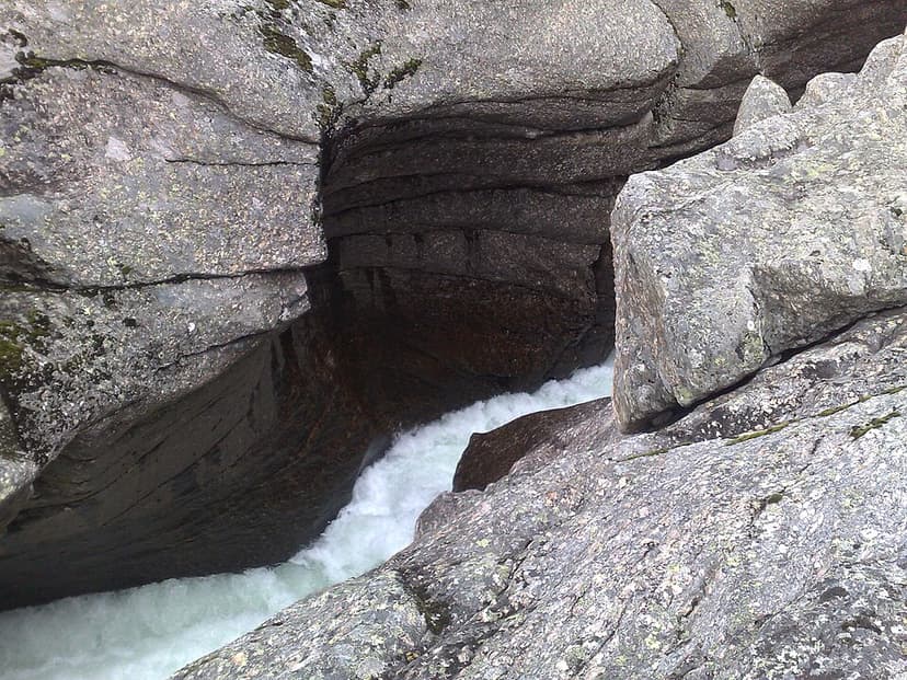
Mågålaupet Gorge is a striking 100-meter long, zigzag-shaped canyon carved by the river Driva in Oppdal Municipality, Norway. Its formation is attributed to the continuous erosion and the development of giant's kettles by the river since the last ice age, primarily in hard gneiss bedrock. The gorge is notable for its extreme narrowness, measuring just 1.5 meters at its tightest point.

Mianus River Gorge
The Mianus River Gorge is a nature preserve in Bedford, New York, recognized as a National Natural Landmark for its old-growth hemlock forest and the gorge itself. Formed by streams during glacial retreat, the gorge showcases diverse bedrock types and is managed by Mianus River Gorge, Inc. in conjunction with The Nature Conservancy.

Barron Gorge
Barron Gorge is a dramatic gorge located in Queensland, Australia, carved by the Barron River as it descends the eastern escarpment of the Atherton Tablelands. Renowned for its spectacular waterfalls, particularly the Barron Falls which cascade 265 meters, the gorge is a significant natural landmark within the Wet Tropics World Heritage Area. Historically important for Indigenous peoples and later for hydroelectric power generation, it is now a protected national park and a popular tourist destination.