
Ravine des Casoars
Ravine des Casoars, meaning 'Ravine of the Cassowaries,' is a steep-sided gorge on the west coast of Kangaroo Island, South Australia. Formed by erosion, it features a unique geological landscape where a creek and lagoon meet the sea, with ancient Aboriginal sites and evidence of early European exploration.
Key Facts
- ›Located on the west coast of Kangaroo Island, South Australia.
- ›Approximately 3 kilometers (1.9 miles) in length with a maximum depth of 100 meters (330 feet).
- ›Drains a catchment area of approximately 9,600 hectares (24,000 acres).
- ›Meets the sea via a gap in the coastline, featuring a beach and sand dune.
- ›Contains caves with geological formations like flowstone and stalactites, and historically housed a little penguin rookery.
- ›Has been identified as an Aboriginal site with evidence of presence dating back approximately 7,500 years.

Ravine of the Cassowaries
Erosion
Caves With Flowstone and Stalactites, Little Penguin Rookery, Beach and Sand Dune, Creek and Lagoon
Little Penguins
About Ravine des Casoars
Ravine des Casoars, translating to 'Ravine of the Cassowaries,' is a significant geological and historical site located on the west coast of Kangaroo Island, South Australia. This steep-sided gorge stretches for approximately 3 kilometers (1.9 miles) with a maximum depth of 100 meters (330 feet) and drains a substantial catchment area of about 9,600 hectares (24,000 acres).
Geological Features
The ravine exhibits a dramatic meeting of land and sea. It opens to the ocean via a 120-meter (390-foot) gap in the coastline, where a beach and an extensive sand dune extend inland up to 600 meters (2,000 feet) and an elevation of about 100 meters (330 feet). Contrasting this, a creek and an associated lagoon flow along the northern side of the ravine. The base of the northern cliffs has been eroded, creating caves. Two caves, 'K5' and 'K16,' are documented, with 'K5' historically housing a little penguin rookery and featuring formations like flowstone, while 'K16' is noted for its length and decorations of rimstone and stalactites.
Human History and Significance
Ravine des Casoars holds deep historical importance, evidenced by the identification of Aboriginal sites within its vicinity. Archaeological excavations suggest a human presence in the western end of Kangaroo Island dating back approximately 7,500 years BP, with evidence extending as recently as 350–400 years BP. The first Europeans known to have visited the ravine were members of the Baudin expedition between 1800 and 1803. Baudin is credited with naming the ravine, reportedly after observing what he mistook for cassowaries, but which were likely the now-extinct Kangaroo Island Emu. A reported inscription of Baudin's name and other French names within a coastal cave has been a point of interest, though its current location remains unconfirmed, possibly due to sand movement and changes in the cave floor.
Protected Area
Today, Ravine des Casoars is situated within the Ravine des Casoars Wilderness Protection Area, ensuring the preservation of its unique natural and historical values.
Source: Wikipedia ↗
Frequently Asked Questions
What is the geological formation of Ravine des Casoars?
Ravine des Casoars is a steep-sided valley, essentially a gorge, carved by erosion. It features a creek and lagoon on one side and a beach and sand dune on the other where it meets the sea. The base of the northern cliffs shows signs of erosion leading to cave formation.
What is the historical significance of Ravine des Casoars?
The ravine is significant for its documented Aboriginal sites, with evidence suggesting human presence in the area for thousands of years. It was also visited by the Baudin expedition in the early 19th century, who are believed to have named it after mistaking emus for cassowaries.
Are there any notable features within the ravine?
Yes, the ravine contains caves along the northern cliff base, some of which exhibit decorative geological features like flowstone and stalactites. Historically, one cave, 'K5,' was noted for accommodating a little penguin rookery.
Is Ravine des Casoars a protected area?
Yes, Ravine des Casoars is located within a protected area of the same name, the Ravine des Casoars Wilderness Protection Area, on Kangaroo Island.
What is the origin of the name Ravine des Casoars?
The name 'Ravine des Casoars' translates to 'Ravine of the Cassowaries.' It was reportedly named by members of the Baudin expedition who mistook the then-present Kangaroo Island Emu for the cassowary.
Related Canyons

Barron Gorge
Barron Gorge is a dramatic gorge located in Queensland, Australia, carved by the Barron River as it descends the eastern escarpment of the Atherton Tablelands. Renowned for its spectacular waterfalls, particularly the Barron Falls which cascade 265 meters, the gorge is a significant natural landmark within the Wet Tropics World Heritage Area. Historically important for Indigenous peoples and later for hydroelectric power generation, it is now a protected national park and a popular tourist destination.
Bass Canyon
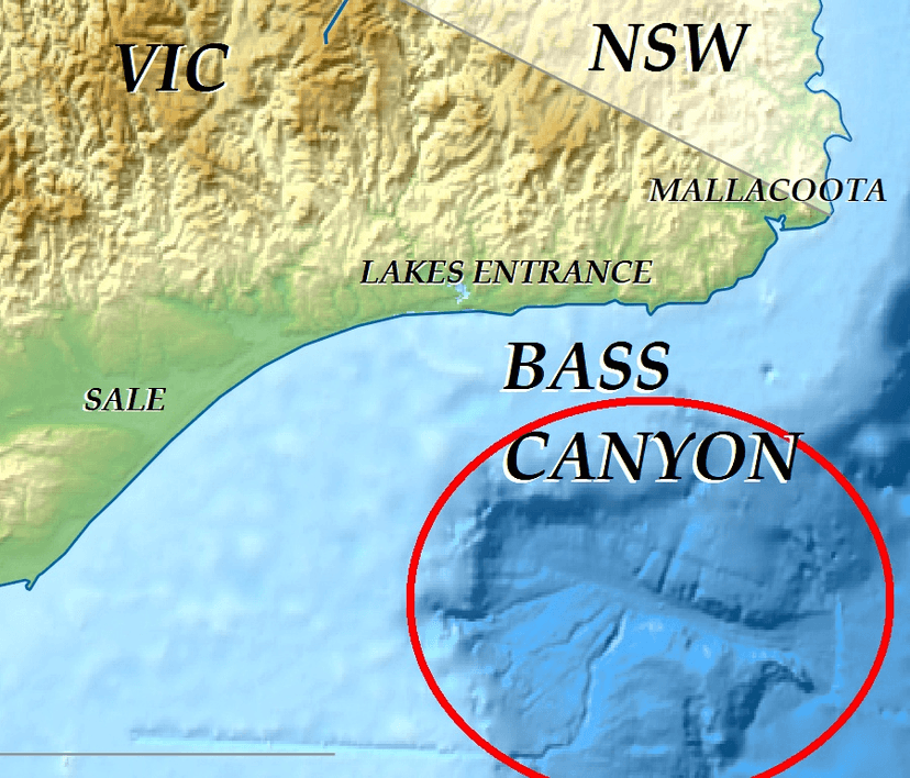
Bass Canyon is a vast submarine canyon system located off the coast of eastern Victoria, Australia, in Bass Strait. It is one of the deepest and largest submarine canyons globally, extending over 160 kilometers and reaching depths exceeding 3,000 meters. Its formation is attributed to complex erosional processes involving sediment gravity flows and tectonic activity, with evidence suggesting it has evolved over millions of years.

Capertee Valley
Capertee Valley, located in New South Wales, Australia, is recognized as the world's widest canyon, surpassing even the Grand Canyon in its breadth. Carved by the Capertee River over millions of years through Permian and Triassic sedimentary rocks, the valley features dramatic sandstone cliffs and limestone formations. It holds significant ecological importance as a prime breeding site for endangered bird species and is a popular destination for birdwatching and bushwalking.