
Atuel Canyon
River Canyon·Argentina·Atuel River
The Atuel Canyon is a significant geological feature carved by the Atuel River in the Mendoza province of Argentina. Formed by river erosion, it is characterized by a deep gorge and rapids that make it a popular destination for water sports and tourism. The canyon plays a crucial role in hydroelectric power generation through a series of dams and reservoirs.
Key Facts
- ›The Atuel Canyon is approximately 60 kilometers (37 miles) long.
- ›The river's elevation drops from 1,250 to 700 meters (4,100 to 2,300 ft) within the canyon.
- ›It is a key area for hydroelectric power generation with four power stations located along its course.
- ›The canyon features rapids classified between Class II (novice) and Class IV (advanced).
- ›The Atuel River is the longest river in the Mendoza province.

River Erosion
Rapids, Hydroelectric Power Stations, El Nihuil Dam Reservoir
About Atuel Canyon
The Atuel Canyon is a prominent natural and recreational area located in the Mendoza province of Argentina, carved by the Atuel River. This gorge is approximately 60 kilometers (37 miles) in length, with the river's elevation dropping significantly from 1,250 meters (4,100 ft) to 700 meters (2,300 ft) above sea level along its course. The formation of the canyon is a result of the Atuel River's erosive power over time.
Hydroelectric Significance
A critical aspect of the Atuel Canyon is its role in hydroelectric power generation. Before entering the canyon, the Atuel River is dammed to form the El Nihuil reservoir. Downstream, the canyon's steep gradient is harnessed by a chain of four hydroelectric power stations: Nihuil I, II, III, and IV. A substantial portion of the river's flow in this section is channeled through tunnels within the mountains to these facilities, underscoring the canyon's importance for regional energy supply.
Tourism and Recreation
The Atuel Canyon is a major tourist attraction, drawing visitors for its scenic beauty and adventurous activities. The river's rapids are a prime draw, offering opportunities for rafting and canoeing. These rapids are classified on the International Scale of River Difficulty, ranging from Class II (suitable for novices) to Class IV (challenging for advanced paddlers). The surrounding area is equipped with various tourist amenities, including hotels, camping sites, and country clubs, making it a comprehensive destination for both nature enthusiasts and adventure seekers.
Source: Wikipedia ↗
Frequently Asked Questions
What is the Atuel Canyon?
The Atuel Canyon is a gorge formed by the Atuel River in the Mendoza province of Argentina. It is known for its rapids and is a significant site for hydroelectric power generation.
What activities can be done in the Atuel Canyon?
The canyon is a major tourist attraction offering activities such as rafting and canoeing on its rapids. The rapids are rated from Class II (novice) to Class IV (advanced) on the International Scale of River Difficulty.
Where is the Atuel Canyon located?
The Atuel Canyon is primarily located in the south of the Argentine province of Mendoza, near the city of San Rafael. The Atuel River itself also extends into the La Pampa province.
What geological processes formed the Atuel Canyon?
The Atuel Canyon was formed by the erosive power of the Atuel River. The river becomes entrenched in a canyon after passing through the El Nihuil Dam reservoir.
What is the significance of the Atuel Canyon for energy generation?
The Atuel Canyon is vital for hydroelectric power, with four power stations (Nihuil I, II, III, and IV) utilizing the river's significant elevation drop. Most of the river's flow in this section is redirected through tunnels to these facilities.
Related Canyons
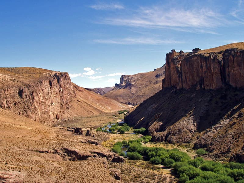
Pinturas River Canyon
The Pinturas River Canyon, also known as Cañadón Río Pinturas, is a significant geological formation in Santa Cruz, Argentina, carved by the Pinturas River. Its walls are composed of Jurassic-era volcanic rocks, primarily ignimbrite from the Chon Aike Formation, and the canyon is renowned for its ancient rock art, most notably at the Cueva de las Manos, which attracts considerable tourism.

Aare Gorge
The Aare Gorge is a dramatic canyon carved through a limestone ridge near Meiringen, Switzerland, by the Aare River. Formed approximately 10,000 years ago by glacial meltwater erosion at the end of the Ice Age, this narrow passage features sheer cliffs and is a significant tourist attraction, partly due to its proximity to the famous Reichenbach Falls.

Agawa Canyon
Agawa Canyon is a shallow canyon in Ontario, Canada, formed approximately 1.2 billion years ago by faulting and later carved by the Agawa River. It is now a popular tourist destination within the Agawa Canyon Wilderness Park, accessible by train or hiking trail, and is renowned for its natural beauty, waterfalls, and seasonal foliage.