
Blackhand Gorge
River Canyon·North America·Licking River·Sandstone
Blackhand Gorge is a 4-mile-long sandstone formation in Licking County, Ohio, carved by the Licking River. Named for a prehistoric petroglyph of a black hand, the gorge has served as a vital transportation corridor for centuries, hosting canal boats, railroads, interurban cars, and automobiles. Designated an Ohio Nature Preserve in 1975, it preserves a unique geological and historical landscape.
Key Facts
- ›The gorge is approximately 6.4 km (4 miles) long.
- ›It is a sandstone formation carved by the Licking River.
- ›Designated an Ohio Nature Preserve in 1975, covering 387 ha (957 acres).
- ›Historically significant as a transportation route for canals, railroads, and interurban lines.
- ›Named after a prehistoric petroglyph of a black hand found on the cliff face.
- ›The Black Hand Sandstone is a resistant rock type also found in the Hocking Hills region.
River Erosion
Black Hand Petroglyph, Black Hand Sandstone Formations, Transportation History Corridor
About Blackhand Gorge
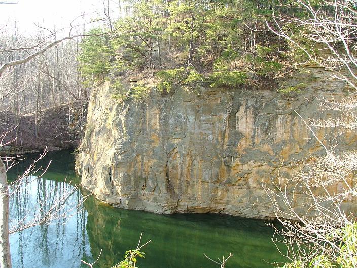
Blackhand Gorge is a significant geological and historical site located in Licking County, Ohio. This 4-mile-long (6.4 km) formation is carved by the Licking River through resistant sandstone. Its name originates from a prehistoric petroglyph of a black hand that was once visible on its cliff faces, a symbol believed to have signified peaceful passage for Native American tribes traveling to nearby flint pits.
Geological Significance
The gorge's walls are composed of Black Hand Sandstone, a durable rock that also forms the bedrock of the popular Hocking Hills region. The erosive power of the Licking River has sculpted this sandstone over millennia, creating the dramatic landscape of the gorge. While the original petroglyph was destroyed during the construction of the Ohio and Erie Canal in 1828, other carvings were recorded by early settlers before being lost to further development.
A Corridor Through Time
Blackhand Gorge has a rich history as a vital transportation corridor. From the early 19th century, it facilitated the movement of goods and people. The Ohio and Erie Canal utilized the gorge, requiring blasting to create a towpath. Later, the Central Ohio Railroad laid its tracks in 1850, carving "The Deep Cut" through solid rock. In the early 20th century, electric interurban lines also traversed the gorge, even necessitating the blasting of a tunnel. The construction of Dillon Dam in the mid-20th century altered the landscape and required the relocation of transportation routes.
Preservation and Access
In 1975, 957 acres (387 ha) of Blackhand Gorge were designated as an Ohio Nature Preserve, recognizing its unique natural and historical value. The preserve protects the geological formations and provides insight into Ohio's transportation history. While much of the original petroglyphic art is gone, the gorge itself remains a testament to the interplay between natural forces and human endeavors.
Source: Wikipedia ↗
Frequently Asked Questions
What is the origin of the name Blackhand Gorge?
The gorge is named after a prehistoric petroglyph, a black hand with spread fingers and part of a wrist, that was discovered on the cliff face by early settlers. Legends also describe a story where a severed hand became a permanent mark on the cliff.
What geological formations are found in Blackhand Gorge?
The gorge is primarily composed of Black Hand Sandstone, a resistant rock that forms its backbone. This sandstone has been shaped over time by the erosive power of the Licking River.
What historical transportation methods have utilized Blackhand Gorge?
Blackhand Gorge has been a significant transportation route throughout history. It has accommodated canal boats on the Ohio and Erie Canal, steam railroads like the Baltimore and Ohio, electric interurban cars, and modern automobiles.
What happened to the original Black Hand petroglyph?
The original petroglyph, which gave the gorge its name, was destroyed in 1828 during the construction of the Ohio and Erie Canal. Subsequent blasting for railways also removed other petroglyphs.
Is Blackhand Gorge a protected natural area?
Yes, 387 hectares (957 acres) of the gorge were designated as an Ohio Nature Preserve in 1975. This designation aims to protect its unique geological and ecological features.
Related Canyons
Breaks Canyon
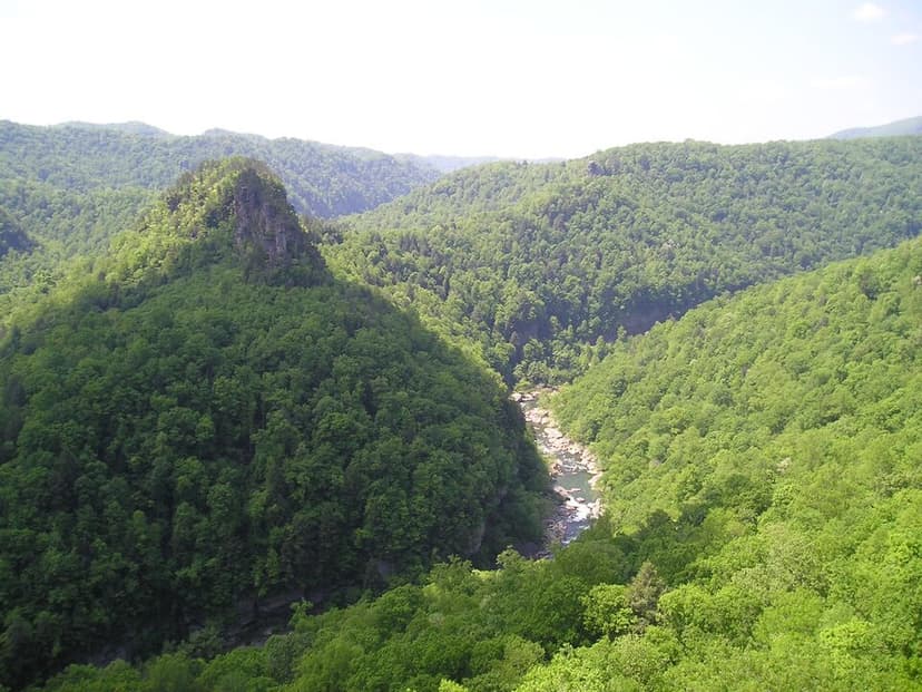
Breaks Canyon, often referred to as "the Breaks" and sometimes called the "Grand Canyon of the South," is a significant gorge carved by the Russell Fork River in southeastern Kentucky and southwestern Virginia. This natural wonder, formed over millions of years of erosion, is a prominent feature within Breaks Interstate Park, a unique bi-state park managed jointly by Virginia and Kentucky.

Canyon de Chelly
Canyon de Chelly National Monument, located in northeastern Arizona, preserves one of North America's longest continuously inhabited landscapes. Established in 1931, it protects the canyons and ruins of indigenous tribes, from the Ancestral Puebloans to the Navajo. The monument is unique as it is entirely owned and cooperatively managed by the Navajo Nation, with approximately 40 Navajo families residing within its boundaries.

Canyonlands National Park
Canyonlands National Park is a national park in southeastern Utah, celebrated for its dramatic landscape of canyons, mesas, and buttes carved by the Colorado and Green Rivers. Established in 1964, it is a testament to millions of years of geological processes, primarily erosion, and preserves a unique desert environment that was once home to Ancestral Puebloans. The park is a popular destination for recreation, offering rugged trails and challenging whitewater experiences, while also serving as a critical area for scientific study regarding climate change impacts on desert ecosystems.