
Breaks Canyon
River Canyon·North America·Russell Fork river·Sandstone
Breaks Canyon, often referred to as "the Breaks" and sometimes called the "Grand Canyon of the South," is a significant gorge carved by the Russell Fork River in southeastern Kentucky and southwestern Virginia. This natural wonder, formed over millions of years of erosion, is a prominent feature within Breaks Interstate Park, a unique bi-state park managed jointly by Virginia and Kentucky.
Key Facts
- ›Breaks Canyon is five miles long.
- ›The canyon's depth ranges from 830 to 1,600 feet (250 to 490 meters).
- ›It was formed by the Russell Fork river through millions of years of erosion.
- ›The area's geology includes sandstone, favored by rock climbers.
- ›The canyon is located within Breaks Interstate Park, a bi-state park covering 4,500 acres.
- ›Daniel Boone is credited with naming the area "the Breaks".
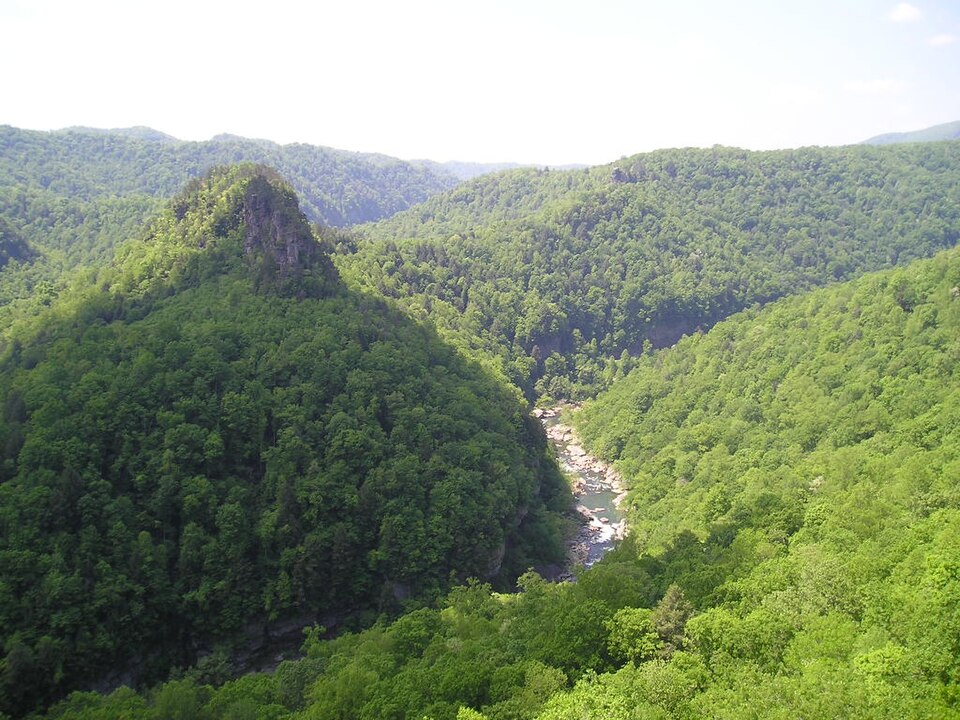
The Breaks, Grand Canyon of the South
River Erosion
Sandstone Formations
Rocky Mountain Elk
About Breaks Canyon
Breaks Canyon, commonly known as "the Breaks" and sometimes lauded as the "Grand Canyon of the South," is a significant geological formation located primarily within Breaks Interstate Park. This bi-state park is uniquely managed through an interstate compact between the states of Virginia and Kentucky, with land also situated within the Jefferson National Forest.
Formation and Geography
The canyon's dramatic landscape was sculpted over millions of years by the persistent erosive power of the Russell Fork River. This geological process carved through the rock, creating deep valleys and impressive cliffs. Breaks Canyon itself extends for approximately five miles and features a striking depth that ranges from 830 to 1,600 feet (250 to 490 meters). The surrounding geology includes sandstone formations, which are noted for their similarity to those found in the New River Gorge and are a draw for rock climbers.
Human History and Naming
Historically, the area served as a vital hunting ground for Indigenous peoples, including the Shawnee and Cherokee. The name "The Breaks" is attributed to American frontiersman Daniel Boone, who passed through the region in 1767 while searching for a westward route over Pine Mountain. The park also offers opportunities to see Rocky Mountain elk, which were reintroduced and have been sighted in the area for the first time since the 1800s.
Activities and Features
Breaks Interstate Park, encompassing 4,500 acres, provides a range of recreational activities. Visitors can explore numerous hiking trails, engage in fishing, and enjoy water sports such as paddle boating, canoeing, and hydro biking on Laurel Lake. The Russell Fork River is also popular for white-water rafting. The park features a lodge, cottages, and a campground, alongside a visitor center with exhibits on the area's natural and historical significance, a conference center with dining, and an amphitheater. Seasonal guided bus tours are available for elk viewing.
Source: Wikipedia ↗
Frequently Asked Questions
How was Breaks Canyon formed?
Breaks Canyon was formed by the Russell Fork river gradually carving through the rock over millions of years of erosion. This process created the spectacular valleys that characterize the gorge.
What activities are available at Breaks Canyon?
Visitors can enjoy hiking trails, fishing, paddle boating, canoeing, and hydro biking on Laurel Lake. White-water rafting on the Russell Fork is also a popular activity. Rock climbing is available on the canyon's sandstone walls.
Where is Breaks Canyon located?
Breaks Canyon is located within Breaks Interstate Park, which spans across southeastern Kentucky and southwestern Virginia. It is situated at the northeastern terminus of Pine Mountain.
What are the dimensions of Breaks Canyon?
The canyon is approximately five miles long. Its depth varies, ranging from 830 to 1,600 feet (250 to 490 meters).
Is Breaks Canyon a protected area?
Yes, Breaks Canyon is the main feature of Breaks Interstate Park, a bi-state state park managed jointly by Virginia and Kentucky. The park covers 4,500 acres and offers various recreational opportunities.
Related Canyons
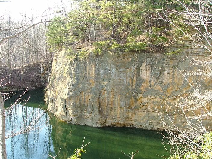
Blackhand Gorge
Blackhand Gorge is a 4-mile-long sandstone formation in Licking County, Ohio, carved by the Licking River. Named for a prehistoric petroglyph of a black hand, the gorge has served as a vital transportation corridor for centuries, hosting canal boats, railroads, interurban cars, and automobiles. Designated an Ohio Nature Preserve in 1975, it preserves a unique geological and historical landscape.

Canyon de Chelly
Canyon de Chelly National Monument, located in northeastern Arizona, preserves one of North America's longest continuously inhabited landscapes. Established in 1931, it protects the canyons and ruins of indigenous tribes, from the Ancestral Puebloans to the Navajo. The monument is unique as it is entirely owned and cooperatively managed by the Navajo Nation, with approximately 40 Navajo families residing within its boundaries.

Canyonlands National Park
Canyonlands National Park is a national park in southeastern Utah, celebrated for its dramatic landscape of canyons, mesas, and buttes carved by the Colorado and Green Rivers. Established in 1964, it is a testament to millions of years of geological processes, primarily erosion, and preserves a unique desert environment that was once home to Ancestral Puebloans. The park is a popular destination for recreation, offering rugged trails and challenging whitewater experiences, while also serving as a critical area for scientific study regarding climate change impacts on desert ecosystems.