
Buller Gorge
River Canyon·New Zealand·Buller River
The Buller Gorge is a deep canyon carved by the Buller River in the northwest of New Zealand's South Island. It is named after Charles Buller, a prominent figure in the New Zealand Company. The gorge features New Zealand's longest swingbridge and is traversed by State Highway 6 and a railway line.
Key Facts
- ›Located in the northwest of New Zealand's South Island.
- ›Carved by the Buller River.
- ›Features New Zealand's longest swingbridge, spanning 110 meters.
- ›State Highway 6 and the Stillwater - Westport Line railway pass through the gorge.
- ›Divided into Upper and Lower Buller Gorge sections by Land Information New Zealand.

River Erosion
New Zealand's Longest Swingbridge
Bush
About Buller Gorge
The Buller Gorge is a significant natural landmark located in the northwestern region of New Zealand's South Island. This deep canyon is carved by the powerful Buller River, which flows through it on its course between the towns of Murchison and Westport. Land Information New Zealand officially recognizes two distinct sections: the Upper Buller Gorge and the Lower Buller Gorge, reflecting the varied character of the canyon.
Formation and Geography
The primary geological force behind the formation of Buller Gorge is the relentless erosion by the Buller River over time. The canyon's depth and dramatic landscape are a testament to this ongoing natural process. State Highway 6 follows a route alongside the river, often at a considerable elevation above the water, providing scenic views of the gorge. Additionally, the Stillwater - Westport Line railway navigates through the gorge, highlighting its importance as a transportation corridor.
Notable Features and Activities
One of the most prominent features within Buller Gorge is New Zealand's longest swingbridge, an impressive structure spanning 110 meters (360 ft) across the Buller River. This bridge is a popular attraction, offering visitors a unique perspective of the gorge. The surrounding area also provides opportunities for adventure, including zip-line rides across the canyon and several accessible bush walks, allowing visitors to experience the natural beauty of the gorge up close.
Naming and Historical Context
The Buller Gorge and the river that defines it are named in honor of Charles Buller. He was a Member of Parliament in the United Kingdom during the early 1800s and served as a director of the New Zealand Company. This company, established with a royal charter, played a pivotal role in the early colonization efforts of New Zealand, making the name a direct link to the country's colonial history.
Source: Wikipedia ↗
Frequently Asked Questions
Where is Buller Gorge located?
Buller Gorge is situated in the northwest of the South Island of New Zealand. The Buller River flows through it between the towns of Murchison and Westport.
What is the significance of the name Buller Gorge?
The gorge and the river are named after Charles Buller, who was a Member of Parliament in the United Kingdom and a director of the New Zealand Company in the early 1800s. This company was instrumental in the colonization efforts of New Zealand.
What are some notable features or activities in Buller Gorge?
A significant feature is New Zealand's longest swingbridge, which spans the Buller River and is 110 meters long. The area also offers zip-line rides across the gorge and several short bush walks.
How is Buller Gorge traversed?
State Highway 6 runs alongside the river through the gorge, considerably above its level. The Stillwater - Westport Line railway also passes through the gorge.
Related Canyons

Cromwell Gorge
Cromwell Gorge is a steep gorge carved by the former Clutha River in New Zealand's Central Otago region. It winds between the Dunstan and Cairnmuir Mountains, historically significant for gold mining and fruit orchards. The gorge and parts of old Cromwell were flooded in the early 1990s to create Lake Dunstan behind the Clyde Dam.
Karangahake Gorge
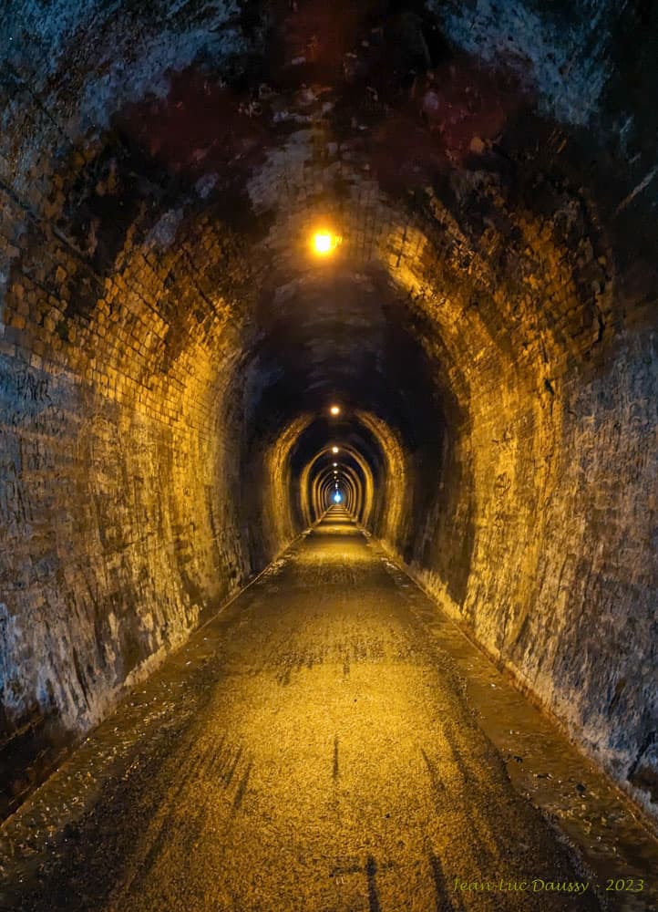
The Karangahake Gorge is a sharply winding canyon located between the Coromandel and Kaimai ranges in New Zealand's North Island. Carved by the Ohinemuri River, it was a significant site for gold mining from the 1880s to the 1950s, producing a substantial portion of New Zealand's gold output during its peak. Today, the gorge is a popular area for walking and cycling, with remnants of its mining past visible along its trails.

Karapoti Gorge
Karapoti Gorge is a narrow, bush-clad gorge in the Wellington Region of New Zealand, serving as an entrance to the Akatarawa Forest. The Akatarawa River West flows through it, and a road winds along its steep slopes, facilitating access for various recreational activities. It is notably the starting point for the annual Karapoti Classic mountain bike event.