
Karangahake Gorge
River Canyon·New Zealand·Ohinemuri River
The Karangahake Gorge is a sharply winding canyon located between the Coromandel and Kaimai ranges in New Zealand's North Island. Carved by the Ohinemuri River, it was a significant site for gold mining from the 1880s to the 1950s, producing a substantial portion of New Zealand's gold output during its peak. Today, the gorge is a popular area for walking and cycling, with remnants of its mining past visible along its trails.
Key Facts
- ›Located between the Coromandel and Kaimai ranges in New Zealand's North Island.
- ›Formed by the erosion of the Ohinemuri River.
- ›Historically a major gold mining area, particularly from the 1880s to the 1950s.
- ›Remains of mining infrastructure, such as the Talisman, Crown, and Woodstock stamping batteries, are notable features.
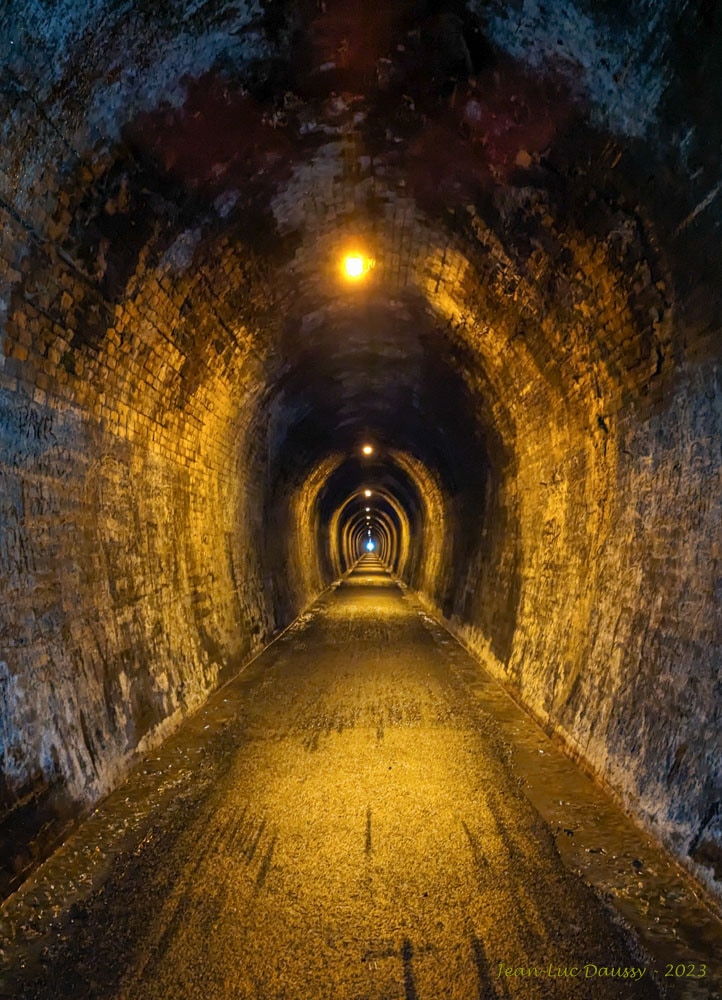
- ›The former East Coast Main Trunk Railway line through the gorge is now a walkway and cycleway, part of the Hauraki Rail Trail.
- ›Features include the 'Windows Walk' which passes through old gold mining tunnels.
River Erosion
- Talisman, Crown, and Woodstock Stamping Battery Remains
- Victoria Battery
- Old Gold Mining Tunnels
- Glowworms
- Cave Weta
- Hauraki Rail Trail Section
Glowworms, Cave Weta
Bush
About Karangahake Gorge
The Karangahake Gorge is a sharply winding canyon situated between the Coromandel and Kaimai ranges in the southern part of New Zealand's Coromandel Peninsula, within the North Island. This geologically significant area was carved by the Ohinemuri River, creating a dramatic landscape that has been shaped by both natural forces and human industry.
Mining History
The gorge is deeply connected to New Zealand's gold mining past. From roughly the 1880s to the 1950s, the area was a hive of mining activity, with its most productive years occurring around the turn of the 20th century. During this peak period, the Karangahake Gorge was responsible for producing 60 percent of the total gold extracted from New Zealand. Key remnants of this era include the Talisman, Crown, and Woodstock stamping battery sites, strategically located at the confluence of the Waitawheta and Ohinemuri rivers to harness water power. These batteries were used to crush ore from extensive tunnels dug into the steep mountainsides. The Victoria Battery, noted as one of the largest and most advanced of its time, was also a prominent feature.
Recreation and Modern Use
Today, the Karangahake Gorge serves as a popular destination for recreation and tourism. The former East Coast Main Trunk Railway line, which once passed through the gorge, has been transformed into a combined walkway and cycleway, forming a significant section of the Hauraki Rail Trail. This route offers visitors a chance to experience the natural beauty of the gorge and its historical context. Additionally, numerous walking tracks originate from the Karangahake Reserve car park, catering to various fitness levels and interests, with options ranging from 30 minutes to over two hours. A particularly notable walk is the 'Windows Walk,' which guides visitors through old gold mining tunnels of the Talisman Mine, crosses the Waitawheta River via a suspension bridge, and follows the path of an old bush tramway along the cliffs of the Waitawheta Gorge. These tunnels, some of which are safe to enter, are also home to glowworms and cave weta. The Woodstock Underground Pumphouse is another accessible historical site.
Source: Wikipedia ↗
Frequently Asked Questions
What geological processes formed the Karangahake Gorge?
The Karangahake Gorge was formed by the erosive power of the Ohinemuri River, which carved its winding path between the Coromandel and Kaimai ranges. The surrounding steep mountainsides, through which mining tunnels were dug, also contribute to the gorge's dramatic topography.
What are the main activities available in the Karangahake Gorge?
The gorge is a popular destination for outdoor activities, particularly walking and cycling. The former railway line has been converted into a walkway and cycleway as part of the Hauraki Rail Trail. Several other walking tracks, including the 'Windows Walk' through old mining tunnels, are also accessible.
What is the historical significance of the Karangahake Gorge?
The gorge holds significant historical importance due to its extensive gold mining operations, which were most productive around the turn of the 20th century. During this period, the area produced 60 percent of New Zealand's total gold output. Remnants of the mining era, such as stamping batteries and tunnels, are still present.
Can I visit old gold mining tunnels in the Karangahake Gorge?
Yes, the 'Windows Walk' allows visitors to explore old gold mining tunnels from the Talisman Mine. Two of these tunnels, approximately 2 meters high and wide, are safe to enter and are known to be home to glowworms and cave weta.
What are the remnants of mining that can be seen in the gorge?
Key reminders of the gold mining era include the Talisman, Crown, and Woodstock stamping battery remains, located at the confluence of the Waitawheta and Ohinemuri rivers. The Victoria Battery, one of the largest and most advanced of its time, was also situated here. The tunnels and the 'windows' used for tipping tailings are also visible.
Related Canyons

Buller Gorge
The Buller Gorge is a deep canyon carved by the Buller River in the northwest of New Zealand's South Island. It is named after Charles Buller, a prominent figure in the New Zealand Company. The gorge features New Zealand's longest swingbridge and is traversed by State Highway 6 and a railway line.

Cromwell Gorge
Cromwell Gorge is a steep gorge carved by the former Clutha River in New Zealand's Central Otago region. It winds between the Dunstan and Cairnmuir Mountains, historically significant for gold mining and fruit orchards. The gorge and parts of old Cromwell were flooded in the early 1990s to create Lake Dunstan behind the Clyde Dam.

Karapoti Gorge
Karapoti Gorge is a narrow, bush-clad gorge in the Wellington Region of New Zealand, serving as an entrance to the Akatarawa Forest. The Akatarawa River West flows through it, and a road winds along its steep slopes, facilitating access for various recreational activities. It is notably the starting point for the annual Karapoti Classic mountain bike event.