
Caminito del Rey
River Canyon·Spain·Mesozoic Era·Guadalhorce River
The Caminito del Rey, meaning 'The King's Little Path,' is a walkway constructed in the early 20th century along the walls of a narrow gorge in Málaga, Spain. Originally built for workers of hydroelectric power plants, it became known for its dangerous sections, leading to its closure for over a decade before extensive renovations and its reopening in 2015. The walkway offers a dramatic experience through a landscape shaped by millions of years of geological processes.
Key Facts
- ›The walkway is approximately 2.9 km long.
- ›It rises over 100 meters above the river below.
- ›The landscape was formed during the Mesozoic Era, approximately 250 million years ago.
- ›The gorges were carved by the Guadalhorce River and shaped by Karst weathering.
- ›It was originally constructed between 1901 and 1905.
- ›The walkway reopened to the public in 2015 after extensive repairs.

Camino del Rey, The King's Little Path, The King's Pathway
River Erosion, Karst Weathering, Accumulation of Marine Sediment
Narrow Gorge, Steep Walls, Limestone and Dolomite Rocks, Network of Caves and Grottos, Jagged Rock Formations, Massive Potholes
About Caminito del Rey
What is the Caminito del Rey?
The Caminito del Rey, translating to 'The King's Little Path,' is a dramatic pedestrian walkway constructed along the steep walls of a narrow gorge in El Chorro, near Ardales in the province of Málaga, Spain. Originally known as the Camino del Rey or 'King's Pathway,' its current name is a locally abbreviated form.
Construction and Purpose
The walkway was originally built in the early 20th century, with construction commencing in 1901 and finishing in 1905. Its primary purpose was to provide workers at the Chorro Falls and Gaitanejo Falls hydroelectric power plants with a secure route for crossing between the facilities, enabling the transport of materials and facilitating inspections and maintenance of the water channel. The original path was constructed of concrete, supported by steel rails embedded into the rock face.
Historical Significance and Renaming
In 1921, King Alfonso XIII used the walkway during the inauguration of the Conde del Guadalhorce dam. Following this event, the path became widely known by its present name, Caminito del Rey.
Deterioration and Closure
Over the decades, the original walkway fell into a state of severe disrepair. Numerous sections of the concrete path collapsed, leaving large gaps bridged only by narrow steel beams or other rudimentary supports. Despite the presence of a safety wire, the precarious state of the path led to several fatalities. Following two fatal accidents in 1999 and 2000, local authorities closed both entrances to the walkway. Even after closure, individuals attempting to traverse the gorge continued to face risks, with four deaths recorded in the four years leading up to 2013.
Restoration and Reopening
In June 2011, the regional government of Andalusia and the local government of Málaga agreed to share the costs of a significant restoration project, amounting to €9 million, which also included provisions for car parking and a museum. The rehabilitation project, which took approximately three years to complete, aimed to preserve many of the original features while ensuring modern safety standards. The cornerstone of this rehabilitation was laid in March 2014 by specialized alpinists. The newly renovated Caminito del Rey officially reopened to the public on March 29, 2015, and was subsequently recognized by Lonely Planet as one of the best new attractions for that year. The new pathway offers a walk of 2.9 km along the side of the gorge.
Geological Landscape
The striking landscape of the Caminito del Rey was shaped over millions of years. Its formation began during the Mesozoic Era, approximately 250 million years ago, when the region was submerged under water. The accumulation of marine sediments from ancient coral and other marine species resulted in the limestone and dolomite rocks that characterize the gorges today. Furthermore, the gorges themselves were sculpted by extensive physical and chemical weathering processes, including Karst weathering of the limestone, which created a mesmerizing network of caves, grottos, and jagged rock formations. The Guadalhorce River played a crucial role in carving the gorge, with water erosion also forming massive potholes through the swirling action of water around large rocks.
Source: Wikipedia ↗
Frequently Asked Questions
How was the Caminito del Rey formed?
The landscape of the Caminito del Rey was initially formed during the Mesozoic Era, around 250 million years ago, when the area was covered by water, leading to the accumulation of marine sediments that formed limestone and dolomite rocks. The gorges themselves were later carved by the Guadalhorce River and shaped by processes like Karst weathering.
What was the original purpose of the Caminito del Rey?
The walkway was originally built between 1901 and 1905 to provide workers at the hydroelectric power plants at Chorro Falls and Gaitanejo Falls with a safe means of crossing between them. It facilitated the transport of materials and aided in the inspection and maintenance of the water channel.
Why is the Caminito del Rey sometimes called dangerous?
The original walkway fell into disrepair over the years, with sections collapsing and leaving open gaps bridged only by narrow supports. This led to its reputation as the 'world's most dangerous walkway' after several fatalities occurred, prompting its closure before substantial renovations.
When did the Caminito del Rey reopen?
After being closed for over a decade due to its dangerous condition, the Caminito del Rey underwent extensive repairs and renovations. It officially reopened to the public on March 29, 2015.
What geological processes shaped the Caminito del Rey?
The primary geological processes include the accumulation of marine sediments over millions of years forming limestone and dolomite rocks, followed by the carving action of the Guadalhorce River which created the gorge. Karst weathering also played a significant role in shaping the complex network of caves and rock formations.
Is the Caminito del Rey a popular tourist attraction?
Yes, after its reopening in 2015, the Caminito del Rey was listed by Lonely Planet as one of the best new attractions for that year. It has since become a significant tourist destination, attracting visitors interested in its history and dramatic natural setting.
Related Canyons

Ordesa y Monte Perdido
Ordesa y Monte Perdido National Park is a protected area in the Pyrenees, recognized for its dramatic geological formations and rich biodiversity. Originally established to preserve the Ordesa Valley, its scope was expanded in 1982 to encompass the entire region, becoming a UNESCO Biosphere Reserve and part of a World Heritage Site. The park's landscape is characterized by deep canyons carved by glacial and tectonic activity, with diverse flora and fauna.
Arribes del Duero Natural Park
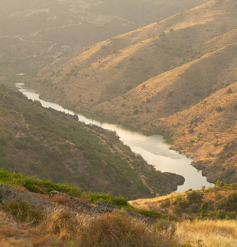
Arribes del Duero Natural Park is a protected area in western Spain, encompassing 1,061.05 km2 within the Castile and León region. It is renowned for its rich biodiversity and the dramatic landscapes carved by the Duero River, which forms the border with Portugal. The park's name, 'Arribes,' reflects these deeply eroded valleys and steep cliffs.

Duratón River Gorges
The Duratón River Gorges Natural Park is a protected area in Spain, characterized by dramatic 100-meter-high cliffs carved by the Duratón River. This region holds historical significance, having been a hermitage for Saint Fructus in the 8th century, and it remains a vital habitat for a significant population of griffon vultures and other raptors.