
Ordesa y Monte Perdido
National Park·Spain·Quaternary·Limestone
Ordesa y Monte Perdido National Park is a protected area in the Pyrenees, recognized for its dramatic geological formations and rich biodiversity. Originally established to preserve the Ordesa Valley, its scope was expanded in 1982 to encompass the entire region, becoming a UNESCO Biosphere Reserve and part of a World Heritage Site. The park's landscape is characterized by deep canyons carved by glacial and tectonic activity, with diverse flora and fauna.
Key Facts
- ›The park covers 156.08 square kilometers in the Pyrenees.
- ›It features limestone karst formations, including karren, sinkholes, and caves.
- ›Glacial erosion during the Quaternary period sculpted cirques and U-shaped valleys.
- ›Notable flora includes beech, fir, pine, oak, and alpine wildflowers like edelweiss.
- ›The park was a habitat for the extinct bucardo (Pyrenean ibex) and currently hosts Pyrenean chamois, marmots, and various raptors.

River Erosion, Glacial Erosion, Tectonic Activity
Karst Formations, Cirques, U-Shaped Valleys, Alpine Meadows
Pyrenean Chamois, Alpine Marmot, Boar, Pyrenean Desman, Golden Eagle, Bearded Vulture, Griffon Vulture
Beech Forests, Abies Alba Forests, Pine Forests, Oak Forests, Birch Forests, Ash Forests, Willow Forests, Boxwood Bushes, Alpine Meadows, Endemic Flora
About Ordesa y Monte Perdido
Ordesa y Monte Perdido National Park
Ordesa y Monte Perdido National Park, known in Spanish as Parque nacional de Ordesa y Monte Perdido, is a significant protected area situated in the Pyrenees mountain range. Its designation as a national park underscores its importance for preserving the high mountain topography of Monte Perdido and the surrounding Pyrenean landscape. The park's protected status has evolved over time, with an initial declaration for the Ordesa Valley in 1918, followed by a substantial enlargement in 1982 that expanded its boundaries to cover the entire region, amounting to 156.08 square kilometers.
Geological Significance
The park's geology is dominated by limestone formations, a legacy of its origins from the Cretaceous and Eocene periods. These limestone layers have been sculpted by powerful geological forces, resulting in a landscape rich in karst features such as karren fields, sinkholes, and extensive cave systems. Tectonic uplift played a crucial role in creating the deep canyons that characterize the park. Furthermore, during the Quaternary period, repeated glaciations were instrumental in carving out spectacular cirques and broad, U-shaped valleys, defining much of the park's dramatic topography.
Biodiversity and Climate
The climate within Ordesa y Monte Perdido National Park is characteristic of the Pyrenean region, exhibiting significant variations due to the considerable difference in altitude, ranging from 750 meters at the entrance of the Añisclo canyon to 3,355 meters at the summit of Monte Perdido. These altitudinal gradients, combined with the orientation of the valleys, lead to substantial fluctuations in humidity and temperature between day and night, influencing the distribution of vegetation zones. The park supports a diverse array of flora, with extensive forests of beech, fir, pine, and oak at lower elevations, transitioning to mountain pine and alpine meadows at higher altitudes. These meadows are home to numerous endemic plant species, and the edelweiss is a recognized symbol of the park. Fauna includes species like the Pyrenean chamois, alpine marmot, and various raptors, though the park also mourns the extinction of the bucardo, or Pyrenean ibex.
Protected Status and Recognition
Ordesa y Monte Perdido's ecological and geological significance has been formally recognized through multiple designations. It is an IUCN Category II National Park. In 1997, it was incorporated into the Biosphere Reserve of Ordesa-Viñamala by UNESCO. In the same year, it gained further international recognition by being included in the cross-border Pyrénées - Mont Perdu World Heritage Site, specifically acknowledged for its spectacular geological landforms. The park's protection was championed by individuals who recognized its unique natural value and worked to secure its conservation for future generations.
Source: Wikipedia ↗
Frequently Asked Questions
How was Ordesa y Monte Perdido National Park formed?
The park's dramatic topography was shaped by a combination of tectonic uplift, which created deep canyons, and significant glacial erosion during the Quaternary period. Glaciers carved out prominent cirques and large U-shaped valleys within the region.
What kind of geology is found in the park?
The region is predominantly composed of limestone, originating from the Cretaceous and Eocene periods. This limestone is characterized by extensive karst formations, including karren fields, sinkholes, and numerous caves.
What are the main vegetation types in the park?
Lower elevations feature forests of beech, fir, pine, and oak, with boxwood bushes common between 700 and 1,800 meters. Higher elevations, up to 3,000 meters, support alpine meadows with numerous endemic plant species, and the edelweiss is a symbolic flower of the park.
What wildlife can be found in Ordesa y Monte Perdido National Park?
Historically, the park was known for the bucardo, or Pyrenean ibex, which is now extinct. Current fauna includes the Pyrenean chamois, alpine marmot, boar, and the Pyrenean desman. Birdlife is also diverse, with raptors such as the golden eagle and bearded vulture.
What is the protected status of Ordesa y Monte Perdido?
Ordesa y Monte Perdido is an IUCN Category II National Park. It is also recognized as a UNESCO Biosphere Reserve and is part of the cross-border Pyrénées - Mont Perdu World Heritage Site, acknowledging its significant geological and ecological value.
Related Canyons
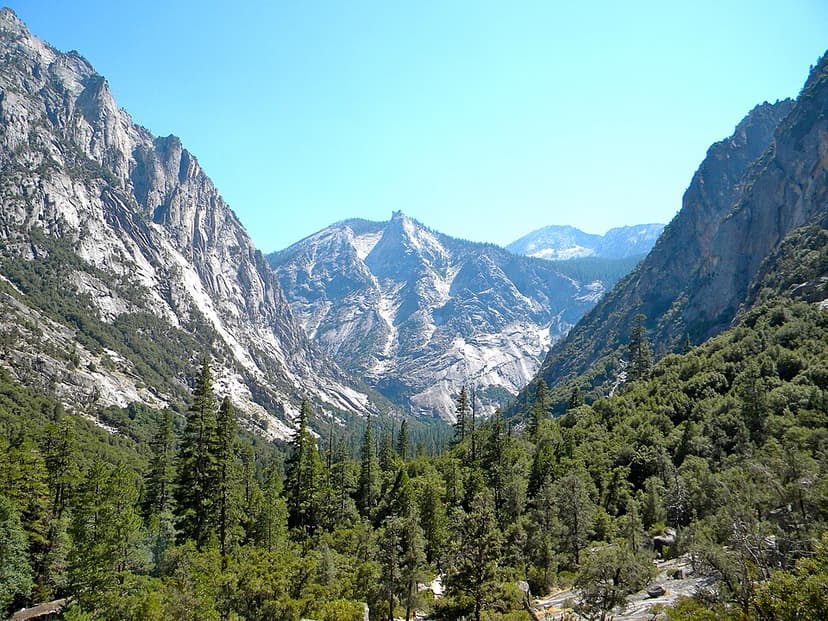
Kings Canyon
Kings Canyon is a rugged, glacier-carved valley in California's southern Sierra Nevada, renowned for its extreme vertical relief and natural beauty. Formed by Ice Age glaciations and subsequent river erosion, it is part of the larger Sequoia and Kings Canyon National Parks and is a significant protected wilderness area.

Caminito del Rey
The Caminito del Rey, meaning 'The King's Little Path,' is a walkway constructed in the early 20th century along the walls of a narrow gorge in Málaga, Spain. Originally built for workers of hydroelectric power plants, it became known for its dangerous sections, leading to its closure for over a decade before extensive renovations and its reopening in 2015. The walkway offers a dramatic experience through a landscape shaped by millions of years of geological processes.

Aare Gorge
The Aare Gorge is a dramatic canyon carved through a limestone ridge near Meiringen, Switzerland, by the Aare River. Formed approximately 10,000 years ago by glacial meltwater erosion at the end of the Ice Age, this narrow passage features sheer cliffs and is a significant tourist attraction, partly due to its proximity to the famous Reichenbach Falls.