
Gandikota
River Canyon·India·Penna River·Quartzite
Gandikota is a historic fort and village situated on the right bank of the Penna River in Andhra Pradesh, India. It is renowned for the Gandikota canyon, a geological formation carved by the Penna River through the Erramala hills. The fort itself has a long history, serving as a strategic center for various dynasties and featuring a blend of architectural styles.
Key Facts
- ›Located on the right bank of the Penna River in Kadapa district, Andhra Pradesh, India.
- ›The Gandikota canyon is formed by the Penna River cutting through the Erramala hills.
- ›The fort was initially a sand fort built by a Kalyani Chalukya vassal and later expanded by the Pemmasani Nayakas and during Muslim rule.
- ›Geologically, the canyon is composed of 'Gandikota Quartzite' within the Chitravati Group of the Cuddapah Supergroup.
- ›Notable structures within the fort include ancient temples, a Jamia Masjid, granaries, and a pigeon tower.
- ›The area is referred to as 'the Grand Canyon of India'.

River Erosion
Gandikota Quartzite, Erramala Hills, Rayalacheruvu, Madhavaswamy Temple, Ranganathaswamy Temple, Jamia Masjid
Lime Gardens, Plantain Gardens
About Gandikota
Gandikota is a historic village and fort located on the right bank of the Penna River, approximately 15 km from Jammalamadugu in the Kadapa district of Andhra Pradesh, India. It is most famously recognized for the dramatic gorge it overlooks, a natural formation carved by the Penna River through the Erramala range of hills, which has earned it the moniker "the Grand Canyon of India."
Historical Significance
The site's strategic importance is evident in its long history as a political and military center. The original fortification was a sand fort constructed in 1123 by Kaka Raja, a vassal of the Kalyani Chalukya rulers. The village evolved into a significant fortified settlement with the ascendance of the Pemmasani Nayakas. Subsequent periods of Muslim rule saw additions that reflected Islamic architectural styles. The fort itself has been a central power base for numerous dynasties, including the Kalyani Chalukyas, the Pemmasani Nayakas, and the Golconda Sultanate.
Geological Features
The Gandikota canyon is a striking geological feature composed of sedimentary rocks, specifically "Gandikota Quartzite." This quartzite is part of the Chitravati Group, which falls under the broader Cuddapah Supergroup. The formation of the canyon is a result of the Penna River's erosive power cutting through the Erramala hills, creating a dramatic gorge that narrows the river's width significantly in places.
Structures and Attractions
Within the fort complex, several structures remain, though many are in ruins. These include ancient temples dedicated to Madhava and Ranganatha, a Jamia Masjid with two adjacent minarets, a large granary (now used as quarters), a magazine, and a graceful "pigeon tower" with fretted windows. An old cannon lies within the fort grounds. The "Rayalacheruvu," a perennial spring, is noted for irrigating some lime and plantain gardens and is said to have been connected to the Jamia Masjid by pipes. Other points of interest include the House of the Drum, Charminar, Jail, and the "Red Koneru" or "Pond of Swords," a lake where warriors reputedly dipped their swords.
Access and Tourism
Gandikota is accessible via road, with buses running from Jammalamadugu. The nearest railway stations are Muddanuru and Jammalamadugu. Inside the fort, exploration is primarily on foot, with a notable downhill trek leading to the riverbed. The Andhra Pradesh Tourism Development Corporation operates a hotel in the vicinity, and the area has been a focus for government investment in tourism development.
Source: Wikipedia ↗
Frequently Asked Questions
What is the geological formation of the Gandikota canyon?
The Gandikota canyon is composed of sedimentary rocks, specifically 'Gandikota Quartzite', which is part of the Chitravati Group within the Cuddapah Supergroup. This quartzite is formed by the erosion of the Erramala range of hills by the Penna River.
What are the main historical periods associated with Gandikota fort?
Gandikota's history spans several dynasties. It began as a sand fort built in 1123 by a vassal of the Kalyani Chalukyas. It later became a major fortified settlement under the Pemmasani Nayakas and saw additions reflecting Islamic architecture during periods of Muslim rule.
What are the significant structures within the Gandikota fort complex?
Within the fort, visitors can see ruined ancient temples dedicated to Madhava and Ranganatha, a Jamia Masjid with minarets, a large granary, a magazine, a pigeon tower, and remnants of a palace. There is also an old cannon and the 'Rayalacheruvu' with its springs.
How can one access Gandikota and what transportation is available?
The nearest railway stations are Muddanuru and Jammalamadugu. Buses are available from Jammalamadugu to Gandikota. Once inside the fort, exploration is primarily done on foot, although there is a downhill trek to the riverbed.
Is Gandikota a popular tourist destination?
Yes, Gandikota is a significant tourist attraction and has been popularly referred to as 'the Grand Canyon of India'. The Andhra Pradesh government has invested in its tourism development.
Related Canyons
Raneh Falls
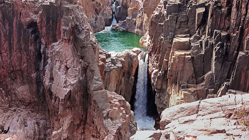
Raneh Falls is a natural cascade located on the Ken River in Khajuraho, Madhya Pradesh, India. The falls carve a striking 5-kilometer-long and 30-meter-deep canyon composed of crystalline granite in various colors, with both permanent and seasonal waterfalls. This geological wonder is situated near the Ken Gharial Sanctuary and is part of a gorge rich in igneous rocks. The area is a significant natural attraction, offering a unique display of geological formations and flowing water.

Tallulah Gorge
The Tallulah Gorge is a significant canyon located in the southern Appalachian Mountains of Georgia, carved by the Tallulah River through the Tallulah Dome rock formation. Measuring approximately 2 miles long and nearly 1,000 feet deep, it is a protected area within Georgia's Tallulah Gorge State Park and is recognized as one of the "Seven Natural Wonders of Georgia."

Satkosia Tiger Reserve
Satkosia Tiger Reserve, located in Odisha, India, is a significant protected area known for its tiger conservation efforts and its dramatic gorge carved by the Mahanadi River. Established as a wildlife sanctuary in 1976 and later as a tiger reserve in 2007, it encompasses a diverse ecosystem of moist deciduous forests and riverine habitats.