
Ha Gorge
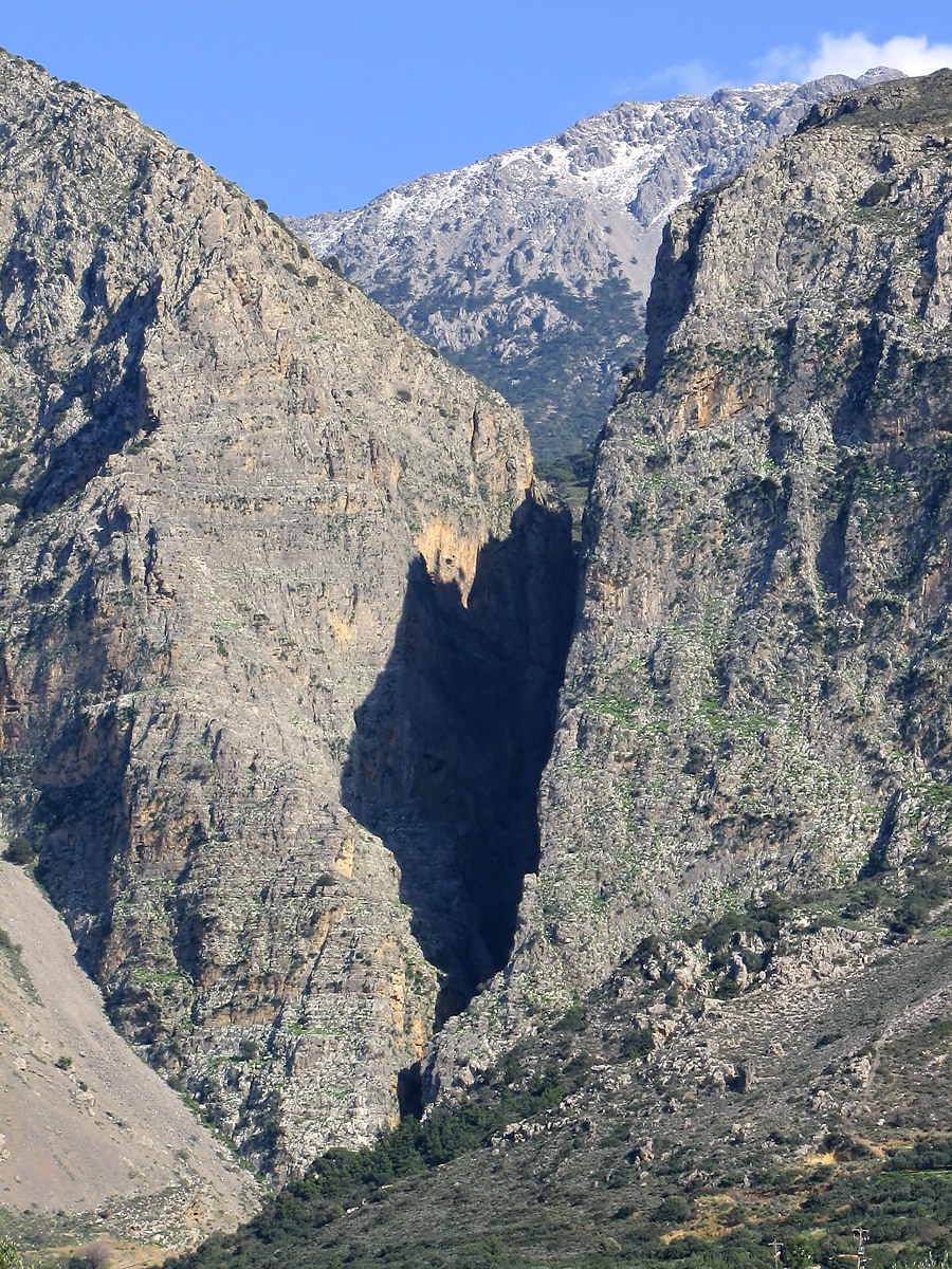
Ha Gorge is a remarkably narrow and deep gorge located on the eastern part of Crete, Greece. Formed by tectonic activity along the Ierapetra active fault, it is characterized by its sheer rocky walls and challenging accessibility. The gorge is significant for its rich biodiversity and the presence of important archaeological sites dating back to the Neolithic and Minoan periods.
Key Facts
- ›Depth of approximately 1,000 meters, making it one of the largest fissures globally.
- ›Length of about 1.5 kilometers with rocky walls rising up to 300 meters.
- ›Width varies significantly, from 1.5 meters to 10 meters.
- ›Geologically formed by the Ierapetra active fault, a tectonic normal fault.
- ›Home to diverse flora and fauna, including the plant genus Smyrnium.
- ›Contains Late Neolithic-Final Neolithic and Late Minoan IIIC archaeological sites.
Tectonic Activity, River Erosion
Cascade Form Rock Walls, 250m Waterfall, 26 Abseils
Migratory Birds, Endemic Birds, Mammals, Reptiles, Insects, Smyrnium Plants
Diverse Flora
About Ha Gorge
Ha Gorge, known in the local Cretan dialect as Φαράγγι Χά, is a dramatic and exceptionally narrow gorge situated on the eastern side of the island of Crete in Greece. Located on the western slope of the Thrypti mountain range, it emerges east of Vasiliki village into the plain of Ierapetra. The gorge's name is derived from the Greek Cretan dialect word 'hasko,' meaning 'to gape' or 'to separate,' a fitting description for its profound fissure.
Geological Formation and Features
The gorge is a significant geological feature, interpreted as a product of the Ierapetra active fault, a tectonic normal fault oriented northeast-southwest. This fault has split a cliff face, creating a deep fissure with rocky walls that rise dramatically. Ha Gorge boasts a depth of approximately 1,000 meters, positioning it among the world's largest gorges. Its length is about 1.5 kilometers, and its width is highly variable, ranging from as narrow as 1.5 meters to about 10 meters at certain points. The walls are characterized by a cascade form, reaching up to 300 meters in height. The geological structure clearly exposes rock-beds and their folds, which are mirrored on both sides of the gorge. Several waterfalls are present along its course, including a notable steep fall of 250 meters. The stream that flows from the gorge has historically been used to drive watermills, and the gorge is also a site for abseiling, offering 26 descents of varying lengths.
Accessibility and Surroundings
Access to Ha Gorge is extremely difficult, making it largely inaccessible to the general public. The nearest major town is Ierapetra. Reaching the gorge involves a significant journey, starting with a national highway drive from Iraklio to Agios Nikolaos, then proceeding through Ierapetra and the village of Episkopi. From Episkopi, a diversion road leads to the Thripti area, where a church marks the point from which access is solely by walking and is considered very challenging. Despite its inaccessibility, the location offers scenic views overlooking Pahia Amos and its bay.
Archaeological Significance
The area surrounding Ha Gorge is rich in archaeological history, with evidence of human presence dating back millennia. Excavations have revealed Late Neolithic-Final Neolithic occupation (4000-3000 BC) at Monastiraki Katalimata, a site precariously located at the gorge's edge. Nearby, Monastiraki Halasmenos is recognized as a Late Minoan IIIC site, situated on a hill close to the gorge's mouth. These sites, along with Kavousi and Vasiliki-Kephala, form a crucial triad of important settlements from this period. Ruins and artifacts have been unearthed on the northern bank of the gorge, with some structures perched on narrow rock shelves near the sheer cliff faces.
Flora and Fauna
The inaccessibility of Ha Gorge has helped preserve a rich and diverse ecosystem. It is home to a variety of flora and fauna, including the genus of flowering plants known as Smyrnium, which has three species found in Crete and present in the gorge. The gorge also supports numerous migratory and endemic birds, mammals, reptiles, and insects, contributing to its ecological importance.
Source: Wikipedia ↗
Frequently Asked Questions
How was Ha Gorge formed?
Ha Gorge was formed by tectonic activity along the Ierapetra active fault. This fault is a normal fault with a northeast-southwest orientation that has created a significant geological fissure.
What are the dimensions of Ha Gorge?
The gorge has a depth of about 1,000 meters and a length of approximately 1.5 kilometers. Its width varies from 1.5 meters to 10 meters, with rocky walls reaching up to 300 meters in height.
Is Ha Gorge easy to access?
No, Ha Gorge is practically inaccessible to people. While there is a road approach to the Thripti area, access to the gorge itself is only possible by walking and is described as very difficult.
What is notable about the geology of Ha Gorge?
The gorge's geological formations reveal rock-beds and folds identical on both banks, a result of the wide fault. It is interpreted as being created by the Ierapetra active fault, a geologically significant tectonic feature.
Are there historical sites near Ha Gorge?
Yes, archaeological excavations near Ha Gorge have uncovered important sites. These include Late Neolithic-Final Neolithic occupation at Monastiraki Katalimata and a Late Minoan IIIC site at Monastiraki Halasmenos.
What kind of wildlife can be found in Ha Gorge?
The gorge maintains a rich and diverse flora and fauna due to its inaccessibility. It is home to various migratory and endemic birds, mammals, reptiles, and insects, as well as plants like Smyrnium.
Related Canyons
Kotsifos Gorge
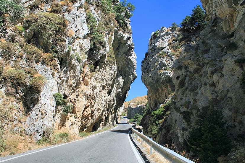
The Kotsifos Gorge is a significant natural feature located on the southern side of western Crete, Greece. It is renowned for its rich biodiversity, hosting a high number of plant species endemic to Crete. The gorge lies west of the Kouroupa mountain and north of Plakias, accessible via the road connecting Sellia and Angouseliana.

Vikos Gorge
The Vikos Gorge is a dramatic gorge located in the Pindus Mountains of northwestern Greece, renowned for being the deepest canyon relative to its width in the world. Carved over millions of years by the Vikos Stream and the Voidomatis River, it showcases diverse geological strata and ecosystems. Historically, the area was utilized for pastoralism and is significant for its unique flora, with local healers known as "Vikos doctors" using medicinal herbs found within the gorge.

Agia Eirini Gorge
Agia Eirini Gorge is a scenic canyon located in southwestern Crete, Greece, renowned for its natural beauty and historical significance. Stretching 7.5 kilometers from the village of Agia Eirini to the coastal village of Sougia, it features steep mountain cliffs and forested areas. The gorge played a role in history, notably as an escape route for civilians during Ottoman rule.