
Huguan Taihang Grand Canyon
River Canyon·China·Palaeozoic·Carbonate rocks
Huguan Taihang Grand Canyon is a significant geographical feature and popular tourist destination located in Shanxi, China. Formed by the uplift of the Taihang Mountains and subsequent river erosion, it features a complex network of deep gorges and steep slopes. The area is recognized for its geological importance, with deep gorges cutting through ancient carbonate rocks, and is a major attraction drawing millions of visitors annually.
Key Facts
- ›Spans a total area of 155.6 square kilometers.
- ›Features over 3,400 ravines and gorges, with some sections exceeding 100m in height.
- ›Maximum elevation within the Geopark reaches 1,822 meters.
- ›Geologically, gorges cut through Palaeozoic carbonate rocks, with Yanshanian tectonics being dominant.
- ›Includes notable gorges such as Hongdou Gorge, Qinglong Gorge, Baquan Gorge, Wangmang Gorge, and Wuzhi Gorge.
- ›Baquan Gorge is named after eight streams originating from the same location within the canyon.

River Erosion, Tectonic Uplift
Hongdou Gorge, Qinglong Gorge, Baquan Gorge, Wangmang Gorge, Wuzhi Gorge, Wanfo Mountain
About Huguan Taihang Grand Canyon
Huguan Taihang Grand Canyon is a prominent geographical feature and a major tourist destination situated in Shanxi Province, China. This expansive canyon system is recognized for its dramatic landscapes, shaped by the geological forces of tectonic uplift and river erosion.
Geological Formation and Characteristics
The landforms of Huguan Taihang Grand Canyon were primarily formed through the uplift of the Taihang Mountains, followed by extensive river erosion that carved deep valleys and steep slopes. The valleys generally slope from west to east, with terrain becoming significantly steeper towards the east and gentler in the northwest. Geologically, the deep gorges cut through ancient carbonate rocks from the Palaeozoic era. Yanshanian tectonics play a dominant role, with fault lines mainly oriented in the north-northeast direction. The lithology of the area includes quartzite, mudstone, limestone, and dolomite, with exposed strata from systems such as the Changcheng, Cambrian, Ordovician, and Quaternary, alongside local diorite intrusions related to Yanshanian activity.
Notable Features and Scale
The Taihang Grand Canyon Scenic Area covers a total of 155.6 square kilometers and is characterized by a vast network of over 3,400 ravines and gorges. Some of these gorges feature steep sections that exceed 100 meters in height. The highest elevation within the Geopark reaches 1,822 meters. Among its prominent features are five main gorges: Hongdou Gorge, Qinglong Gorge, Baquan Gorge, Wangmang Gorge, and Wuzhi Gorge. Wanfo Mountain is another significant scenic spot within the area.
The Baquan Gorge, translating to "Eight Springs" Gorge, is located in the central part of the Grand Canyon and spans 24.11 square kilometers. It derives its name from eight streams of water that originate from the same point within the gorge. The geological composition of Baquan Gorge includes Proterozoic red sandstone, as well as limestone and shale from the Paleozoic era.
Tourism and Recognition
Huguan Taihang Grand Canyon is a highly visited tourist attraction, drawing more than four million visitors annually. Its significance is recognized by its designation as one of China's AAAAA Tourist Attractions, a status awarded in 2019. The area was also established as a National Geopark in 2005, highlighting its importance for geological heritage and tourism.
Source: Wikipedia ↗
Frequently Asked Questions
How was Huguan Taihang Grand Canyon formed?
The landforms in Huguan Taihang Grand Canyon were shaped by the uplift of the Taihang Mountains, which was followed by extensive river erosion. This geological process resulted in the formation of steep slopes and deep river valleys.
What are the main geological features of the canyon?
The canyon's deep gorges are cut through carbonate rocks dating back to the Palaeozoic era. Dominant geological forces include Yanshanian tectonics, with faults primarily oriented north-northeast. The lithology consists of quartzite, mudstone, limestone, and dolomite, with exposed strata from various geological systems.
What are the notable gorges within the Taihang Grand Canyon Scenic Area?
The scenic area encompasses five main gorges: Hongdou Gorge, Qinglong Gorge, Baquan Gorge, Wangmang Gorge, and Wuzhi Gorge. Wanfo Mountain is another significant scenic spot within the region.
What kind of rock is found in Huguan Taihang Grand Canyon?
The deep gorges are primarily cut through carbonate rocks from the Palaeozoic era. Specific lithologies include limestone and dolomite, as well as Proterozoic red sandstone found in the Baquan Gorge area, alongside shale.
Is Huguan Taihang Grand Canyon a popular tourist destination?
Yes, Huguan Taihang Grand Canyon is a significant tourist attraction, drawing over four million visitors annually. It is recognized as one of China's AAAAA Tourist Attractions and became a National Geopark in 2005.
What is the elevation and terrain like in the canyon?
The terrain is characterized by steep slopes and river valleys, sloping from west to east. The eastern areas are steeper, becoming more gentle towards the northwest. The maximum elevation within the Geopark is 1,822 meters, and gorges can have steep sections exceeding 100 meters in height.
Related Canyons
Dniester Canyon
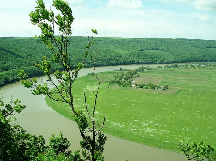
The Dniester Canyon is a significant river canyon in southwestern Ukraine, carved by the Dniester River over a 250 km stretch. Its formation involves erosion through various geological layers, resulting in dramatic landscapes with steep walls, unique rock formations, and numerous caves. The canyon is recognized for its scenic beauty and ecological importance, leading to its designation as a National Nature Park and its inclusion as one of the Seven Natural Wonders of Ukraine.
Longtan Grand Canyon
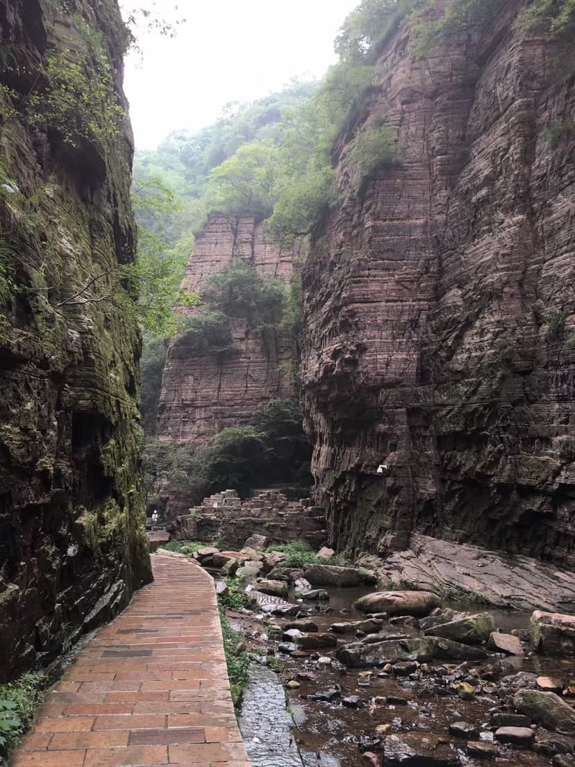
Longtan Grand Canyon is a prominent tourist attraction located in Xin'an County, Luoyang, Henan, China. This U-shaped valley, stretching 12 kilometers, is celebrated for its majestic mountains, serene valleys, cascading waterfalls, and distinctive purplish-red quartz sandstone shaped by centuries of water erosion. It is recognized as a significant part of the Wangwushan-Daimeishan UNESCO Global Geopark and has been lauded as the "First Gorge of Chinese Valleys."

Qutang Gorge
The Qutang Gorge is the shortest and narrowest of China's Three Gorges, carved by the Yangtze River between the Chijia and Baiyan Mountains. Renowned for its spectacular, dramatic scenery, it is often considered the most beautiful of the three gorges due to the combination of high mountains and tight passages. Historically, it served as a crucial passage for boat haulers via ancient pathways, and it contains numerous significant historical and cultural sites, some of which have been impacted by the Three Gorges Dam.