
Grand Canyon
River Canyon·North America·Proterozoic/Paleozoic strata exposed, formation ongoing·Colorado River
The Grand Canyon is a vast, steep-sided canyon carved by the Colorado River in Arizona, United States. Its immense size and intricate, colorful landscape are renowned, exposing nearly two billion years of Earth's geological history. The canyon has been continuously inhabited by Native Americans for thousands of years and holds significant cultural and geological importance.
Key Facts
- ›The Grand Canyon is 277 miles (446 km) long.
- ›It can be up to 18 miles (29 km) wide.
- ›The canyon reaches a depth of over a mile (1,857 meters).
- ›Geological history exposed ranges from the two-billion-year-old Vishnu Schist to the 270-million-year-old Kaibab Limestone.
- ›The Colorado River began carving the canyon about 5 to 6 million years ago, with some segments forming much earlier.
- ›The canyon and its adjacent rim are part of Grand Canyon National Park and other protected areas.

River Erosion, Uplift of the Colorado Plateau
Vishnu Schist, Kaibab Limestone, Great Unconformity, Coconino Sandstone, Inner Gorge, Terraced Walls
Ponderosa Pine Forests, Sagebrush Steppe
About Grand Canyon
The Grand Canyon is a monumental, steep-sided canyon situated in Arizona, United States, carved predominantly by the relentless action of the Colorado River. It is celebrated globally for its immense scale, visually overwhelming size, and its intricately colored, rugged landscape. The canyon's geological significance lies in the exceptionally well-preserved and exposed sequence of ancient rock layers, which collectively offer a profound glimpse into nearly two billion years of Earth's geological history. This natural wonder is not only a testament to the power of erosion but also a vital record of the North American continent's past.
Geography and Formation
Located within the Colorado Plateau, the Grand Canyon is one of its distinct physiographic sections. While not the deepest canyon globally, its visual impact is unparalleled. The formation process is attributed to the Colorado River and its tributaries, which have cut through uplifted Proterozoic and Paleozoic strata. While some details of its incision history are debated, a prevailing hypothesis suggests the Colorado River established its course through the area approximately 5 to 6 million years ago. Subsequent erosion by the river and its tributaries has deepened and widened the canyon, while the uplift of the Colorado Plateau, beginning around 65 million years ago, played a crucial role in steepening the river's gradient and enhancing its erosive power.
The elevation difference between the North and South Rims, with the North Rim being significantly higher, influences regional hydrology. The North Rim receives more precipitation, contributing to deeper and longer tributary canyons on that side, whereas the South Rim features shorter, steeper side canyons. Temperatures are generally cooler on the higher-elevation North Rim.
Geological Significance
The canyon walls display a diverse range of geological formations, from the ancient Vishnu Schist at the bottom of the Inner Gorge, dating back two billion years, to the relatively younger Kaibab Limestone, dating to 270 million years. Notably, there is a significant gap in the geological record known as the Great Unconformity, representing a period where no deposits are present between 1.75 billion and 1.25 billion years ago. Various rock layers, including the Permian Coconino Sandstone, reveal evidence of ancient environments such as aeolian sand dunes and warm shallow seas. Volcanic activity in the more recent geological past, between 100,000 and 3 million years ago, also deposited ash and lava, sometimes obstructing the river's flow.
Human History and Indigenous Significance
The Grand Canyon region has been inhabited by Native Americans for thousands of years. Early inhabitants included the Ancestral Puebloans, Cohonina, and Sinagua cultures. By the time of European arrival, groups such as the Hualapai, Havasupai, Southern Paiutes, and Navajo resided in the area. For some Hopi communities, the Grand Canyon holds a place in their mythology as the origin point of humankind. European contact began in 1540 with Spanish explorer García López de Cárdenas. Subsequent Spanish priests and American explorers, including Jacob Hamblin and Major John Wesley Powell, further documented the canyon. President Theodore Roosevelt was a strong proponent for preserving the Grand Canyon, visiting it multiple times.
Source: Wikipedia ↗
Frequently Asked Questions
How was the Grand Canyon formed?
The Grand Canyon was primarily formed by the erosive power of the Colorado River and its tributaries cutting through the uplifted Colorado Plateau over millions of years. The geological history exposed in the canyon walls dates back nearly two billion years.
What are the dimensions of the Grand Canyon?
The Grand Canyon stretches for 277 miles (446 km) in length and can be up to 18 miles (29 km) wide. Its maximum depth exceeds a mile, reaching over 6,093 feet (1,857 meters).
What is the geology of the Grand Canyon?
The canyon exposes a remarkable sequence of ancient rock layers, from the two-billion-year-old Vishnu Schist at the bottom to the 270-million-year-old Kaibab Limestone at the rim. This stratigraphy records a significant portion of the North American continent's early geological history.
When was the Grand Canyon formed?
While the precise age of the Grand Canyon is debated among geologists, recent studies suggest the Colorado River established its course through the area about 5 to 6 million years ago. However, some segments of the canyon are believed to have formed much earlier, with evidence suggesting parts could be as old as 70 million years.
Is the Grand Canyon a national park?
Yes, the Grand Canyon and its adjacent rim are contained within Grand Canyon National Park. The area is also part of Grand Canyon–Parashant National Monument, Kaibab National Forest, and several Native American reservations.
What activities can be done at the Grand Canyon?
Visitors can explore the canyon through hiking, camping, and scenic drives. The park offers numerous viewpoints along the South Rim and a more limited access North Rim, with opportunities for guided tours and ranger programs.
Related Canyons

Cataract Canyon
Cataract Canyon is a significant 74 km stretch of the Colorado River in southern Utah, known for its powerful whitewater rapids. Carved into the Colorado Plateau, its lower half is submerged under Lake Powell, impacting its historical geology and accessibility. The canyon holds historical importance for indigenous peoples and early European explorers, and remains a popular destination for whitewater rafting.
Westwater Canyon
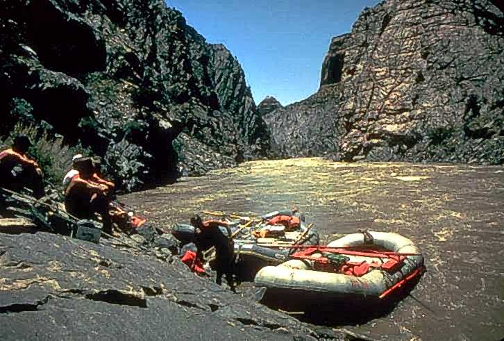
Westwater Canyon is a narrow gorge carved by the Colorado River in eastern Utah, notable for its exposed Precambrian basement rocks within the inner gorge. It features challenging Class III and IV rapids, including the significant "Skull" rapid, making it a draw for whitewater enthusiasts. The canyon is managed by the Bureau of Land Management, which oversees a permitting system for river travelers.

Glen Canyon
Glen Canyon is a natural canyon carved by the Colorado River, primarily located in southeastern Utah and extending into northern Arizona. Its formation is a result of the river's erosive power over millennia, with significant prehistoric human occupation. In 1963, the construction of Glen Canyon Dam created the artificial reservoir Lake Powell, which inundated much of the canyon, making it a focal point for modern environmentalist movements concerned with dam removal and river restoration.