
Jamison Valley
River Canyon·Australia·Coxs River·Sandstone
Jamison Valley is a significant geological feature in the Blue Mountains of New South Wales, Australia, carved by the erosion of sandstone and underlying shale layers. Named by Governor Lachlan Macquarie in honor of Sir John Jamison, it has a rich indigenous history and was later explored by Charles Darwin. The valley is a popular destination for bushwalking, camping, and offers iconic natural landmarks and tourist attractions.
Key Facts
- ›Located in the Blue Mountains, New South Wales, Australia, about 100 km west of Sydney.
- ›Approximately 4 km long (north-south) and 10 km wide (west-east).
- ›Formed by the erosion of sandstone cliffs and softer underlying shale layers.
- ›Contains numerous waterfalls including Wentworth Falls, Empress Falls, and Katoomba Falls.
- ›Features iconic landmarks such as the three Sisters and Mount Solitary.
- ›Densely forested with eucalypt and pockets of semi-rainforest.
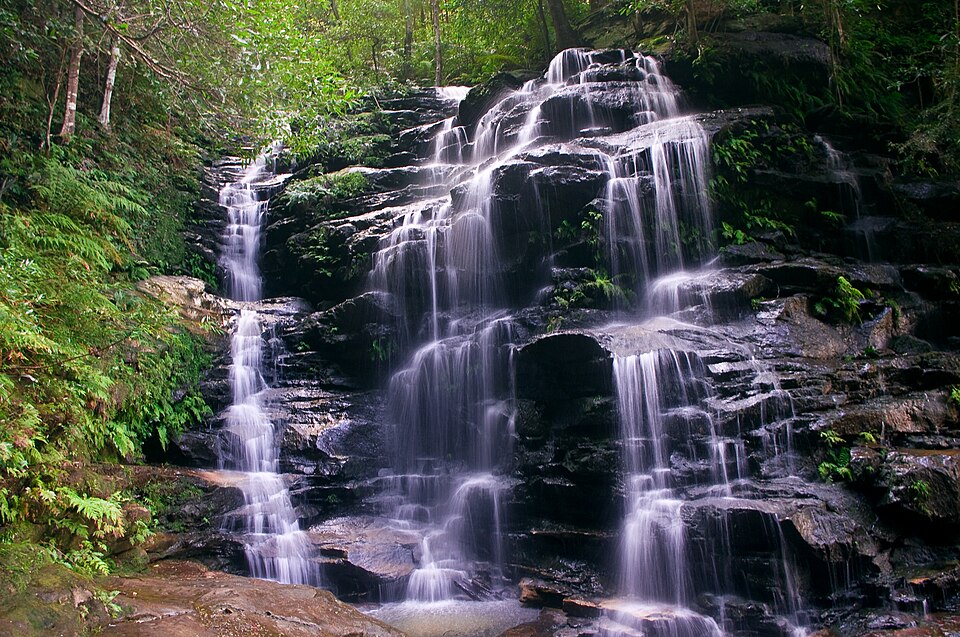
River Erosion, Differential Erosion of Sandstone and Shale
Three Sisters, Mount Solitary, Wentworth Falls, Empress Falls, Katoomba Falls, Ruined Castle, Jamison Creek, Valley of the Waters Creek, Gordons Creek, Leura Falls Creek, Kedumba River, Causeway Creek
Eucalypt Forest, Semi-Rainforest
About Jamison Valley
Jamison Valley is a significant natural landmark within the Coxs River canyon system, located in the Blue Mountains of New South Wales, Australia. Situated approximately 100 kilometers west of Sydney and a short distance south of Katoomba, it represents a prime example of the sandstone valleys and canyons for which the Blue Mountains region is renowned.
Geology and Formation
The valley's formation is a product of geological processes involving sandstone and shale. The region is characterized by steep sandstone cliffs, with a layer of softer shale found deeper within the soil. As watercourses eroded this shale layer, it collapsed, bringing down the overlying sandstone and thus shaping the characteristic valleys and canyons. Jamison Valley stretches about 4 kilometers north-south and approximately 10 kilometers west-east, encompassing notable features like Mount Solitary, which lies across its southern expanse and is connected to the Narrow Neck Plateau by a ridge featuring the Ruined Castle rock formation. Numerous watercourses, including Jamison Creek and Kedumba River, carve through the valley, feeding a series of spectacular waterfalls such as Wentworth Falls, Empress Falls, and Katoomba Falls.
History and Indigenous Significance
The traditional custodians of the land now known as Jamison Valley are the Aboriginal Gundungurra people, whose presence in the region is estimated to date back 40,000 years. European exploration and naming of the valley occurred in the early 19th century. Governor Lachlan Macquarie named it in 1815 in honor of Sir John Jamison, a prominent landowner and physician who accompanied him on a visit to the Blue Mountains. Later, in 1836, the British naturalist Charles Darwin toured the area, undertaking a walk along Jamison Creek to the valley's escarpment, a route now commemorated as Darwin's Walk.
Human Activity and Tourism
Commercial activity in Jamison Valley began around 1872 with the commencement of coal mining, which necessitated the development of substantial infrastructure, including the Katoomba Scenic Railway, to navigate the challenging terrain. Today, Jamison Valley is a major tourist destination and a popular site for outdoor recreation. Bushwalkers and campers frequent the valley, utilizing a network of tracks along the northern escarpment and cliffs. Iconic attractions include Scenic World, which features the world's steepest funicular railway and the Scenic Skyway offering panoramic views, and the globally recognized Three Sisters rock formation on the northern escarpment. The Giant Stairway walking track provides access to nature walks within the valley floor.
Source: Wikipedia ↗
Frequently Asked Questions
How was Jamison Valley formed?
Jamison Valley was formed through the erosion of sandstone cliffs and softer shale layers beneath. Watercourses carved through the land, causing the shale to erode and collapse, which in turn brought down the overlying sandstone, creating the characteristic valley and canyon formations of the Blue Mountains.
What are the main activities available in Jamison Valley?
The valley is popular for bushwalking and camping, with a network of tracks across its northern escarpment and along cliffs. Visitors can explore routes like Darwin's Walk, the tracks in the Valley of the Waters, and trails leading to Mount Solitary and the Ruined Castle.
What are the most notable natural attractions in Jamison Valley?
Key attractions include the Three Sisters, a famous rock formation on the northern escarpment, and Mount Solitary, a large mountain within the valley. The valley is also characterized by numerous waterfalls, such as Wentworth Falls and Katoomba Falls.
What are the key geological features of Jamison Valley?
The valley is composed of sandstone cliffs with a layer of shale underneath. Its formation is a result of this differential erosion. Mount Solitary is a prominent geological feature within the valley, and the Ruined Castle is a notable rock formation near a ridge connecting to the Narrow Neck Plateau.
What are the main tourist facilities or attractions near Jamison Valley?
Near the valley, attractions include Scenic World, a tourist complex with the steepest funicular railway in the world, the Katoomba Scenic Railway, and the Scenic Skyway cable car offering views of Katoomba Falls and Orphan Rock. The Three Sisters are also a major landmark on the northern escarpment.
What indigenous people inhabited the Jamison Valley region?
The traditional inhabitants of the land in what is now Jamison Valley are the Aboriginal Gundungurra people. They are estimated to have lived in the region for 40,000 years.
Related Canyons

Capertee Valley
Capertee Valley, located in New South Wales, Australia, is recognized as the world's widest canyon, surpassing even the Grand Canyon in its breadth. Carved by the Capertee River over millions of years through Permian and Triassic sedimentary rocks, the valley features dramatic sandstone cliffs and limestone formations. It holds significant ecological importance as a prime breeding site for endangered bird species and is a popular destination for birdwatching and bushwalking.
Carnarvon Gorge
Carnarvon Gorge, located in Central Queensland, Australia, is a significant natural attraction carved primarily by water erosion. Stretching approximately 30 kilometers in length and reaching depths of up to 600 meters, it is renowned for its diverse ecosystems, Indigenous cultural sites, and dramatic sandstone landscapes. As the most visited feature within Carnarvon National Park, it draws over 70,000 visitors annually, offering a unique oasis in a semi-arid region.
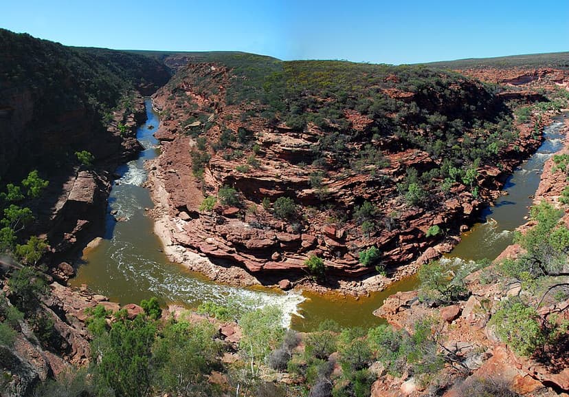
Murchison River Gorge
Murchison River Gorge is a significant riverine gorge located in the Mid West region of Western Australia, carved by the lower reaches of the Murchison River. Extending over 80 kilometers and reaching depths of up to 129 meters, it is renowned for its natural beauty and geological importance. The gorge is a major tourist attraction and contains important paleontological evidence of early land animals.