
Wind River Canyon
River Canyon·North America·Quaternary·Wind River
Wind River Canyon is a significant geological feature in Wyoming, carved by the Wind River. Its formation is a result of the river maintaining its course through an established path as the surrounding Owl Creek Mountains uplifted over the past two million years. The canyon is a popular scenic route, offering visitors views of diverse rock strata and natural landmarks, and serves as a gateway to Yellowstone National Park.
Key Facts
- ›The canyon is approximately 760 meters (2,500 feet) deep at its deepest points.
- ›It exposes a comprehensive set of Wyoming rock strata, including Precambrian rocks, Madison Limestone, Bighorn Dolomite, and Chugwater Formation sandstone.
- ›The canyon was formed by the Wind River cutting through the landscape as the Owl Creek Mountains uplifted.
- ›It is accessible via U.S. Highway 20 and Wyoming Highway 789, which runs through the canyon.
- ›The northern end of the canyon is known as the Wedding of the Waters, where the Wind River becomes the Bighorn River.

River Erosion, Uplift of Mountains
- Chimney Rock
- Wedding of the Waters
- Road Tunnels Through Precambrian Rocks
- High Cliffs of Madison Limestone, Bighorn Dolomite, and Sandstone
- Red Sandstone of the Chugwater Formation
About Wind River Canyon
Wind River Canyon is a significant geological formation located in Wyoming, carved by the Wind River. It serves as a popular scenic route and a vital stop for visitors traveling to Yellowstone National Park, situated between the towns of Shoshoni and Thermopolis. The canyon's accessibility is facilitated by U.S. Highway 20 and Wyoming Highway 789, which traverses its length and offers direct views of the canyon's dramatic landscape and natural features.
Geological Formation and Features
The formation of Wind River Canyon is a testament to the enduring power of rivers. The canyon was cut by the Wind River along its established course, which predates the uplift of the surrounding Owl Creek Mountains. As the topography of these mountains rose over the past two million years from what was once flat terrain, the river maintained its path, creating a dramatic water gap. The canyon exposes a comprehensive array of Wyoming rock strata, with geological information often presented on roadside signs. At its deepest points, the canyon reaches approximately 760 meters (2,500 feet). The route through the canyon navigates through areas of complex faulting and narrows as it descends into Precambrian rocks, visible at three road tunnels. Further along, high cliffs composed of sedimentary Madison Limestone, Bighorn Dolomite, and sandstone are prominent. The northern extent of the canyon features striking red sandstone from the Chugwater Formation.
Scenic Route and Accessibility
U.S. Highway 20 and Wyoming Highway 789 are integral to the experience of Wind River Canyon, with the road at times running level with the canyon floor. This scenic route provides visitors with panoramic views of the canyon's depths and notable natural structures, such as Chimney Rock. The change in elevation between the Bighorn Basin and the Wind River Basin is about 91 meters (300 feet). The southern entrance to the canyon is situated near the Boysen Dam in Boysen State Park, lying a few miles north of the state park's boundaries with the Wind River Indian Reservation. Within the canyon, the highway is lined with homes and a Burlington Northern Santa Fe railroad line. The northern terminus of the canyon is marked by the "Wedding of the Waters," the point where the Wind River officially becomes the Bighorn River. The scenic byway continues through Thermopolis, concluding at T Hill in Hot Springs State Park.
Designation and Importance
In recognition of its scenic beauty and geological significance, Wind River Canyon was designated as a Wyoming Scenic Byway in 2005. The canyon's unique geological exposures and its role as a passage for the Wind and Bighorn rivers make it a noteworthy natural landmark in Wyoming.
Source: Wikipedia ↗
Frequently Asked Questions
How was Wind River Canyon formed?
Wind River Canyon was formed by the Wind River. The river maintained its established course as the Owl Creek Mountains were uplifted over the past two million years, creating a water gap through the rising topography.
What geological features can be seen in Wind River Canyon?
The canyon exposes a wide variety of Wyoming rock strata, with many noted on roadside signs. These include Precambrian rocks, Madison Limestone, Bighorn Dolomite, and red sandstone from the Chugwater Formation at the northern end. Natural landmarks like Chimney Rock are also visible.
What activities are available in or near Wind River Canyon?
While the article focuses on its scenic route aspect, Wind River Canyon is a popular stop for visitors to Yellowstone National Park. The U.S. Highway 20/Wyoming Highway 789 route through the canyon offers scenic drives and views of natural landmarks.
Where is Wind River Canyon located and how can I access it?
Wind River Canyon is located in Wyoming, between the towns of Shoshoni and Thermopolis. It is accessible by U.S. Highway 20 and Wyoming Highway 789, which passes directly through the canyon.
What is the significance of the 'Wedding of the Waters' in Wind River Canyon?
The 'Wedding of the Waters' marks the northern end of Wind River Canyon. It is the specific point where the Wind River transitions into the Bighorn River, continuing its journey northward.
Related Canyons

Sabino Canyon
Sabino Canyon is a significant canyon located in the Santa Catalina Mountains north of Tucson, Arizona, and is a popular recreation area. Formed over 12 million years ago, it features waterfalls along Sabino Creek and is home to diverse wildlife, making it a notable destination for outdoor activities.

Aare Gorge
The Aare Gorge is a dramatic canyon carved through a limestone ridge near Meiringen, Switzerland, by the Aare River. Formed approximately 10,000 years ago by glacial meltwater erosion at the end of the Ice Age, this narrow passage features sheer cliffs and is a significant tourist attraction, partly due to its proximity to the famous Reichenbach Falls.
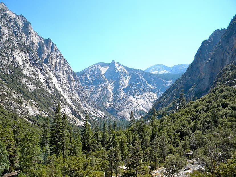
Kings Canyon
Kings Canyon is a rugged, glacier-carved valley in California's southern Sierra Nevada, renowned for its extreme vertical relief and natural beauty. Formed by Ice Age glaciations and subsequent river erosion, it is part of the larger Sequoia and Kings Canyon National Parks and is a significant protected wilderness area.