
Yarlung Tsangpo Grand Canyon
River Canyon·China·Yarlung Tsangpo River
The Yarlung Tsangpo Grand Canyon, also known as the Tsangpo Canyon or Brahmaputra Canyon, is the deepest and one of the longest canyons in the world, located in Tibet, China. Carved by the Yarlung Tsangpo River, it cuts through the eastern Himalayas, featuring extreme depths and diverse ecosystems that remain largely unexplored.
Key Facts
- ›It is the deepest canyon on land, with a deepest point reaching 6,009 meters (19,714 feet).
- ›The canyon has an average depth of approximately 2,268 meters (7,440 feet).
- ›Its length is approximately 240 kilometers (150 miles) as it bends around Mount Namcha Barwa.
- ›The canyon's ecosystem ranges from subtropical to Arctic, supporting diverse vegetation zones.
- ›It is home to the South Tibetan cypress, believed to be the tallest tree in Asia at 102.3 meters (336 ft).
- ›The canyon is referred to as the 'Everest of Rivers' due to its extreme conditions.
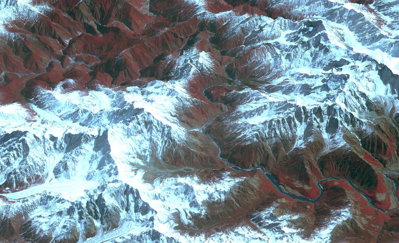
Yarlung Zangbo Grand Canyon, Tsangpo Canyon, Brahmaputra Canyon, Tsangpo Gorge
River Erosion
Namcha Barwa, Gyala Peri, Rainbow Falls, Hidden Falls, Tsangpo Badong Waterfalls
Takin
- Lowland Tropical Forests
- Tropical Rainforest
- Seasonal Tropical Forests
- Tropical Montane and Subtropical Broad-Leaved Forest
- Subalpine Temperate Coniferous Forest
- Subalpine Cool Coniferous Forest
- Alpine Shrubland
- Tundra
About Yarlung Tsangpo Grand Canyon
The Yarlung Tsangpo Grand Canyon, also known as the Yarlung Zangbo Grand Canyon, Tsangpo Canyon, or Brahmaputra Canyon, is a monumental gorge located in the Tibet Autonomous Region of China. It stands as the deepest canyon on Earth and is one of the world's longest, surpassing even the Grand Canyon in length. The canyon is carved by the Yarlung Tsangpo River, the upper course of the Brahmaputra River, as it flows eastward through the Himalayas.
Geological Formation and Dimensions
The formation of the Yarlung Tsangpo Grand Canyon is a testament to the erosive power of the Yarlung Tsangpo River. The gorge is particularly dramatic as it bends around the towering peak of Mount Namcha Barwa, reaching an average depth of approximately 5,000 meters (16,000 feet) in this section, with its deepest point recorded at 6,009 meters (19,714 feet). Overall, the canyon's average depth is about 2,268 meters (7,440 feet). Its length as a gorge is approximately 240 kilometers (150 miles), with the river's elevation dropping significantly from about 2,900 meters (9,500 ft) to 660 meters (2,170 ft) at the Indian border.
Ecosystem and Biodiversity
The Yarlung Tsangpo Grand Canyon boasts a remarkably diverse and largely unexplored ecosystem, influenced by its vast altitudinal range. The climate varies from subtropical to Arctic, supporting multiple vegetation zones. These include lowland tropical forests, tropical rainforests, seasonal tropical forests, tropical montane and subtropical broad-leaved forests, subalpine temperate and cool coniferous forests, and alpine shrubland and tundra. The region is home to rare species such as the takin, and in 2023, the discovery of a South Tibetan cypress measuring 102.3 meters (336 ft) tall suggested it might be the tallest tree in Asia. The hottest recorded temperature in Tibet, 43.6 °C (110.5 °F), has been noted near the Indian border at approximately 600 meters (2,000 ft) above sea level.
Exploration and Human Interest
Western fascination with the Tsangpo's destination began in the 19th century, with British explorers employing Indian "pundits" to map its course. Kinthup's perilous journey in the 1880s, aimed at confirming the river's connection to the Brahmaputra, involved hardship including being sold into slavery. Significant expeditions in the early 20th century, such as those by Frederick Marshman Bailey, Henry Morshead, and Frank Kingdon-Ward, finally confirmed the Tsangpo's identity as the upper Brahmaputra and identified its series of waterfalls, including the 'Rainbow Falls'. The area experienced restricted access following geopolitical events but reopened to visitors, including kayakers, in the 1990s. The dramatic conditions have earned the canyon the moniker "Everest of Rivers." The waterfalls and the surrounding Pemako area hold deep spiritual significance for Tibetan Buddhists.
Potential Development and Conservation Concerns
While the Chinese government has designated the area as a "Yarlung Tsangpo Grand Canyon National Reservation," there have been proposals for significant hydroelectric projects, such as the Medog Project. These plans, which envision a dam potentially larger than the Three Gorges Dam, have raised concerns among conservationists and downstream nations like India regarding ecosystem disruption, displacement of local populations, and impacts on water resources.
Source: Wikipedia ↗
Frequently Asked Questions
How deep is the Yarlung Tsangpo Grand Canyon?
The Yarlung Tsangpo Grand Canyon reaches a deepest point of 6,009 meters (19,714 feet), making it the deepest canyon on land. Its average depth is approximately 2,268 meters (7,440 feet).
What is the length of the Yarlung Tsangpo Grand Canyon?
The canyon has a length of about 240 kilometers (150 miles) as it navigates around Mount Namcha Barwa. It is slightly longer than the Grand Canyon in the United States.
What geological processes formed the Yarlung Tsangpo Grand Canyon?
The canyon was primarily formed by river erosion from the Yarlung Tsangpo River cutting its way through the eastern Himalayas.
What are some notable features of the Yarlung Tsangpo Grand Canyon?
Notable features include its extreme depth, the towering peaks of Namcha Barwa and Gyala Peri, diverse vegetation zones ranging from tropical forests to alpine tundra, and waterfalls like Rainbow Falls and Hidden Falls.
What kind of wildlife and vegetation can be found in the canyon?
The canyon supports a unique ecosystem with minimal human influence, featuring diverse vegetation zones from lowland tropical forests to alpine tundra. The rare takin is one of the animals found there, and it is home to the South Tibetan cypress, potentially the tallest tree in Asia.
Has the Yarlung Tsangpo Grand Canyon been explored by kayakers?
Yes, the gorge has been visited by kayakers since the 1990s. Expeditions, including one sponsored by the National Geographic Society, have attempted and completed full descents of its upper sections, though these expeditions have also faced tragic events.
Related Canyons

Huguan Taihang Grand Canyon
Huguan Taihang Grand Canyon is a significant geographical feature and popular tourist destination located in Shanxi, China. Formed by the uplift of the Taihang Mountains and subsequent river erosion, it features a complex network of deep gorges and steep slopes. The area is recognized for its geological importance, with deep gorges cutting through ancient carbonate rocks, and is a major attraction drawing millions of visitors annually.
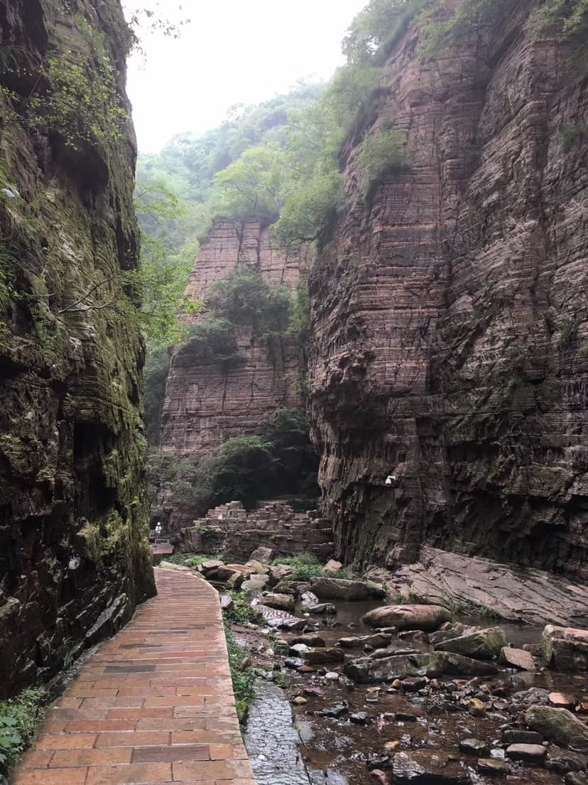
Longtan Grand Canyon
Longtan Grand Canyon is a prominent tourist attraction located in Xin'an County, Luoyang, Henan, China. This U-shaped valley, stretching 12 kilometers, is celebrated for its majestic mountains, serene valleys, cascading waterfalls, and distinctive purplish-red quartz sandstone shaped by centuries of water erosion. It is recognized as a significant part of the Wangwushan-Daimeishan UNESCO Global Geopark and has been lauded as the "First Gorge of Chinese Valleys."

Qutang Gorge
The Qutang Gorge is the shortest and narrowest of China's Three Gorges, carved by the Yangtze River between the Chijia and Baiyan Mountains. Renowned for its spectacular, dramatic scenery, it is often considered the most beautiful of the three gorges due to the combination of high mountains and tight passages. Historically, it served as a crucial passage for boat haulers via ancient pathways, and it contains numerous significant historical and cultural sites, some of which have been impacted by the Three Gorges Dam.