
Franz Josef Glacier
Franz Josef Glacier, or Kā Roimata o Hine Hukatere in Māori, is a temperate maritime glacier located in Westland Tai Poutini National Park on New Zealand's South Island. It is notable for its rapid descent from high-altitude snowfields to near sea level, allowing it to coexist with temperate rainforest and making it a significant tourist attraction. The glacier is known for its dynamic behavior, exhibiting cycles of advance and retreat influenced by precipitation patterns.
Key Facts
- ›It is a 12-kilometer-long temperate maritime glacier in Westland Tai Poutini National Park.
- ›It descends from the Southern Alps to less than 300 meters above sea level.
- ›The Māori name for the glacier is Kā Roimata o Hine Hukatere, meaning 'the tears of Hine Hukatere'.
- ›The glacier's néVé is over 2,500 meters above sea level and covers 20 square kilometers.
- ›It exhibits a cyclic pattern of advance and retreat, influenced by precipitation in the Southern Alps.
- ›Franz Josef Glacier is one of New Zealand's most publicly accessible glaciers and a major tourist attraction.

Known For
- Its rapid descent to low altitudes
- Its coexistence with temperate rainforest
- Its dynamic cycles of advance and retreat
- Its accessibility as a tourist destination
NéVé Over 2,500 Meters Above Sea Level, Terminal Moraine Known As the Waiho Loop, Kettle Lakes Like Lake Wombat and Peters Pool
Westland Tai Poutini National Park, Te WāHipounamu World Heritage Site
About Franz Josef Glacier
Franz Josef Glacier / Kā Roimata o Hine Hukatere
Franz Josef Glacier, known in Māori as Kā Roimata o Hine Hukatere, is a significant temperate maritime glacier located within Westland Tai Poutini National Park on New Zealand's South Island. This glacier is renowned for its dramatic descent from the high snowfields of the Southern Alps, reaching altitudes of less than 300 meters above sea level. This remarkable characteristic allows it to exist alongside lush temperate rainforest, a rarity for glaciers in similar latitudes.
Geography and Formation
The glacier's extensive snowfield, or névé, sits at over 2,500 meters and covers approximately 20 square kilometers. This vast area of compacted snow feeds a steep and narrow valley, resulting in a rapid glacial descent. The glacier's terminal moraine, the Waiho Loop, provides evidence of its past extents, with features like kettle lakes such as Lake Wombat and Peters Pool formed by ice left behind as the glacier retreated.
Dynamic Behavior: Advance and Retreat
Franz Josef Glacier is characterized by a distinctive cyclic pattern of advance and retreat, primarily influenced by the precipitation falling on the western face of the Southern Alps. Unlike many glaciers globally that have been in consistent retreat, Franz Josef has shown periods of significant advance, particularly in the latter half of the 20th century. This sensitivity to increased snowfall, which takes several years to manifest at the glacier's terminus, makes it a key indicator of climatic shifts in the region. Despite periods of regrowth, the long-term trend, influenced by global warming, points towards significant future retreat.
Cultural Significance and Naming
The Māori name, Kā Roimata o Hine Hukatere, translates to 'The tears of Hine Hukatere'. Oral traditions recount a story of Hine Hukatere, a skilled mountain climber, whose lover Tuawe tragically died in an avalanche. Her immense grief and tears are said to have frozen to form the glacier, a poignant connection between landscape and legend. The glacier was first described by Europeans in 1859 and later named by geologist Julius von Haast in 1865 in honor of Emperor Franz Joseph I of Austria. The official name now incorporates both the European and Māori designations.
Tourism and Accessibility
Franz Josef Glacier is one of New Zealand's most accessible glaciers and a major tourist draw. For over a century, it has attracted visitors keen to witness its impressive icy expanse. While direct walking access to the glacier's face became unsafe due to its dynamic nature and collapses, the area remains a popular destination. Tourists can experience the glacier through helicopter flights that land on the ice, offering guided walks across its surface, or by visiting viewpoints overlooking the valley. The nearby village of Franz Josef serves as a hub for these activities, offering accommodation and services for the hundreds of thousands of visitors who come each year.
Source: Wikipedia ↗
Frequently Asked Questions
What is the Māori name for Franz Josef Glacier and what does it mean?
The Māori name for Franz Josef Glacier is Kā Roimata o Hine Hukatere. This name translates to 'The tears of Hine Hukatere', referring to a legend about a woman whose tears formed the glacier.
Where is Franz Josef Glacier located?
Franz Josef Glacier is located in Westland Tai Poutini National Park on the West Coast of New Zealand's South Island. It is part of the Te Wāhipounamu World Heritage Site.
Why does Franz Josef Glacier descend to such a low altitude?
The glacier's wide snowfield at high altitude feeds a steep and narrow valley, causing it to descend rapidly to very low altitudes. This unique geography allows it to persist in a temperate zone and coexist with rainforest.
How does Franz Josef Glacier's advance and retreat cycle work?
The glacier's behavior is driven by precipitation on the western face of the Southern Alps. If increased precipitation falls as snow, the glacier advances; if it falls as rain, it retreats. Changes in snowfall take about 5-6 years to affect the glacier's terminus.
Is it possible to walk to Franz Josef Glacier?
Direct walking access to the glacier's terminal face became too dangerous after a collapse in 2012. Valley walks now end at a lookout significantly distant from the main terminal face, and glacier exploration typically requires helicopter access and specialized equipment.
What is the historical trend of Franz Josef Glacier's size?
While most glaciers have retreated globally, Franz Josef Glacier has shown periods of advance and retreat. It retreated significantly between its first mapping in 1893 and 1983, then advanced substantially between 1983 and 2008, before entering a rapid retreat phase after 2008.
Related Glaciers
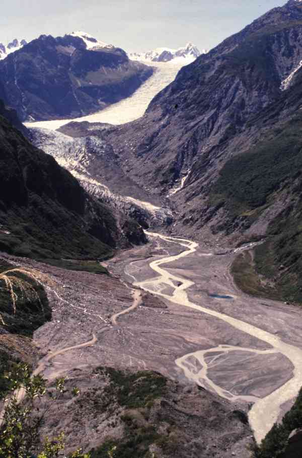
Fox Glacier
Fox Glacier, known to Māori as Te Moeka o Tuawe, is an 11.7-kilometer-long temperate maritime glacier situated in Westland Tai Poutini National Park on New Zealand's South Island. It is one of the most accessible glaciers globally, with its terminal face descending to a low elevation, making it a significant tourist attraction and a key indicator of climate change.

Hooker Glacier
Hooker Glacier is a significant glacial feature situated near Aoraki / Mount Cook in New Zealand's Southern Alps. Despite being smaller than its neighbor, the Tasman Glacier, it plays a crucial role in the local hydrology, forming the source of the Hooker River. Its accessibility makes it a popular destination for both casual walkers and serious mountaineers.

Tasman Glacier
The Tasman Glacier is New Zealand's largest glacier, located within Aoraki / Mount Cook National Park on the South Island. It is a significant geographical feature, flowing south and east from the Southern Alps, and is a prominent subject of study due to its rapid recent retreat.