
Sierra Nevada de Santa Marta
Mountain Range·Colombia·South America·Tropical Alpine/Montane
The Sierra Nevada de Santa Marta is an isolated mountain range in northern Colombia, distinct from the Andes. It is the highest coastal range in the tropics, with its peaks reaching nearly 5,700 meters and lying just 42 kilometers from the Caribbean coast. This range is a crucial ecological hub, housing diverse ecosystems and serving as the source of 36 rivers that supply water to approximately 1.2 million people.
Key Facts
- ›It is the highest coastal mountain range in the tropics.
- ›Its highest points, Pico Cristóbal Colón and Pico Simón Bolívar, are approximately 5,700 meters high.
- ›The range is home to 36 rivers, essential for millions of people.
- ›It is an isolated massif, separated from the main Andes range by low-lying land.
- ›The Sierra Nevada de Santa Marta National Natural Park was established in 1964 and designated a UNESCO Biosphere Reserve in 1979.
- ›It is considered the most irreplaceable protected area in the world for threatened species.

Known For
- Highest coastal range in the tropics
- Isolated massif
- Biodiversity hotspot
- Source of 36 rivers
Pico CristóBal ColóN, Pico SimóN BolíVar, Santa Marta PáRamo Ecoregion, Permanent Snow Cap Above 5,000 M
- Sierra Nevada De Santa Marta National Natural Park
- Unesco Biosphere Reserve
About Sierra Nevada de Santa Marta
What is the Sierra Nevada de Santa Marta?
The Sierra Nevada de Santa Marta is a distinct and isolated mountain range located in northern Colombia, geologically separate from the Andes. It holds the remarkable distinction of being the highest coastal range in the tropics and one of the highest globally, with its peaks reaching approximately 5,700 meters (18,700 ft) and situated a mere 42 kilometers from the Caribbean coast. This compact massif covers an area of about 17,000 km² and serves as the vital source for 36 rivers, providing essential freshwater to an estimated 1.2 million people.
Biodiversity and Ecoregions
The range's significant elevation changes create a dramatic array of ecoregions. These vary from the Guajira-Barranquilla xeric scrub near the coast to the Sinú Valley dry forests on lower slopes. Higher up, the Santa Marta montane forests host numerous endemic species, transitioning into Sub-Andean and Andean forests. At the highest altitudes, the Santa Marta Páramo, a unique high-altitude grassland and shrubland belt, is the northernmost Páramo enclave in South America. This incredible biodiversity includes 44 of Colombia's endemic bird species and a variety of mammals, with three native reptile species named after the range itself.
Conservation and Cultural Significance
The Sierra Nevada de Santa Marta National Natural Park, established in 1964, is Colombia's second-oldest national park and was designated a UNESCO Biosphere Reserve in 1979. It is recognized as the world's most irreplaceable protected area for threatened species. The region is culturally significant as the ancestral home of indigenous groups such as the Koguis, Arhuacos, Kankuamos, and Wiwas, who reside in traditional reserves. The park also preserves remnants of the ancient Tairona Culture, with sites like Ciudad Perdida (The Lost City) being important archaeological discoveries.
Source: Wikipedia ↗
Frequently Asked Questions
Where is the Sierra Nevada de Santa Marta located?
The Sierra Nevada de Santa Marta is an isolated mountain range situated in northern Colombia. It is located within the departments of Magdalena, Cesar, and La Guajira.
What is the highest point in the Sierra Nevada de Santa Marta?
The highest points in the range are Pico Cristóbal Colón and Pico Simón Bolívar. Their elevations are approximately 5,700 meters (18,700 ft), though exact measurements have varied.
Why is the Sierra Nevada de Santa Marta ecologically significant?
The range is a vital ecological area, supporting a wide variety of ecoregions from xeric scrub to permanent snow caps. It is home to numerous endemic species and serves as the source for 36 rivers.
What is the Sierra Nevada de Santa Marta National Natural Park?
Established in 1964, this park protects the Sierra Nevada de Santa Marta. It is recognized for its diverse environments, from beaches to snowy peaks, and was designated a UNESCO Biosphere Reserve in 1979.
What indigenous groups inhabit the Sierra Nevada de Santa Marta?
The range is home to indigenous peoples such as the Arhuacos, Koguis, Wiwas, and Kankuamos. These groups live in indigenous reserves located in the mid-highlands of the mountain range.
Is access to the highest peaks easy?
Access to the highest summits has been difficult in recent years due to local opposition and historical armed turmoil, although a documented ascent occurred in 2015. The most straightforward access point is to Cuchillo de San Lorenzo for views.
Related Glaciers

Nevado del Ruiz
Nevado del Ruiz is a stratovolcano in Colombia that is the highest point in both the Caldas and Tolima departments. It is part of the Andes mountain range and is known for its glaciers and its history of devastating lahars, particularly the 1985 eruption that destroyed the town of Armero and caused an estimated 25,000 deaths, making it the deadliest lahar in recorded history.
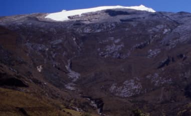
Ritacuba Blanco
Ritacuba Blanco is the highest peak in Colombia's Cordillera Oriental, part of the Andes Mountains. It is significant as the location of a rapidly melting glacier, which serves as a stark indicator of global warming's impact on tropical mountains. The peak is accessible for climbing, though its glacier is a notable feature for those who ascend it.

Amalia Glacier
Amalia Glacier, also known as Skua Glacier, is a tidewater glacier situated in Bernardo O'Higgins National Park, Chile. Originating from the Southern Patagonian Ice Field, it is notable for its significant retreat between 1945 and 1986, which was among the most dramatic observed in the region during that period. The glacier also plays a role in shaping the landscape by partially surrounding and eroding the northern flank of the Reclus volcano.