
BP
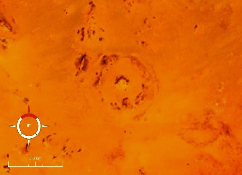
The BP Impact Structure, also known as Gebel Dalma, is a deeply eroded impact crater in southwestern Libya. It is characterized by three discontinuous concentric ridges formed from deformed sedimentary rocks, with an estimated diameter of 3.2–3.4 km. The structure's impact origin has been confirmed through the analysis of shock metamorphism in quartz grains found at the site.
Key Facts
- ›Located 165 km northeast of the Kufra Oasis in southwest Libya.
- ›Estimated diameter is 3.2–3.4 km.
- ›Consists of three discontinuous, concentric ridges of deformed early Cretaceous Nubian Sandstone.
- ›First recognized in 1967 using space and aerial photography.
- ›Impact origin confirmed in the early 1970s through field studies and shock metamorphism analysis.
- ›Absolute age is unknown, but the maximum age is estimated based on the Nubian sandstone, around 90–120 million years old.
Oasis Impact Structure
Shocked Quartz
About BP
BP Impact Structure
The BP Impact Structure, also referred to as Gebel Dalma, is a significant geological feature located in southwestern Libya, approximately 165 km northeast of the Kufra Oasis. This deeply eroded impact crater is distinguished by three discontinuous, concentric ridges that rise above the surrounding desert plain. These prominent ridges are composed primarily of deformed sedimentary rocks, predominantly sandstone, siltstone, and minor conglomerate, belonging to the early Cretaceous Nubian Sandstone formation.
Discovery and Confirmation
The structure's potential as an impact site was first recognized in 1967 by Kohman and colleagues, who identified it along with the Oasis Impact Structure through analysis of space and aerial photography. W. M. Johnson also noted both landforms as possible impact structures while engaged in geological mapping of the Gebel Dalma area. A. J. Martin, working for British Petroleum, was the first geologist to visit the site in 1968 and subsequently named it after his company. More detailed field studies conducted in the early 1970s by B. M. French, J. R. Underwood, Jr., and others provided definitive confirmation of its impact origin.
Description and Morphology
The BP Impact Structure exhibits a morphology characterized by highly eroded and discontinuous hills forming three concentric rings. These hills can rise between 20 to 30 meters above the intervening valleys. The innermost ring, approximately 400–600 meters in diameter, is considered the deeply eroded central uplift of a small, complex impact structure. Outcrops of chaotically deformed light-colored sandstones, the oldest rocks exposed in the area, are found in the southern part of this inner ring. The middle ring, with a diameter of about 2 km, displays outward-dipping strata forming a prominent inward-dipping scarp, with dips ranging from 30° to 70°. The outer ring is a semicircular feature with a diameter of 2.8 km, though its southern half is heavily eroded and difficult to identify. Radar imagery has revealed a more complete bulls-eye pattern, suggesting a diameter of 3.2–3.4 km, which is larger than estimates derived from visual imagery.
Shock Metamorphism and Age
Evidence for an extraterrestrial impact is supported by the presence of shock metamorphism in quartz grains found at the site. Initial studies in 1974 by French and colleagues identified multiple sets of planar elements, including shock lamellae, in sandstone samples, indicating high-pressure shock. While some later investigations found only planar fractures, more comprehensive re-sampling and petrographic analysis in 2010 revealed diagnostic planar deformation features, planar fractures, and feather features in quartz grains, unequivocally confirming the impact origin. The absolute age of the BP Impact Structure remains unknown due to the absence of datable rocks and minerals. However, its maximum age is estimated to be between 90 and 120 million years old, based on the presumed age of the Nubian sandstone. It has been speculated that the BP and Oasis impact structures may be of similar age and possibly the result of a double impact event.
Source: Wikipedia ↗
Frequently Asked Questions
Where is the BP Impact Structure located?
The BP Impact Structure is located 165 km northeast of the Kufra Oasis in southwest Libya. It is also known by the name Gebel Dalma.
What is the size of the BP Impact Structure?
The diameter of the BP Impact Structure is estimated to be around 3.2–3.4 km. This estimate is based on present-day morphology and radar data.
How was the BP Impact Structure discovered?
The BP Impact Structure was first recognized in 1967 by Kohman and others using space and aerial photography. W. M. Johnson also identified it as a potential impact structure from aerial photography.
What evidence confirms the BP Impact Structure as an impact crater?
The impact origin is confirmed by the geometry and style of deformation of the structure, and crucially, by the presence of shock metamorphism in quartz grains. These grains exhibit diagnostic planar deformation features, planar fractures, and feather features.
What is the age of the BP Impact Structure?
The absolute age of the BP Impact Structure is unknown because rocks and minerals suitable for radiometric dating are absent. However, its maximum age is estimated to be between 90 and 120 million years old, based on the age of the surrounding Nubian sandstone.
Is the BP Impact Structure eroded?
Yes, the BP Impact Structure is described as deeply eroded. Its outermost ridge is poorly preserved, and the structure consists of highly eroded and discontinuous hills.
Related Impact Craters
Oasis
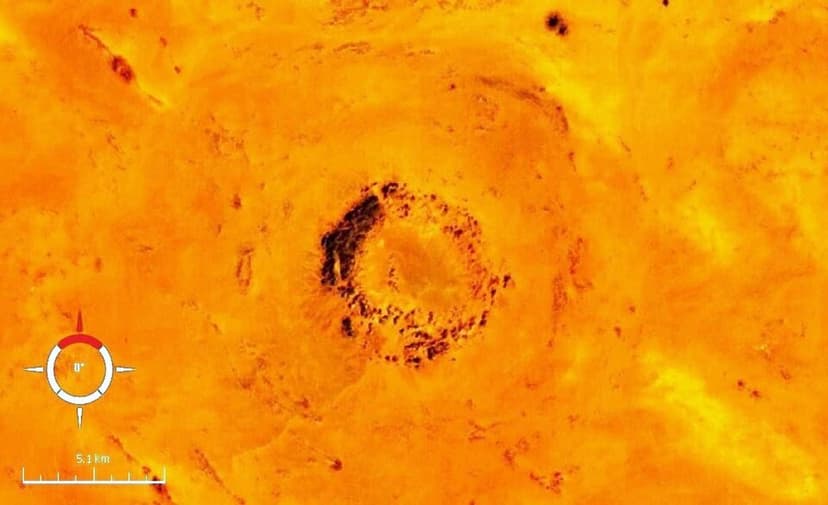
The Oasis Impact Structure is a deeply eroded impact site in southwestern Libya, located south of the BP Impact Structure. While its original crater has been entirely destroyed by erosion, the structure is characterized by a discontinuous ring of hills approximately 5.1 km in diameter, and its overall diameter is estimated to be around 18 km. The presence of shocked quartz confirms its origin as an impact event.
Mount Toondina
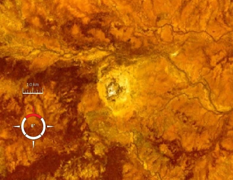
Mount Toondina is an eroded impact structure located in northern South Australia, characterized by a circular topographic feature rising from the desert landscape. Initially thought to be a salt dome, its impact origin was proposed in 1976 and subsequently supported by geophysical studies, revealing characteristics of a complex impact crater.
Mien
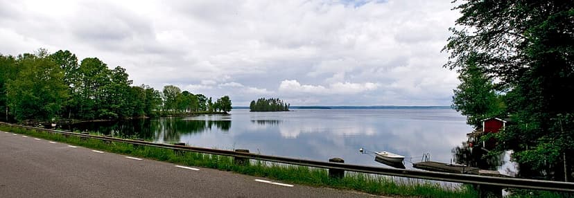
Mien is a lake in southern Sweden situated within a meteorite crater. The eroded crater is characterized by a circular lake, Lake Mien, with a diameter of 5.5 km. Its formation is attributed to an impact event estimated to have occurred in the Early Cretaceous period, approximately 121 million years ago.