
Manson
United States·Cretaceous·Mesozoic·asteroid or comet nucleus
The Manson impact structure is a large, buried impact crater in Iowa, formed approximately 74 million years ago by an asteroid or comet. Despite its significant size and historical consideration for a role in the dinosaur extinction, its surface evidence is obscured by glacial till, making it a hidden geological feature.
Key Facts
- ›The Manson impact structure has a diameter of approximately 38 km.
- ›It was formed during the Cretaceous Period, about 74 million years ago.
- ›The impactor is believed to have been a stony meteorite around 2 km in diameter.
- ›The structure is buried 20 to 90 meters below the surface and is not visible on the surface.
- ›Evidence of the impact event includes deformed rock cuttings discovered in 1912.
- ›Shocked quartz grains confirmed its origin as an impact structure.
Shocked Quartz
About Manson
Manson Impact Structure
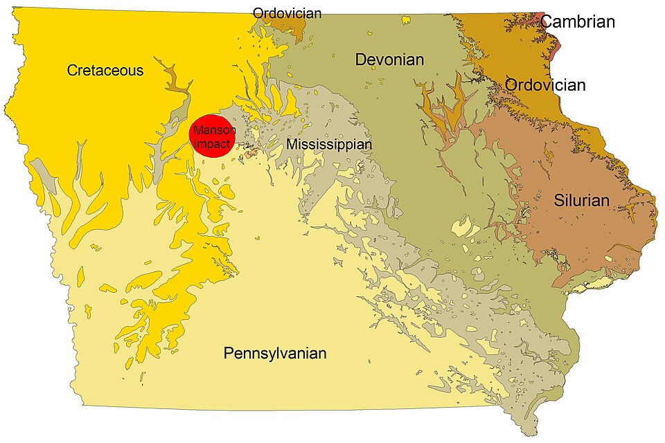
The Manson impact structure is a significant, though hidden, testament to a powerful extraterrestrial event on Earth. Located near the city of Manson, Iowa, this impact crater was formed approximately 74 million years ago during the Cretaceous Period by the collision of an asteroid or comet nucleus. It ranks among the largest known impact events to have occurred in North America. Despite its potential for immense geological impact, the structure is entirely buried beneath 20 to 90 meters of glacial till, rendering it invisible on the modern landscape.
Discovery and Confirmation
Initial clues to an anomalous structure beneath the area emerged in 1912 through unusual water well drill cuttings that revealed deformed rock. This "crystalline clast breccia with a melt matrix" prompted further investigation. The site was initially hypothesized as a "cryptovolcanic structure," but research by Robert S. Dietz in 1959 and Nicholas Short in 1966 provided crucial evidence, including the identification of shocked quartz grains, which confirmed its extraterrestrial impact origin.
Geological Characteristics and Significance
The Manson impact structure measures about 38 kilometers in diameter. The impactor itself is believed to have been a stony meteorite approximately 2 kilometers across. At the time of impact, the region was situated at the shore of the Western Interior Seaway. The immense energy of the collision disrupted a variety of rock types, including Precambrian basement rocks like granite, gneiss, and shales, as well as Paleozoic sedimentary formations. Notably, limestone layers were vaporized down to the basement, a process that contributes to the anomalous soft water found in Manson today.
Historical Context and Research
In the early 1990s, detailed research, including isotopic dating, was conducted by the U.S. Geological Survey and the Iowa Geological Survey. This research aimed, in part, to explore a potential link between the Manson impact and the Cretaceous–Paleogene extinction event. The dating results, establishing the impact's age at roughly 74 million years, indicated it occurred about 10 million years prior to the K–Pg boundary, effectively ruling out its role as the primary cause of the dinosaur extinction. The Manson impact structure remains a vital site for understanding impact processes and Earth's geological history.
Source: Wikipedia ↗
Frequently Asked Questions
Where is the Manson impact structure located?
The Manson impact structure is located near the city of Manson, Iowa, in the United States. It lies under the southeast corner of Pocahontas County and extends into portions of three adjoining counties.
How large is the Manson impact structure?
The buried impact structure is approximately 38 kilometers (24 miles) in diameter. The celestial body that caused the impact is estimated to have been about 2 kilometers (1.2 miles) in diameter.
When did the Manson impact occur?
The impact event that formed the Manson structure occurred during the Cretaceous Period, approximately 74 million years ago. This age was determined through isotopic dating of core samples from the structure.
Is there any visible evidence of the Manson impact structure on the surface?
No, there is no surface evidence of the Manson impact structure. This is because the site has been covered by glacial till relatively recently, leaving a flat landscape. The structure is buried 20 to 90 meters below the surface.
What was the impactor that created the Manson structure?
The impactor is considered to have been a stony meteorite with a diameter of about 2 kilometers (1.2 miles). The impact occurred when the site was the shore of a shallow inland sea.
What type of rock was impacted?
The impact disrupted Precambrian basement rocks, including granite, gneiss, and shales, as well as sedimentary formations of Paleozoic age, from Devonian through Cretaceous. Limestone layers were vaporized down to the basement rocks.
Did the Manson impact cause the extinction of the dinosaurs?
Initially, it was thought that the Manson impact might have led to the extinction of the dinosaurs. However, isotopic dating revealed the impact occurred about 10 million years before the Cretaceous-Paleogene extinction event, ruling out this connection.
Related Impact Craters
Kentland
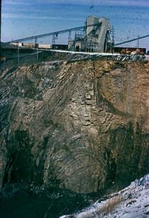
The Kentland structure, located in Newton County, Indiana, is a deeply eroded impact crater first identified by farmers in the late 19th century. Its geological significance lies in the extreme deformation of bedrock, including uplifted ancient rock layers and the presence of shatter cones, which confirmed its extraterrestrial impact origin by the late 1960s. The structure is currently an active quarry.

Gosses Bluff
Gosses Bluff is the eroded remnant of a significant impact crater located in Australia's southern Northern Territory. Estimated to have formed around 142.5 million years ago from an asteroid or comet impact, its original 22 km diameter rim is now gone, leaving a 5 km wide central uplift structure. Known as Tnorala to the Western Arrernte people, it holds deep cultural and spiritual significance.

Ouarkziz
Ouarkziz Crater is an impact structure located in northwestern Algeria, near the Moroccan border. This 3.5-kilometer diameter crater was formed by a meteor impact less than 70 million years ago, during the late Cretaceous Period. Despite significant erosion, its circular shape is still discernible, highlighting older sedimentary rock layers.