
Kentland
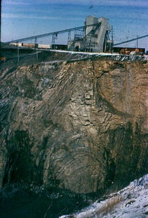
The Kentland structure, located in Newton County, Indiana, is a deeply eroded impact crater first identified by farmers in the late 19th century. Its geological significance lies in the extreme deformation of bedrock, including uplifted ancient rock layers and the presence of shatter cones, which confirmed its extraterrestrial impact origin by the late 1960s. The structure is currently an active quarry.
Key Facts
- ›Located in Newton County, Indiana, United States.
- ›Diameter of the disturbed area is approximately 13 km (8.1 MI).
- ›Age is estimated to be less than 97 million years (Cretaceous or younger), though this is disputed.
- ›Features include shatter cones and severely deformed bedrock, with vertical contacts between normally horizontal rock formations.
- ›The central uplifted core consists of Ordovician rocks, uplifted about 2,000 feet higher than surrounding areas.
- ›Discovered around 1880 by farmers quarrying for crushed rock.
Coesite, Shatter Cones
About Kentland
Kentland Impact Structure
The Kentland structure, also known as the Kentland crater or the Kentland disturbed area, is a significant impact structure located in Newton County, Indiana, United States. It was first brought to attention around 1880 through the quarrying activities of local farmers.
Geological Significance and Confirmation
Geological investigations by the late 1960s confirmed that the Kentland structure is a deeply eroded impact site, rather than a volcanic formation. This conclusion was supported by the presence of shatter cones and highly deformed bedrock. The deformation is so extreme that vertical contacts between normally horizontal rock formations of different ages are frequently observed. The core of the site features Ordovician rocks that have been uplifted approximately 2,000 feet higher than their surrounding levels.
Dimensions and Age
The structure itself is characterized by a circular dome approximately 7.24 km (4.50 mi) in diameter, though the entire disturbed area spans about 13 km (8.1 mi). The age of the Kentland structure is estimated to be less than 97 million years, placing it within the Cretaceous period or younger. However, this age estimation is subject to dispute, with some research suggesting an age of around 300 million years, corresponding to the Late Pennsylvanian Epoch of the Carboniferous Period.
Erosion and Current Status
The Kentland structure has undergone substantial erosion since its formation, with estimates suggesting over 300 meters (980 ft) of material has been removed. This erosion, coupled with subsequent glacial deposits, has obscured the original crater morphology. The site is currently an active quarry, where upper Ordovician carbonates have been extracted since 1906. Despite the erosion, the underlying geological disturbances remain a subject of scientific study.
Source: Wikipedia ↗
Frequently Asked Questions
Where is the Kentland impact structure located?
The Kentland structure is situated near the town of Kentland in Newton County, Indiana, United States. It is located about 4 kilometers (2.5 miles) east of Kentland.
How large is the Kentland impact structure?
The entire disturbed area associated with the Kentland structure is approximately 13 kilometers (8.1 miles) in diameter. The circular dome itself measures about 7.24 km (4.50 mi) in diameter.
When was the Kentland impact structure discovered?
The Kentland structure was discovered around 1880 when two farmers began quarrying for crushed rock in the area. Its recognition as an impact structure by geologists occurred by the late 1960s.
What is the estimated age of the Kentland impact structure?
The age of the Kentland structure is estimated to be less than 97 million years, placing it in the Cretaceous period or younger. However, this age estimate is disputed, with other estimates suggesting an age of around 300 million years (Late Pennsylvanian Epoch).
What geological evidence confirms Kentland as an impact structure?
Geologists concluded that Kentland is an impact structure due to the presence of shatter cones and significantly deformed bedrock. The deformation is so extreme that vertical contacts between normally horizontal rock formations of different ages are common.
What is the current status of the Kentland impact structure?
The Kentland structure is currently being worked as an active quarry. Due to significant erosion over millions of years, the original crater features are no longer visible on the surface.
Related Impact Craters
Clearwater East
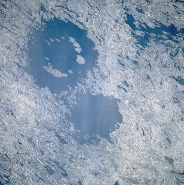
Clearwater East is one of two impact craters, forming the Clearwater Lakes in Quebec, Canada. This complex crater, with a diameter of 26 km, is estimated to be around 460-470 million years old, dating back to the Middle Ordovician period. Its central peak is submerged beneath lake water and sediments, but its presence has been confirmed through geological surveys and core drilling.

Araguainha
The Araguainha crater, located on the border of Mato Grosso and Goiás states in Brazil, is the largest known impact crater in South America, measuring 40 kilometers in diameter. Its age, estimated at 254.7 million years ago, closely overlaps with the Permian-Triassic extinction event, suggesting a potential, though indirect, role in this catastrophic global event.
Manson
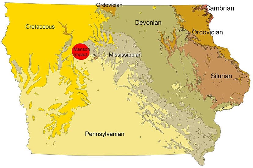
The Manson impact structure is a large, buried impact crater in Iowa, formed approximately 74 million years ago by an asteroid or comet. Despite its significant size and historical consideration for a role in the dinosaur extinction, its surface evidence is obscured by glacial till, making it a hidden geological feature.