
Aberdare ranges
Tectonic uplift forming part of the eastern rim of the Great Rift Valley.
The Aberdare Range is a significant mountain range in west-central Kenya, running north to south and forming part of the eastern rim of the Great Rift Valley. It is a vital water catchment area for Nairobi and for the Tana River, which generates a substantial portion of Kenya's electricity. The range is renowned for its diverse ecosystems, abundant wildlife, and as a protected area within Aberdare National Park.
Key Facts
- ›The range is approximately 160 km (99 MI) long and lies just south of the Equator.
- ›Its highest peak is Mount Satima, reaching an elevation of 3,999 meters (13,120 ft).
- ›The Aberdare Range is a crucial water catchment for Nairobi and the Tana River, supporting hydroelectric power generation.
- ›Ecosystems include rainforests, dense bamboo forests, and moorlands, supporting a wide variety of wildlife.
- ›Much of the range is protected within Aberdare National Park, established in 1950.
- ›It is a popular destination for hikers and climbers, with lower slopes used for farming.

Sattima Range, Nyandarua
Kenya
Alpine, Montane, Submontane
Camphor, Cedar, Podo, Hagenia, Macaranga Capensis, Neoboutonia Macrocalyx, Aningeria Adolfi-Friederici, Kuloa Usambarensis, Syzygium Guineense, Olea Europaea, Olea Capensis, Olea Hochstetteri, Podocarpus Milanjianus, Juniperus Procera, Ekebergia Capensis, Nuxia Congesta, Cassipourea Malosana, Calodendrum Capense, Alpine Grass, Giant Groundsell, Lobelia Deckenii, Heath, Erica Arborea, Hebenstretia Angolensis, Bamboo, Alchemilla Hagenia, Coelachne Friesiorum, Dendrosenecio Brassiciformis, Helichrysum Gloria-Dei, Heracleum Taylorii
Elephant, Buffalo, Giant Forest Hog, Hyena, Black Rhino, Bongo, Leopard, Serval, Civet, Genet, African Golden Cat, Jackson Mongoose, Black and White Colobus Monkey, Sykes' Monkey, Waterbuck, Reedbuck, Duiker, Bushbuck, Aberdare Cisticola
Athir River, Tana River, Ewaso Nyiro, River Malewa
About Aberdare ranges
The Aberdare Range
The Aberdare Range is a significant mountain range located in west-central Kenya, stretching approximately 160 kilometers (99 miles) north to south. It forms a crucial part of the eastern rim of the Great Rift Valley and lies just south of the Equator. The range is known locally among the Agikuyu people as Nyandarua, a name derived from their word for a drying hide, reflecting its distinctive folded silhouette.
Topography and Water Resources
The range features steep western slopes that descend into the Kinangop Plateau and the Great Rift Valley, while its eastern slopes are more gentle. The highest peak is Mount Satima, reaching an elevation of 3,999 meters (13,120 ft). The Aberdare Range is vital for Kenya's water security, serving as a primary water catchment area for the Sasumua and Ndakaini dams, which supply Nairobi with most of its water. Furthermore, the mountain forests are a source for the Tana River, Kenya's largest river, feeding the Seven Forks hydroelectric power complex that generates over half of the country's electricity.
Ecology and Biodiversity
The Aberdare Range supports diverse ecosystems, transitioning from rainforests at lower elevations to dense bamboo forests and then to moorlands at higher altitudes. These varied habitats are home to a rich array of wildlife, including elephants, buffalos, giant forest hogs, hyenas, black rhinos, bongos, and various species of cats such as leopards and the rare African golden cat. Threatened species like the black and white colobus monkey and the endemic Aberdare cisticola also inhabit the range. The Aberdare National Park, established in 1950, protects a significant portion of this natural heritage.
Tourism and Cultural Importance
The Aberdare Range attracts hikers and climbers, with activities often centered around the main towns of Naivasha and Gilgil. The lower slopes are utilized for farming, while the higher areas are known for their wildlife. Historically, the range served as a headquarters for Dedan Kimathi, a leader of the Mau Mau Uprising in the 1950s. It also holds a unique place in modern history as the location where Princess Elizabeth became Queen Elizabeth II while staying at Treetops Hotel.
The range was named in 1884 by explorer Joseph Thomson in honor of Lord Aberdare, who was then president of the Royal Geographical Society and the Royal Historical Society.
Source: Wikipedia ↗
Frequently Asked Questions
What is the Aberdare Range?
The Aberdare Range is a 160 km long mountain range in west-central Kenya, forming part of the eastern rim of the Great Rift Valley. It is an important ecological and water catchment area.
Where is the Aberdare Range located?
The range is located north of Kenya's capital, Nairobi, straddling the counties of Nyandarua, Nyeri, Murang'a, Kiambu, and Laikipia. It lies northeast of Naivasha and Gilgil and just south of the Equator.
What is the highest peak in the Aberdare Range?
The highest peak in the Aberdare Range is Mount Satima, which was formerly known as the Sattima Range. Its name means 'the mountain of the young bull'.
Why is the Aberdare Range important for water resources?
The Aberdare Range serves as a critical water catchment area for the Sasumua and Ndakaini dams, which supply most of Nairobi's water. Its forests also act as catchment areas for the Tana River, Kenya's largest river, supporting hydroelectric power.
What kind of wildlife can be found in the Aberdare Range?
The range is home to a wide variety of wildlife, including elephants, buffalos, giant forest hogs, hyenas, black rhinos, bongos, leopards, servals, civets, genet cats, African golden cats, Jackson mongooses, black and white colobus monkeys, Sykes' monkeys, waterbuck, reedbuck, duikers, and bushbuck. The endemic Aberdare cisticola is also found here.
What are the main ecosystems within the Aberdare Range?
The primary ecosystems include rainforests, which transition into dense bamboo forests, and finally moorlands at higher elevations. These ecosystems vary based on altitude and the western or eastern slopes of the range.
Related Mountain ranges

Accursed Mountains
The Accursed Mountains, also known as Prokletije, are a rugged mountain range in coastal Southeast Europe, forming the southernmost subrange of the Dinaric Alps. This range is notable for its dramatic glacial karst topography, rich biodiversity, and being one of the southernmost glacial masses in Europe. Its challenging terrain and unique geological formations have made it a subject of both scientific interest and local legend.

Ahaggar Mountains
The Ahaggar Mountains, also known as the Hoggar Mountains, are a highland region in the central Sahara desert of southern Algeria. This vast, rocky desert area is significant for its unique biodiversity, ancient geological formations, and rich cultural history, particularly for the Tuareg people. It is home to the highest peak in Algeria, Mount Tahat, and contains the Ahaggar Cultural Park, a protected area of immense ecological and historical importance.
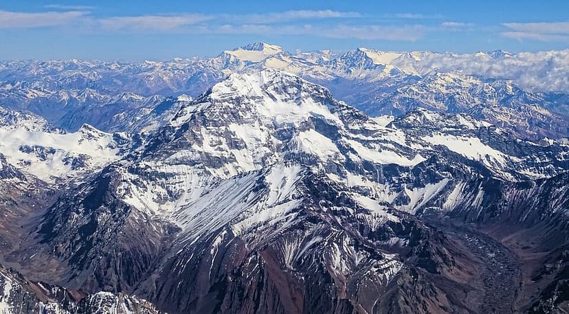
Aconcagua
Aconcagua is the highest mountain in the Americas and the highest peak outside of Asia, located in the Andes mountain range in Mendoza Province, Argentina. It is a significant peak for mountaineers worldwide, often referred to as the highest non-technical mountain, though its extreme altitude presents considerable challenges and risks.