
Devil's Kitchen Sinkhole
dissolution·United States·Redwall Limestone (Pennsylvanian subperiod), Schnebly Hill Formation (sandstone), Hermit Formation (shaly siltstone)
The Devil's Kitchen Sinkhole is a significant geological formation near Sedona, Arizona, located within the Coconino National Forest. It is one of at least seven sinkholes in the area and is notable for its substantial depth and the complex geological processes that formed it, including paleokarst subsidence and rock displacement.
Key Facts
- ›Located on the Soldier Pass Trail near Sedona, Arizona.
- ›Formed by subsidence into paleokarst caverns composed of Redwall Limestone.
- ›Initial collapse occurred in the early 1880s.
- ›A second collapse in late 1989 expanded an internal cave.
- ›Estimated total depth, including the cave, is 840 feet (260 meters).
- ›Its interior features vegetation.

Paleokarst Subsidence, Displaced Rock Blocks, Internal Cave System, Vegetation Within the Sinkhole
About Devil's Kitchen Sinkhole
The Devil's Kitchen Sinkhole is a notable geological feature located in the Coconino National Forest near Sedona, Arizona. Situated along the Soldier Pass Trail, it stands as one of at least seven sinkholes in the surrounding area and is a significant example of karst topography.
Geology and Formation
The sinkhole's formation is attributed to subsidence into paleokarst caverns composed of Redwall Limestone from the Pennsylvanian subperiod. The initial collapse occurred in the early 1880s, creating a deep chasm. Subsequent collapses, including a notable event in late 1989, have widened the sinkhole and exposed an internal cave system. The total depth, including this cave, is estimated to be around 840 feet (260 meters). The upper walls of the sinkhole are characterized by sandstone from the Schnebly Hill Formation, while the lower sections are comprised of shaly siltstone from the Hermit Formation. Observations of rounded rocks and manganese oxide patinas on the south wall suggest that this area was exposed for several hundred years.
History and Study
The first recorded sighting of the newly formed sinkhole was by Jim James in the early 1880s. The expansion of the internal cave in 1989 prompted further investigation. In 1990, the United States Forest Service conducted a geological study of the Devil's Kitchen Sinkhole, aiming to understand its stability and to enhance visitor safety by preventing accidental falls into potential new collapse zones.
Source: Wikipedia ↗
Frequently Asked Questions
Where is the Devil's Kitchen Sinkhole located?
The Devil's Kitchen Sinkhole is situated near Sedona, Arizona, specifically on the Soldier Pass Trail within the Coconino National Forest. It is one of several sinkholes found in the vicinity of Sedona.
When was the Devil's Kitchen Sinkhole formed?
The initial collapse that formed the sinkhole occurred in the early 1880s. A subsequent significant collapse happened in late 1989, which further opened up an internal cave system.
How deep is the Devil's Kitchen Sinkhole?
The sinkhole itself is approximately 660 feet (200 meters) deep. However, it leads to an internal cave that adds another 180 feet (55 meters), bringing the total estimated depth to 840 feet (260 meters).
What geological processes formed the Devil's Kitchen Sinkhole?
The sinkhole was primarily formed by subsidence into caverns within paleokarst composed of Redwall Limestone. A large block of rock was displaced during its formation, with angular edges noted on many of the broken-off rocks.
What are the geological layers present in the Devil's Kitchen Sinkhole?
The upper sections of the sinkhole's walls are composed of sandstone from the Schnebly Hill Formation. The lower areas consist of shaly siltstone belonging to the Hermit Formation.
Has the Devil's Kitchen Sinkhole been studied?
Yes, the United States Forest Service conducted a geological study of the sinkhole in 1990. This study was undertaken to help prevent visitors from experiencing dangers associated with spontaneous sinkhole formations.
Related Sinkholes

Bayou Corne sinkhole
The Bayou Corne sinkhole, also known as Doline de Bayou Corne, is a massive geological formation in Assumption Parish, Louisiana, that appeared in August 2012. It was caused by the collapse of an underground salt dome cavern operated by Texas Brine Company. The sinkhole's emergence led to the mandatory evacuation of 350 residents and has since expanded significantly, becoming a major industrial disaster.

Big Basin Prairie Preserve
The Big Basin Prairie Preserve in Kansas encompasses a significant sinkhole system, most notably the mile-wide Big Basin and the water-filled St. Jacob's Well. These geological features, formed by sinkhole activity, are historically notable as resting places for the Northern Cheyenne and landmarks for cattle drives. The preserve is a designated National Natural Landmark, managed to protect its unique landscape and wildlife.
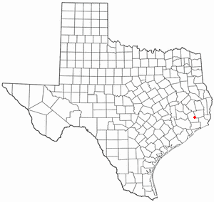
Daisetta, Texas
Daisetta, Texas, is a city in Liberty County known for its geological instability due to its location on a salt dome. This geological feature has led to the formation of multiple sinkholes, most notably a large one in 2008 nicknamed "Sinkhole de Mayo," which posed a significant risk to residents. The sinkholes are a direct consequence of the underlying salt dome's movement and potential dissolution.