
Harwoods Hole
dissolution·New Zealand·Limestone
Harwoods Hole is New Zealand's deepest vertical shaft, a significant cave system in Abel Tasman National Park. Discovered by Henry Harwood and colleagues in the late 19th century, it was first explored in 1958 and later connected to Starlight Cave, becoming a notable site for speleological exploration. Its formation involves a complex hydrological process where water percolates through calcite-saturated rock, leading to the cave system gradually being filled rather than expanded.
Key Facts
- ›New Zealand's deepest vertical shaft at 183 meters (600 ft).
- ›Surface entrance diameter of approximately 50 meters (160 ft).
- ›Overall depth from entry to outlet is 357 meters (1,171 ft).
- ›First explored during the 1958/59 summer by seven cavers.
- ›Connected to Starlight Cave, confirming an underground stream's outflow.
- ›Site of the first fatality for the New Zealand Speleological Society in 1960.
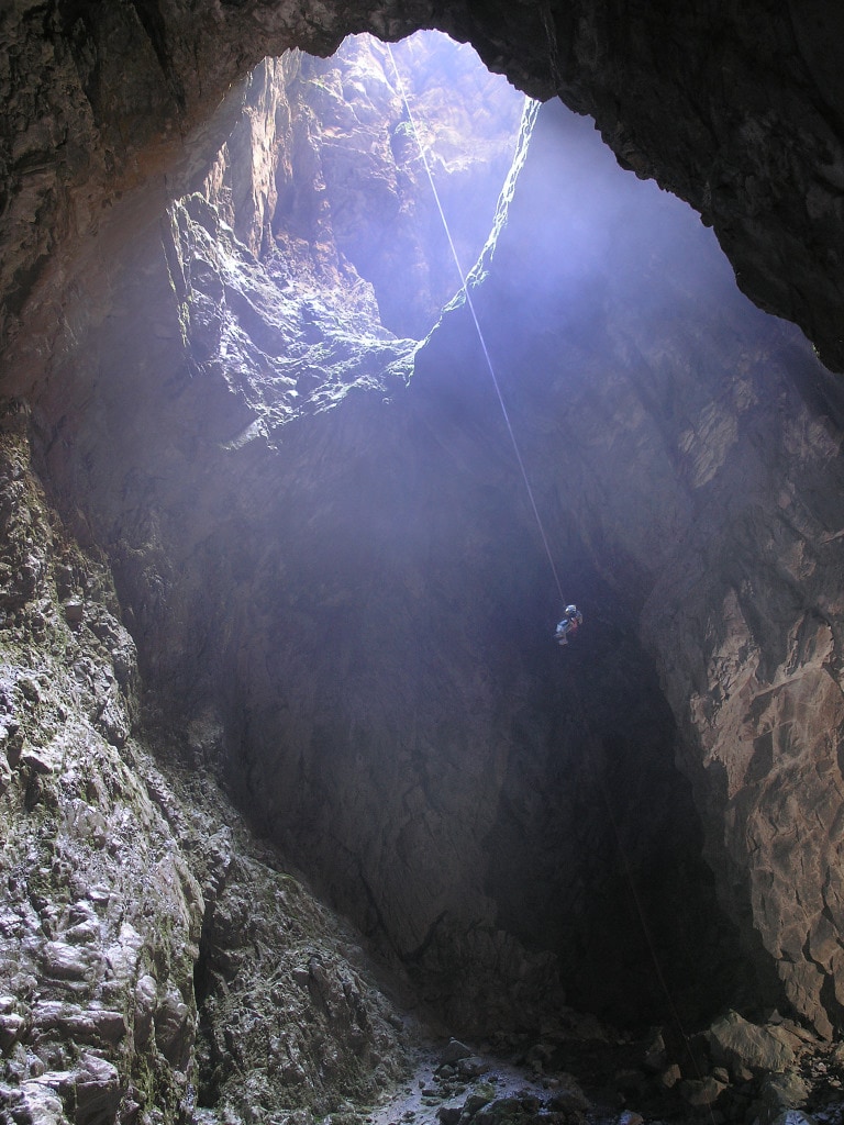
Deepest Vertical Shaft In New Zealand, Connection To Starlight Cave, Spectacular Long Rope Descent
Calcite-Rich Percolation
About Harwoods Hole
Harwoods Hole is a significant cave system located in the northwest of New Zealand's South Island, within the boundaries of Abel Tasman National Park. It holds the distinction of being New Zealand's deepest vertical shaft, measuring 183 meters (600 ft) from its surface entrance. The system is part of the larger network of caves found in the Tākaka Hill region, situated between Golden Bay and Tasman Bay.
Formation and Hydrology
The geological formation of Harwoods Hole is attributed to a complex hydrological process. Evidence suggests that runoff from an area of approximately 20 square kilometers converged into a stream that carved out the present-day Harwoods Hole. Over time, the river changed course, and the sinkhole now receives water through other sinkholes and surrounding dry valleys. This water then percolates through the surrounding rock, becoming saturated with calcite. Upon entering the cave system, this calcite is deposited, a process that leads to the gradual infilling of the cave rather than its expansion.
Historical Exploration and Significance
While the area was opened up and the hole discovered by Henry Harwood, John Horton, and Thomas Manson in the late 19th century, it remained unexplored until the 1958/59 summer. Seven cavers undertook the initial exploration, utilizing a home-built winch to lower the first person down on December 28, 1958. Following this initial exploration, Harwoods Hole became the deepest explored cave in New Zealand, a record it held until surpassed by Nettlebed Cave.
Subsequent explorations in the following summer confirmed its connection to Starlight Cave, with the underground stream's outflow identified at The Gorge Creek in East Tākaka. This connection was further solidified by the use of green dye and the widening of a passage with gelignite. The cave system has also been the site of a notable tragedy; on January 4, 1960, Peter Lambert, the leader of a caving expedition, was killed by a rockfall, marking the first fatality for the New Zealand Speleological Society. A memorial cairn at the bottom of the shaft serves as a tribute to him.
Access and Safety
Access to Harwoods Hole is considered extremely risky, and the track leading to it is no longer marked or maintained by the Department of Conservation (DOC). The inherent dangers include unstable rock platforms and slippery surfaces around the unfenced hole, posing a significant risk of fatal falls. While the public can visit the site at their own discretion, DOC does not manage these risks. The site is signposted from State Highway 60, with an unsealed road leading to a car park, from which a walking track formerly provided access. Nearby campsites and mountain bike tracks remain unaffected.
Source: Wikipedia ↗
Frequently Asked Questions
Where is Harwoods Hole located?
Harwoods Hole is situated in the northwest of the South Island of New Zealand, within the Abel Tasman National Park. It is one of several important cave systems found in Tākaka Hill, located between Golden Bay and Tasman Bay.
What makes Harwoods Hole geologically significant?
Harwoods Hole is recognized as New Zealand's deepest vertical shaft. Its formation involves a unique process where surface water converges, flows into the hole, and percolates through rock saturated with calcite. This calcite deposition contributes to the cave system being gradually filled over time.
When was Harwoods Hole discovered and first explored?
The cave system was discovered by Henry Harwood, John Horton, and Thomas Manson, who opened up the Canaan Downs area. Although discovered in the late 19th century, it remained untouched until cavers explored it over the 1958/59 summer, with the first descent occurring on December 28, 1958.
What are the risks associated with visiting Harwoods Hole?
Visiting Harwoods Hole carries extreme risks due to its unfenced nature. These hazards include unstable rock platforms and slippery surfaces at the hole itself, which create a significant potential for fatal falls. The Department of Conservation no longer maintains the track or manages these dangers.
Is Harwoods Hole a popular tourist attraction?
While accessible to the public at their own risk, Harwoods Hole is not actively developed or promoted as a tourist attraction with maintained infrastructure. The track leading to it is no longer marked or maintained by the Department of Conservation due to the extreme risks involved.
What happened at Harwoods Hole in 1960?
On January 4, 1960, Harwoods Hole was the site of the first fatality for a member of the New Zealand Speleological Society. Peter Lambert, the leader of the caving expedition, was killed by a rockfall. A memorial cairn with his helmet is located at the bottom of the shaft.
Related Sinkholes

Akhayat sinkhole
The Akhayat sinkhole, also known as Aşağı Dünya Obruğu, is a significant geological formation located in Mersin Province, Turkey. It is notable for its substantial dimensions and the presence of ancient man-made features, suggesting a historical connection to human activity and potentially a cultic site.

Big Basin Prairie Preserve
The Big Basin Prairie Preserve in Kansas encompasses a significant sinkhole system, most notably the mile-wide Big Basin and the water-filled St. Jacob's Well. These geological features, formed by sinkhole activity, are historically notable as resting places for the Northern Cheyenne and landmarks for cattle drives. The preserve is a designated National Natural Landmark, managed to protect its unique landscape and wildlife.
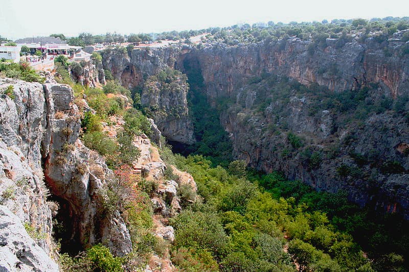
Cennet and Cehennem
Cennet and Cehennem are two large, adjacent sinkholes located in the Taurus Mountains of Mersin Province, Turkey. Cennet, or 'Heaven,' features a large opening and a staircase leading to ruins of a 5th-century monastery, while Cehennem, or 'Hell,' is a deeper, narrower sinkhole with no access to its bottom. They are significant geological formations and tourist attractions, with mythological associations to the Greek god Zeus.