
Pulicchio di Gravina
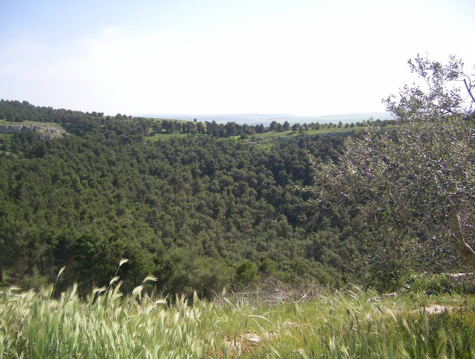
Pulicchio di Gravina is the second-largest doline on the Murge plateau in Apulia, southern Italy, distinguished by its regular, egg-like shape and significant depth. Its formation is primarily attributed to karst processes, specifically the erosive and chemical actions of rainwater on the region's fractured limestone, though debate exists regarding the exact balance between superficial erosion and potential subsurface collapse.
Key Facts
- ›It is the second-largest doline in the Murge plateau, after Pulo DI Altamura.
- ›Its dimensions include a length of 530 meters (NNW-SE), a width of 400 meters (northern part) and 360 meters (southern part), and a maximum depth of 87 meters.
- ›The doline's perimeter measures approximately 1,600 meters.
- ›The toponym 'pulo' is unique to the Murge plateau and denotes a doline, with 'pulicchio' meaning 'small pulo'.
- ›Scientific research on the doline began in earnest with Carmelo Colamonico's study in 1917, who refuted earlier theories of origin.
- ›Originally treeless, a forest was established within Pulicchio DI Gravina in the 1950s.
Pulicchie, Pulidde
Regular Egg-Like Shape, Significant Depth, Karst Processes
About Pulicchio di Gravina
Pulicchio di Gravina is a significant doline, or sinkhole, located on the Murge plateau in the Apulia region of southern Italy. It is recognized as the second-largest doline in the plateau, surpassed only by the Pulo di Altamura. The doline falls within the administrative territory of Gravina in Puglia, situated approximately 10 kilometers north of the town and close to the border with Altamura's territory. It shares the local toponym 'pulo' with other prominent dolines in the area, such as Pulo di Altamura, Pulo di Molfetta, and Pulicchio di Toritto, with 'pulicchio' indicating a smaller version of a 'pulo'.
Dimensions and Shape
The doline is characterized by a highly regular, egg-like shape, with consistently sloping sides. Its greatest length, measured in the NNW-SE direction, is 530 meters (1,740 ft). The width varies, being 400 meters (1,300 ft) in the northern section and 360 meters (1,180 ft) in the southern part. The perimeter of Pulicchio di Gravina is approximately 1,600 meters (5,200 ft), and it reaches a maximum depth of 87 meters (285 ft). The lowest point within the doline is situated at an elevation of 477.5 meters (1,567 ft) above sea level, making it slightly deeper but smaller than the Pulo di Altamura.
Geological Formation and Research
The formation of Pulicchio di Gravina is understood to be a result of karst processes, which involve the physical erosion and chemical dissolution of the fractured limestone bedrock of the Murge plateau by rainwater over extended periods. While superficial erosion is considered a primary driver, the possibility that the doline originated from the collapse of a pre-existing cave ceiling has also been explored, though even in such scenarios, subsequent karst action would have been necessary to enlarge it to its current size. Scientific interest in Pulicchio di Gravina began with Carmelo Colamonico's comprehensive study in 1917, which identified it as previously unknown to geologists and naturalists. Colamonico's work refuted earlier theories, such as that proposed by F. Virgilio in 1900, which suggested an origin solely due to underground water erosion. Colamonico argued that the absence of rock masses at the doline's bottom indicated superficial erosion as the main cause.
Hydrology and Vegetation
Unlike some other karst dolines, Pulicchio di Gravina has a very small drainage basin, meaning it collects only a limited amount of rainwater. Much of the precipitation is quickly absorbed, and local accounts suggest that water is rarely present at the bottom of the doline. Historically, the doline was treeless, as depicted in early photographic records. However, in the 1950s, an afforestation program was implemented, leading to the establishment of a forest within its confines.
Source: Wikipedia ↗
Frequently Asked Questions
What is Pulicchio di Gravina?
Pulicchio di Gravina is a large doline, a type of sinkhole, located on the Murge plateau in Apulia, southern Italy. It is notable for its regular, egg-like shape and considerable depth, making it the second largest doline in its region.
Where is Pulicchio di Gravina located?
Pulicchio di Gravina is situated in the territory of Gravina in Puglia, approximately 10 kilometers north of the town, near the border with Altamura's territory. It is part of the Murge plateau in Apulia, southern Italy.
What are the dimensions of Pulicchio di Gravina?
The doline has a length of 530 meters in the NNW-SE direction and a maximum width of 400 meters in its northern part, narrowing to 360 meters in the south. Its perimeter is about 1,600 meters, and it reaches a maximum depth of 87 meters.
How was Pulicchio di Gravina formed?
The formation of Pulicchio di Gravina is attributed to karst processes, involving the erosion and dissolution of the fractured limestone rock by rainwater over millennia. While superficial erosion is a primary factor, the possibility of a subsurface cave collapse contributing to its origin has also been considered.
Is there water at the bottom of Pulicchio di Gravina?
There is typically scarce rainwater at the bottom of Pulicchio di Gravina. Local farmers have indicated that water is rarely present, as the limited rainfall is quickly absorbed into the ground. No significant sinkholes have been discovered within the doline itself.
What is the significance of the name 'pulo'?
The term 'pulo' is unique to the Murge plateau and is used to denote a doline. 'Pulicchio' is a diminutive form, meaning 'small pulo', and is used for Pulicchio di Gravina and Pulicchio di Toritto. The etymology of 'pulo' itself remains unknown.
When was Pulicchio di Gravina first studied scientifically?
The first thorough scientific study of Pulicchio di Gravina was conducted by Carmelo Colamonico in 1917. Before this, the doline was largely unknown to geologists and naturalists, with only brief mentions by other scientists.
Related Sinkholes
Gurio Lamanna
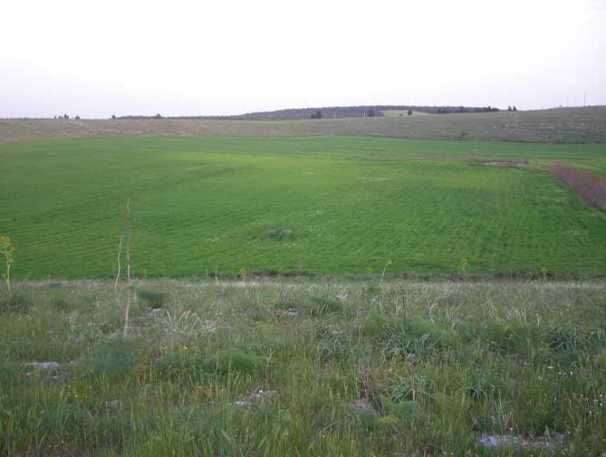
Gurio Lamanna is a large doline, often referred to as a "karst basin," located in the Murge plateau of southern Italy, near Gravina in Puglia and Altamura. Its significant size, shallow depth, and flat, fertile bottom distinguish it from typical dolines, making it a notable example of karst landforms in the region. Despite its size, it was largely unknown to scientists until the early 20th century.
Pulo di Altamura
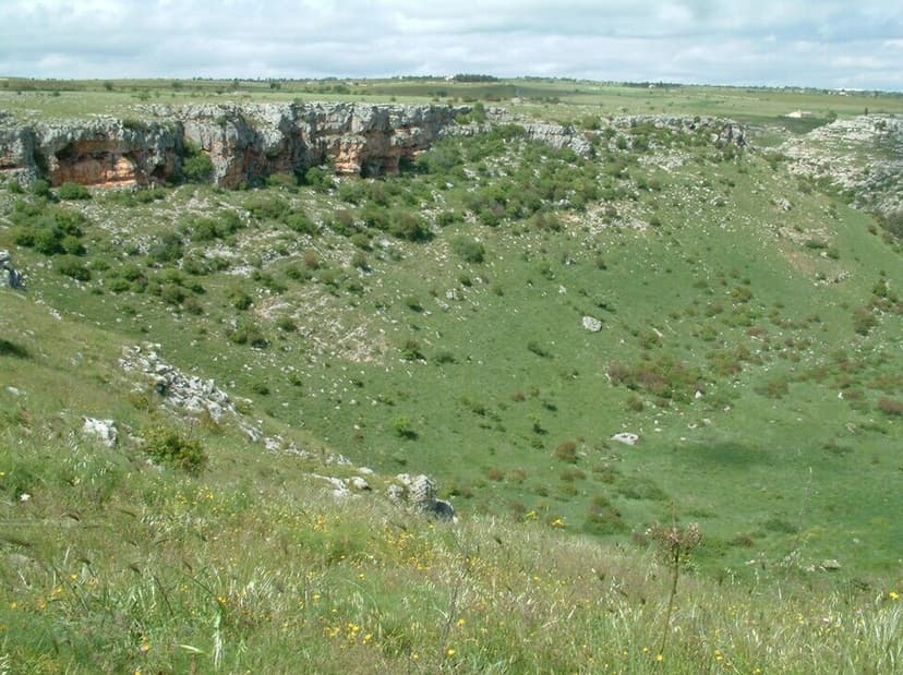
Pulo di Altamura is a significant doline, or sinkhole, located on the Murge plateau in Apulia, Italy. As the largest doline in the region, it plays a crucial role in the karst landscape, formed by the erosive action of rainwater on the fractured limestone. Its immense size and the unique microclimate within its walls support diverse flora and fauna, making it a site of scientific and ecological interest.

Pulo di Molfetta
Pulo di Molfetta is a significant doline situated on the Murge plateau in southern Italy. Its formation is attributed to the collapse of subterranean caves, a process common to other large dolines in the Apulia region, which share the local toponym 'pulo'.