
Bad Rock Canyon
River Canyon·North America·Flathead River
Bad Rock Canyon is a river canyon located east of Columbia Falls, Montana, through which the Flathead River flows. Historically, it served as a significant buffalo trail for various indigenous tribes and later became a gateway to wilderness areas like the Bob Marshall Wilderness and Glacier National Park. The canyon is also known for frequent rock slides that impact the adjacent BNSF Railway tracks.
Key Facts
- ›The Flathead River flows through Bad Rock Canyon.
- ›It was historically part of a buffalo trail through the Rocky Mountains.
- ›The canyon is an entryway to the Bob Marshall Wilderness and Glacier National Park.
- ›Frequent rock slides occur along the northern side of the BNSF Railway tracks.
- ›U.S. Highway 2 runs through the canyon, adjacent to the Flathead River.
- ›A spring on the south side of the canyon is used as a water source by local residents.

River Erosion
Frequent Rock Slides, Spring On the South Side
About Bad Rock Canyon
Bad Rock Canyon is a significant river canyon located east of Columbia Falls, Montana, characterized by the passage of the Flathead River. This natural formation holds historical importance as a centuries-old buffalo trail, connecting the Rocky Mountains to the vast buffalo hunting grounds of the Great Plains. Its strategic location also makes it a critical entryway to several protected natural areas, including the Bob Marshall Wilderness, the Hungry Horse Dam and Recreation Area, and the renowned Glacier National Park.
Historical Significance
The canyon served as a vital corridor for various indigenous peoples. Plateau tribes such as the Kalispel, Pend d'Oreilles, Spokane, Coeur d'Alene, Kootenai, and the nearby Flathead tribe utilized it for their annual buffalo hunts. Conversely, Plains tribes, most notably the Blackfeet, would travel through the area in pursuit of the quality horses bred by the western tribes. Local oral traditions hint at the possibility of historical conflicts occurring within the canyon's confines.
Gateway to Wilderness and Recreation
Beyond its historical role, Bad Rock Canyon acts as a primary access point to extensive wilderness and recreational destinations. Its proximity to Glacier National Park makes it a key point for visitors heading to this popular national park. The U.S. Highway 2, which runs alongside the Flathead River through the canyon, offers scenic views and access points, including interesting water features, particularly during colder months. A spring on the south side of the canyon is also a notable feature, serving as a water source for many local residents.
Geological Considerations
A prominent geological characteristic of Bad Rock Canyon is the frequent occurrence of rock slides along the northern side, adjacent to the BNSF Railway tracks. The railway company has installed specialized slide fences to detect and prevent these rockfalls from impacting train operations. While rock slides also happen on the U.S. Highway 2 side, stabilization efforts have made them less frequent there.
Source: Wikipedia ↗
Frequently Asked Questions
What is Bad Rock Canyon?
Bad Rock Canyon is a river canyon located east of Columbia Falls, Montana. It is carved by the Flathead River and is a significant geographical feature in the region, serving historical and recreational purposes.
What are the main geological features of Bad Rock Canyon?
The canyon is characterized by its riverine formation by the Flathead River. A notable geological concern is the frequent occurrence of rock slides along the northern side, impacting the BNSF Railway.
What historical significance does Bad Rock Canyon hold?
For centuries, the canyon was a vital buffalo trail for indigenous tribes like the Kalispel, Pend d'Oreilles, Spokane, Coeur d'Alene, Kootenai, and Flathead, facilitating their journeys to hunting grounds. It also served as a route for Plains tribes seeking horses.
What are the main activities or attractions in Bad Rock Canyon?
Bad Rock Canyon serves as a gateway to other major attractions, including the Bob Marshall Wilderness, Hungry Horse Dam and Recreation Area, and Glacier National Park. The U.S. Highway 2 pull-off offers interesting water features, especially when frozen.
What is the access situation for Bad Rock Canyon?
U.S. Highway 2 runs through the canyon, providing access. The BNSF Railway also traverses the canyon. A spring on the south side is utilized as a water source by local residents.
Are there any ongoing geological challenges in Bad Rock Canyon?
Yes, frequent rock slides are a significant issue along the northern side of the BNSF Railway tracks within the canyon. The railway has implemented slide fences to mitigate these events.
Related Canyons

Big Bend National Park
Big Bend National Park is a vast protected area in West Texas, notable for its extensive Chihuahuan Desert topography and ecology. Formed by the erosive power of the Rio Grande and significant geological uplift, the park preserves a rich tapestry of life, including over 1,200 plant species and hundreds of animal species, as well as ancient fossils and diverse rock formations. Its remote location and dramatic landscapes, including the Chisos Mountains and deep river canyons, make it a significant destination for naturalists and adventurers.
Big South Fork of the Cumberland River
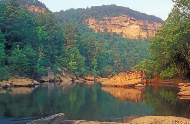
The Big South Fork of the Cumberland River is a significant river system in Tennessee and Kentucky, carved into the Cumberland Plateau. This 76-mile waterway is characterized by rugged terrain with deep gorges, natural arches, and rock shelters, and is the central feature of the Big South Fork National River and Recreation Area. Its formation by river erosion has created a diverse ecosystem and a popular destination for outdoor recreation.
Bighorn Canyon
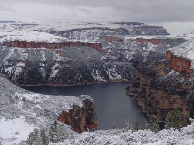
Bighorn Canyon National Recreation Area is a protected area straddling the border of Wyoming and Montana, established in 1966 following the construction of the Yellowtail Dam. The dam harnesses the Bighorn River, creating Bighorn Lake, which offers extensive recreational opportunities and flows through a significant portion of the canyon. The area preserves a rich history, with evidence of human habitation dating back 12,000 years and a significant cultural connection to the Crow people.