
Barranca de Oblatos
River Canyon·Mexico·Río Grande de Santiago
Barranca de Oblatos, also known as Barranca de Huentitán, is a significant canyon located in Jalisco, Mexico, carved by the Río Grande de Santiago. Its striking geological features bear a resemblance to the Grand Canyon and Barranca del Cobre, and it serves as a vital biogeographic corridor within the Guadalajara Metropolitan Area. The canyon is recognized as a protected ecological zone, hosting diverse flora and fauna, and has been a site of historical conflict and development.
Key Facts
- ›Carved by the Río Grande de Santiago in Jalisco, Mexico.
- ›Features an average depth of 600 meters (2,000 ft).
- ›Includes approximately 1,137 hectares (2,810 acres) of protected area.
- ›Declared a Nature Reserve and Zone subject to Ecological Conservation Protected Area in 1997.
- ›Home to diverse vegetation types including Tropical Forest, Deciduous, and Riparian forest.
- ›Supports a variety of endemic flora and fauna, making it a site for biological research.

Barranca de Huentitán, Oblatos-Huentitán
River Erosion
- Biogeographic Corridor
- Diverse Flora and Fauna
- Similar Geological Structure To Grand Canyon and Barranca Del Cobre
Great Horned Owls, Collared Peccaries, Bobcats, Gray Foxes, Opossums, Red-Tailed Boas, Barn Owls, Leaf Cutter Ants, Vampire Bats
Tropical Forest, Deciduous Forest, Riparian Forest Vegetation, Secondary Vegetation
About Barranca de Oblatos
Barranca de Oblatos, also recognized as Barranca de Huentitán, is a prominent canyon situated in the state of Jalisco, Mexico. Carved by the persistent flow of the Río Grande de Santiago, this natural wonder lies to the northeast of Guadalajara, bordering the municipalities of Tonalá, Zapotlanejo, Ixtlahuacán del Río, and Zapopan within the expansive Guadalajara Metropolitan Area.
The canyon's impressive scale and structure draw comparisons to the more famous Grand Canyon in the United States and the Barranca del Cobre in Chihuahua, Mexico. It encompasses approximately 1,137 hectares (2,810 acres) and boasts an average depth of 600 meters (2,000 ft). The significant elevation difference between the canyon's rim and the river below contributes to its dramatic topography, with a notable difference of 520 meters (1,710 ft) at the location of a funicular.
Human History and Development
The Barranca de Oblatos has witnessed numerous pivotal moments in the history of the region. In the 19th century, it was a theater for conflict between indigenous peoples of Huentitán and Spanish forces. It later became a strategic site for battles during both the Mexican Revolution and the Cristero War. A substantial flood also occurred within the canyon during the Porfiriato era, spanning from 1876 to 1911.
Ecological Significance and Conservation
Recognized for its ecological importance, the canyon is designated as a biogeographic corridor, supporting a rich variety of vegetation including Tropical Forest, Deciduous forest, Riparian forest, and secondary vegetation. Its high biological diversity attracts both national and international researchers. On June 5, 1997, the Barranca de Oblatos was officially declared a Nature Reserve, categorized as a Zone subject to Ecological Conservation Protected Area by the World Conservation Union. This designation is particularly crucial given its location within the highly urbanized Guadalajara Metropolitan Area.
The canyon is a habitat for numerous species, including Great Horned Owls, Collared Peccaries, Bobcats, Gray Foxes, Opossums, Red-tailed Boas, Barn Owls, Leaf Cutter Ants, and Vampire Bats, with many flora and fauna species being endemic to the area.
Recreational and Urban Integration
The proximity of the Guadalajara metropolitan area means that many urban developments, such as the University of Guadalajara's CUAAD campus, the Guadalajara Zoo, and the former Planetarium, are situated near or overlook the canyon. The area also offers extensive sporting and recreational facilities, including fields for soccer, basketball, and tennis, as well as picnic areas, a running track, a recreational park, and an outdoor theater, making it a popular destination for hiking and leisure activities. Past proposals for large-scale developments, such as the Guggenheim Museum and the Arcediano dam, have not materialized, though construction is underway for an art museum in Mirador Park.
Source: Wikipedia ↗
Frequently Asked Questions
What is Barranca de Oblatos?
Barranca de Oblatos, also known as Barranca de Huentitán, is a canyon carved by the Río Grande de Santiago in the state of Jalisco, Mexico. It is located on the northeast side of Guadalajara and its surrounding municipalities.
How deep is Barranca de Oblatos?
The canyon has an average depth of 600 meters (2,000 ft). The difference in elevation between the rim and the river at a specific point is 520 meters (1,710 ft).
What kind of vegetation is found in Barranca de Oblatos?
Barranca de Oblatos is considered a biogeographic corridor and is home to several types of vegetation, including Tropical Forest, Deciduous forest, Riparian forest vegetation, and secondary vegetation.
What wildlife inhabits Barranca de Oblatos?
The canyon is home to a variety of species, including Great Horned Owls, Collared Peccaries, Bobcats, Gray Foxes, Opossums, Red-tailed Boas, Barn Owls, Leaf Cutter Ants, and Vampire Bats. Many species are endemic to the canyon.
Is Barranca de Oblatos a protected area?
Yes, on June 5, 1997, the canyon was declared a Nature Reserve under the category of Zone subject to Ecological Conservation Protected Area. It is recognized for its biological diversity within the urbanized Guadalajara Metropolitan Area.
What historical events have occurred in Barranca de Oblatos?
Several important historical events have taken place in the canyon, including combat between indigenous natives and Spaniards during the Spanish Conquest, numerous battles of the Mexican Revolution and Cristero War, and a significant flooding during the Porfiriato era.
What are the recreational activities available at Barranca de Oblatos?
The canyon is a popular destination for hiking. The surrounding areas also feature sporting and recreational facilities such as soccer fields, basketball and tennis courts, picnic spaces, a running strip, a recreational park, and an outdoor theater.
Related Canyons

Copper Canyon
Copper Canyon, also known as Barrancas del Cobre, is a vast network of six interconnected canyons located in the Sierra Madre Occidental of northwestern Mexico. These canyons were carved by six rivers that originate in the Sierra Tarahumara and eventually merge into the Rio Fuerte, emptying into the Gulf of California. The name "Copper Canyon" derives from the distinctive copper-green hue of its canyon walls, and the region holds significant cultural importance for the indigenous Tarahumara (Rarámuri) people.
Sumidero Canyon
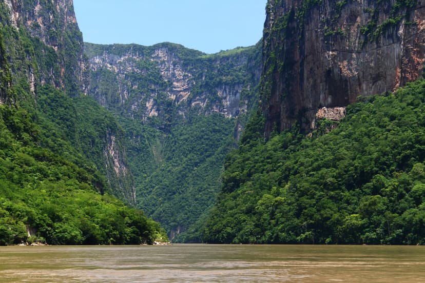
Sumidero Canyon is a deep natural canyon in Chiapas, southern Mexico, carved over millions of years by the Grijalva River. Its formation began concurrently with the Grand Canyon, shaped by tectonic crustal cracks and river erosion. The canyon is a significant natural landmark and a major tourist attraction, renowned for its towering vertical walls and unique geological formations, while also facing considerable environmental challenges.

Aare Gorge
The Aare Gorge is a dramatic canyon carved through a limestone ridge near Meiringen, Switzerland, by the Aare River. Formed approximately 10,000 years ago by glacial meltwater erosion at the end of the Ice Age, this narrow passage features sheer cliffs and is a significant tourist attraction, partly due to its proximity to the famous Reichenbach Falls.