
Bering Canyon
Bering Canyon is the longest submarine canyon in the Bering Sea, stretching approximately 400 km across the continental shelf and slope. It is bordered by the Aleutian Islands to the east and culminates in a submarine channel-lobe system at the Aleutian Basin. Its immense length gives it the largest area among the Bering Sea canyons, despite being narrower at the shelf break than some others.
Key Facts
- ›Extends approximately 400 km across the Bering shelf and slope.
- ›Confined to its eastern edge by the Aleutian Islands.
- ›Width at the shelf break is about 65 km.
- ›Possesses the largest area among Bering Sea canyons due to its length.
- ›Its thalweg reaches the Aleutian Basin at a depth of 3200 M.
- ›Features a low-relief submarine channel-lobe system in the Aleutian Basin.

Submarine Erosion
- Submarine Channel-Lobe System In the Aleutian Basin
About Bering Canyon
Bering Canyon is recognized as the longest submarine canyon within the Bering Sea, extending a considerable distance of approximately 400 kilometers across the Bering shelf and slope. Its eastern boundary is defined by the Aleutian Islands, which confine its extent.
Geological Characteristics
The canyon's dimensions include a width of about 65 kilometers at the shelf break. While this width is less than that of the Zhemchug Canyon and Navarin Canyons, Bering Canyon's exceptional length results in it possessing the largest overall area among these submarine features. The deepest point of the canyon, its thalweg, descends to 3200 meters in the Aleutian Basin. At this depth, a low-relief submarine channel-lobe system has formed, indicative of significant geological processes over time.
Significance
As the most extensive submarine canyon in the Bering Sea, Bering Canyon plays a crucial role in the underwater topography and geological dynamics of the region. Its formation and features are shaped by submarine erosion, contributing to the unique bathymetry of the Bering Sea shelf and slope.
Source: Wikipedia ↗
Frequently Asked Questions
How long is the Bering Canyon?
The Bering Canyon is approximately 400 kilometers long, making it the longest submarine canyon in the Bering Sea.
Where is Bering Canyon located?
Bering Canyon is situated in the Bering Sea, extending across its shelf and slope. It is bounded to the east by the Aleutian Islands.
What is the significance of Bering Canyon's size?
Despite being narrower at the shelf break than some other Bering Sea canyons, Bering Canyon's great length gives it the largest overall area among them.
What geological features are found at the deepest part of Bering Canyon?
At a depth of 3200 meters, the deepest part of Bering Canyon, known as the thalweg, reaches the Aleutian Basin. Here, a low-relief submarine channel-lobe system has developed.
How wide is Bering Canyon at the shelf break?
The width of Bering Canyon at the shelf break is approximately 65 kilometers. This is about two-thirds the width of the Zhemchug Canyon and Navarin Canyons.
Related Canyons

Zhemchug Canyon
Zhemchug Canyon, translating to "pearl" in Russian, is an immense underwater canyon situated in the Bering Sea between the Siberian and Alaskan coastlines. It is recognized as the deepest submarine canyon globally, characterized by its extraordinary size and a unique, highly productive marine environment that supports a vast array of life.

Avilés Canyon
The Avilés Canyon is a significant submarine canyon system located off the coast of Asturias, Spain, in the Cantabrian Sea. As part of the larger Avilés Canyon System, it extends for approximately 75 kilometers and plunges to depths of nearly 5 kilometers, positioning it among the deepest on the planet. This deep-sea environment is a recognized biodiversity hotspot, supporting a rich array of marine life, including various whale species, numerous starfish, and ancient cold-water coral reefs.
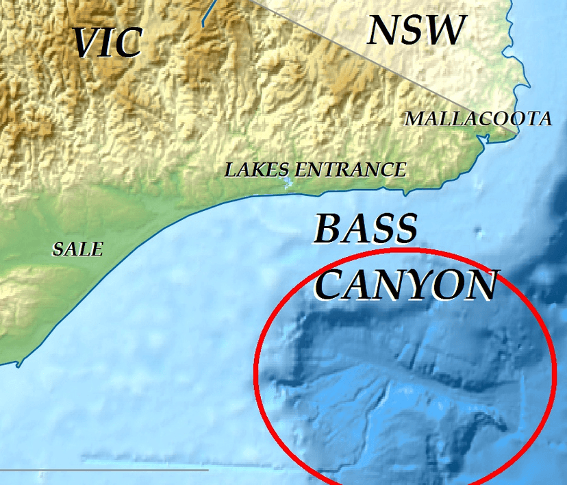
Bass Canyon
Bass Canyon is a vast submarine canyon system located off the coast of eastern Victoria, Australia, in Bass Strait. It is one of the deepest and largest submarine canyons globally, extending over 160 kilometers and reaching depths exceeding 3,000 meters. Its formation is attributed to complex erosional processes involving sediment gravity flows and tectonic activity, with evidence suggesting it has evolved over millions of years.