
Black Canyon of the Gunnison
River Canyon·North America·Precambrian·Gunnison River
The Black Canyon of the Gunnison is a dramatic gorge in western Colorado, carved by the Gunnison River. Its name derives from the fact that its sheer walls receive very little sunlight, often appearing black. The canyon is renowned for its extreme depth, steepness, and narrowness, combining these features into a formidable and awe-inspiring landscape.
Key Facts
- ›The canyon is known for its extreme depth and steepness, with sunlight reaching the canyon floor for only 33 minutes a day in some sections.
- ›Its walls are composed primarily of Precambrian gneiss and schist, formed 1.7 billion years ago.
- ›The Gunnison River drops an average of 34 feet per mile through the canyon, making it one of the steepest mountain descents in North America.
- ›At its narrowest point, the canyon is only 40 feet wide at the river.
- ›The Black Canyon of the Gunnison National Park was established in 1933 and redesignated as a national park in 1999.
- ›The canyon is a significant site for traditional rock climbing and expert-level kayaking.

River Erosion, Uplift, Tectonic Activity
Sheer Walls, Narrow Gorge
Pronghorn, Black Bear, Coyote, Muskrat, Lizard, Cougar, Raccoon, Beaver, Elk, River Otter, Bobcat, Mule Deer, American Dipper, Eagle, Hawk, Owl, Steller's Jay, Mountain Bluebird, Peregrine Falcon, Magpie, White-Throated Swift, Canyon Wren
Aspen, Ponderosa Pine, Sagebrush, Desert Mahogany, Utah Juniper, Gambel Oak, Single-Leaf Ash, Wildflower
Much Rocks, Big Water
About Black Canyon of the Gunnison
The Black Canyon of the Gunnison
The Black Canyon of the Gunnison, located in western Colorado, is a spectacular natural wonder renowned for its extreme depth, sheer walls, and profound darkness. The canyon's name is derived from the fact that its narrow depths receive sunlight for only about 33 minutes each day in certain sections, causing its formidable rock faces to appear black.
Geology and Formation
The canyon's dramatic topography is the result of a long and complex geological history. The bedrock of the Black Canyon consists of Precambrian gneiss and schist that formed approximately 1.7 billion years ago through the collision of ancient volcanic island arcs. This ancient metamorphic rock was later uplifted, most significantly during the Laramide orogeny between 70 and 40 million years ago. While volcanic deposits from surrounding mountains buried the area in subsequent millions of years, the modern Gunnison River began to establish its course about 15 million years ago. As the region underwent further uplift between 2 and 3 million years ago, the river was compelled to cut through the hard Precambrian rocks, forming the deep and steep-sided gorge seen today. The Gunnison River's average gradient through the canyon is an astonishing 34 feet per mile, making it one of the steepest mountain descents in North America.
Human History and Exploration
Indigenous peoples, such as the Ute, were aware of the canyon, referring to the river as 'much rocks, big water,' but generally avoided it. Early European explorers and fur trappers passed through the region, with Captain John Williams Gunnison providing the first official account in 1853, after whom the river was eventually named.
A remarkable feat of engineering occurred in the late 19th century when the Denver and Rio Grande Railroad constructed a narrow-gauge line through the canyon, a perilous undertaking that highlighted the canyon's ruggedness. Later, in the early 20th century, Abraham Lincoln Fellows and William Torrence made historic inner-canyon expeditions, culminating in the identification of a suitable site for the Gunnison Tunnel. Completed in 1909, this 5.8-mile irrigation tunnel was, at the time, the world's longest and remains a testament to human perseverance against formidable natural obstacles.
Conservation and Recreation
The Black Canyon of the Gunnison was established as a national monument in 1933 and redesignated as a national park on October 21, 1999. Today, it is managed by the National Park Service, protecting its unique geological features and biodiversity. The park offers stunning scenic drives along the South Rim and North Rim, hiking trails, camping, and fishing. For the adventurous, the canyon is a renowned destination for traditional rock climbing and challenging whitewater kayaking, though these activities are strictly for experts due to the extreme conditions.
Source: Wikipedia ↗
Frequently Asked Questions
What geological processes formed the Black Canyon of the Gunnison?
The Black Canyon was formed by a combination of geological processes. The Gunnison River is the primary agent of erosion, carving through the rock over millions of years. This was facilitated by significant uplift in the region during the Laramide orogeny and subsequent broad uplift, which caused the river to cut deeply into the Precambrian metamorphic rocks.
Why is it called the Black Canyon?
The canyon earns its name because its extreme steepness and narrowness allow sunlight to penetrate only for very short periods each day, typically just 33 minutes in certain sections. This lack of direct sunlight causes the sheer rock walls to appear dark and shadowy, hence 'Black Canyon'.
What are the main activities available at Black Canyon of the Gunnison National Park?
The park offers scenic drives along the rims, hiking on various trails, camping, and fishing in designated areas. For experienced adventurers, the canyon is a renowned destination for traditional rock climbing and challenging whitewater kayaking.
How can I access the inner canyon or the river?
Access to the inner canyon and the river is challenging and often requires strenuous hiking on steep, unmaintained trails known as 'routes' or 'draws.' These descents are recommended only for individuals in excellent physical condition and require route-finding skills and preparedness for self-rescue. A backcountry permit is generally required for inner canyon use, except at the west end.
What kind of wildlife can be seen in the Black Canyon?
The Black Canyon and its surrounding parklands are home to a diverse range of wildlife. Mammals such as pronghorn, black bear, coyote, elk, and mule deer inhabit the area. The canyon also supports various bird species, including eagles, hawks, owls, and migratory birds, as well as several species of lizards.
Is the Gunnison River safe for recreation?
Recreational use of the Gunnison River within the Black Canyon is highly technical and considered dangerous. While the river is designated as a Gold Medal Water for trout fishing with strict catch-and-release regulations, whitewater rafting and kayaking are only recommended for expert river runners due to impassable stretches and Class III-V rapids. Hikers near the river must also consider high flow rates that can inundate campsites.
Related Canyons
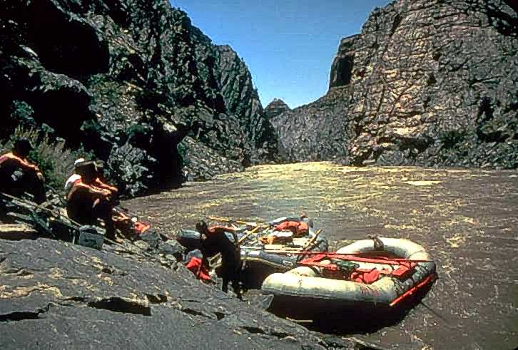
Westwater Canyon
Westwater Canyon is a narrow gorge carved by the Colorado River in eastern Utah, notable for its exposed Precambrian basement rocks within the inner gorge. It features challenging Class III and IV rapids, including the significant "Skull" rapid, making it a draw for whitewater enthusiasts. The canyon is managed by the Bureau of Land Management, which oversees a permitting system for river travelers.
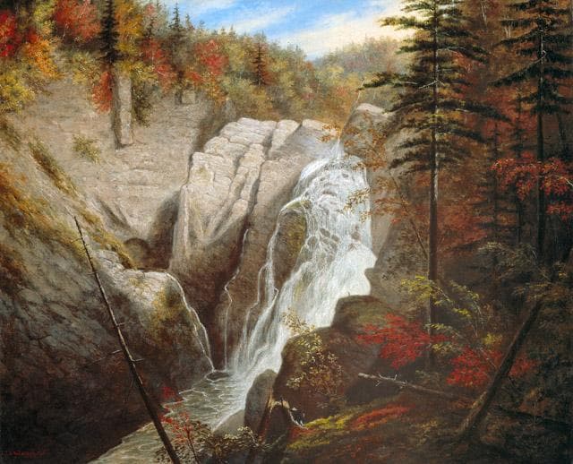
Canyon Sainte-Anne
Canyon Sainte-Anne is a steep-sided gorge located east of Beaupré, Quebec, Canada, carved by the Sainte-Anne-du-Nord River. The canyon features a prominent 74-meter waterfall and is situated within the ancient geological formations of the Canadian Shield. It has been a site of natural and cultural interest, drawing visitors for its scenic beauty and recreational activities.

Big Bend National Park
Big Bend National Park is a vast protected area in West Texas, notable for its extensive Chihuahuan Desert topography and ecology. Formed by the erosive power of the Rio Grande and significant geological uplift, the park preserves a rich tapestry of life, including over 1,200 plant species and hundreds of animal species, as well as ancient fossils and diverse rock formations. Its remote location and dramatic landscapes, including the Chisos Mountains and deep river canyons, make it a significant destination for naturalists and adventurers.