
Chesterfield Gorge
River Canyon·North America·East Branch of the Westfield River·metamorphic bedrock
Chesterfield Gorge, located in Chesterfield, Massachusetts, is a nature reserve carved by glacial meltwater and further shaped by the East Branch of the Westfield River. Its steep walls and surrounding forest offer scenic views and are part of a designated National Wild and Scenic River area, making it a site of natural and historical interest.
Key Facts
- ›The gorge is owned and administered by the Trustees of Reservations since 1929.
- ›Its walls are steep, reaching over 30 feet (9.1 M) in some sections.
- ›A half-mile trail along the cliff top provides views of the gorge, river, and forest.
- ›Remains of an old post road bridge, once connecting Boston and Albany, are found near the gorge.
- ›The area is a popular spot for fly fishing for trout, with stocked Atlantic salmon also present.

Glacial Meltwater Erosion, River Erosion
Steep Gorge Walls, Remains of Old Post Road Bridge, Boulder Fields Along Cliff Ledge
Bears, Bobcats, Turkeys, Trout, Atlantic Salmon
Oak Forest, Pine Forest, Hemlock Forest
About Chesterfield Gorge
Chesterfield Gorge is a significant natural reserve situated in Chesterfield, Massachusetts, managed by The Trustees of Reservations since 1929. This striking gorge was initially sculpted by powerful glacial meltwater torrents acting upon the region's metamorphic bedrock. The gorge continues to be actively shaped by the East Branch of the Westfield River, which flows through its depths.
Geological Features and Accessibility
The gorge is characterized by remarkably steep walls, which in some places exceed 30 feet (9.1 meters) in height. While it is possible to descend to the gorge floor during periods of low water, this is not advised, and no official trails facilitate such access. Rock climbing is also prohibited within the gorge. A well-maintained, half-mile trail runs along the cliff's edge, offering panoramic views of the gorge, the river below, and the surrounding forest. Safety is enhanced by a railing that extends along the entire length of the cliff path. The cliff ledge itself is adorned with fields of boulders, some of considerable size.
Historical Context
The area holds historical resonance with the presence of stone abutments marking the site of a former bridge that once spanned the river. This bridge was a crucial component of the old post road connecting Boston, Massachusetts, and Albany, New York, with a toll gate once situated at its eastern end. During the American Revolution, British redcoats traversed this bridge en route to Boston following the defeat of General Burgoyne at Saratoga. In 1835, devastating floodwaters swept away the bridge, along with several nearby grist and sawmills. A short trail leads upstream from the gorge to the remnants of this old bridge, and a more extensive trail network extends southward along the river, passing through the Hiram H. Fox Wildlife Management Area and towards Knightville Dam.
Natural Environment and Activities
Chesterfield Gorge serves as the gateway to a vast natural expanse along the Westfield River, which is recognized as a National Wild and Scenic River. The river is a popular destination for fly fishing, particularly for trout. The waters are also stocked with Atlantic salmon, which are distinct from the local trout and must be released if caught.
The surrounding forest is a diverse ecosystem featuring oak, pine, and hemlock trees. This habitat supports a variety of wildlife, including bears, bobcats, and turkeys, among other species.
Source: Wikipedia ↗
Frequently Asked Questions
How was Chesterfield Gorge formed?
Chesterfield Gorge was initially carved by torrents of glacial meltwater flowing over the metamorphic bedrock. Today, the East Branch of the Westfield River continues to shape the gorge.
What are the main activities available at Chesterfield Gorge?
A popular pastime is fly fishing for trout in the Westfield River. The area also offers a scenic trail along the cliff top for viewing the gorge, river, and surrounding forest.
Is it possible to access the bottom of Chesterfield Gorge?
During periods of low water, it may be possible to reach the gorge floor. However, it is not recommended, and there are no established trails from the cliff edge to the bottom.
What kind of wildlife can be found in Chesterfield Gorge?
The surrounding forest is home to a variety of wildlife, including bears, bobcats, and turkeys. The river is also stocked with Atlantic salmon for fishing.
What historical significance does Chesterfield Gorge have?
The gorge is located near the remnants of a bridge that was part of the old post road between Boston and Albany. During the American Revolution, British troops marched over this bridge.
Related Canyons

Bad Rock Canyon
Bad Rock Canyon is a river canyon located east of Columbia Falls, Montana, through which the Flathead River flows. Historically, it served as a significant buffalo trail for various indigenous tribes and later became a gateway to wilderness areas like the Bob Marshall Wilderness and Glacier National Park. The canyon is also known for frequent rock slides that impact the adjacent BNSF Railway tracks.

Big Bend National Park
Big Bend National Park is a vast protected area in West Texas, notable for its extensive Chihuahuan Desert topography and ecology. Formed by the erosive power of the Rio Grande and significant geological uplift, the park preserves a rich tapestry of life, including over 1,200 plant species and hundreds of animal species, as well as ancient fossils and diverse rock formations. Its remote location and dramatic landscapes, including the Chisos Mountains and deep river canyons, make it a significant destination for naturalists and adventurers.
Big South Fork of the Cumberland River
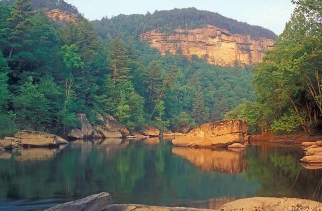
The Big South Fork of the Cumberland River is a significant river system in Tennessee and Kentucky, carved into the Cumberland Plateau. This 76-mile waterway is characterized by rugged terrain with deep gorges, natural arches, and rock shelters, and is the central feature of the Big South Fork National River and Recreation Area. Its formation by river erosion has created a diverse ecosystem and a popular destination for outdoor recreation.