
Columbia River Gorge
The Columbia River Gorge is a significant canyon carved by the Columbia River as it flows westward through the Cascade Range, forming the boundary between Washington and Oregon. This 130 km (80 mile) long and up to 1,200 m (4,000 ft) deep water gap is the sole navigable route through the Cascades and the only water connection between the Columbia Plateau and the Pacific Ocean. It is a popular recreational destination and federally protected as the Columbia River Gorge National Scenic Area.
Key Facts
- ›Stretches for over 130 km (80 miles) and reaches a depth of up to 1,200 M (4,000 ft).
- ›Forms the boundary between Washington to the north and Oregon to the south.
- ›Serves as the only navigable route through the Cascade Range.
- ›Supports a diverse range of ecosystems, from temperate rainforests to dry grasslands.
- ›Features over 90 waterfalls on the Oregon side alone, including the 190 M (620 ft) high Multnomah Falls.
- ›Experiencing strong winds due to atmospheric pressure differentials, making it a popular windsurfing and kiteboarding location.

River Erosion, Glacial Floods, Tectonic Activity
Multnomah Falls, Temperate Rainforest Ecosystems, Dry Grassland Ecosystems, Transitional Dry Woodland, Wind Tunnel Effect, Over 90 Waterfalls
Endemic Plants, Endemic Wildflowers
Temperate Rainforest, Grasslands, Dry Woodland, Bigleaf Maples, Douglas Fir, Western Hemlock, Oregon White Oak, Ponderosa Pine, Cottonwood, Lodgepole Pine
About Columbia River Gorge
The Columbia River Gorge is a dramatic canyon carved by the Columbia River as it winds westward through the Cascade Range, serving as the natural boundary between the states of Washington and Oregon in the Pacific Northwest of the United States. This impressive water gap extends for over 130 kilometers (80 miles) and plunges to depths of up to 1,200 meters (4,000 feet). Its significance lies not only in its breathtaking scenery but also in its crucial role as the only navigable route through the formidable Cascade Mountains and the sole water connection linking the vast Columbia Plateau to the Pacific Ocean. This strategic importance has cemented its status as a vital transportation corridor throughout history, with modern highways and railroad tracks traversing its depths.
Description and Ecology
The gorge is characterized by a remarkable transition in ecosystems over a relatively short distance. Within its 130-kilometer span, the landscape shifts dramatically from the lush, temperate rainforests of its western reaches, characterized by abundant epiphytes on trees like bigleaf maples and Douglas fir, to the expansive, drier grasslands of its eastern end, dotted with occasional pine forests. A transitional zone of dry woodland, featuring Oregon white oak and ponderosa pine, exists between Hood River and The Dalles. This extreme variation in elevation and precipitation—ranging from 100 inches (2,500 mm) annually in the west to as little as 10 inches (250 mm) in the east—supports a diverse array of plant and animal life, including at least 13 endemic wildflower species.
The unique topography of the gorge also creates a pronounced wind tunnel effect. Atmospheric pressure differences between the east and west sides of the Cascades generate consistent 35-mile-per-hour (56 km/h) winds, making the gorge an internationally renowned destination for windsurfing and kiteboarding. Conversely, these winds can contribute to severe snow and ice storms during winter months.
Geology and Formation
The geological history of the Columbia River Gorge is a story of immense natural forces shaping the landscape over millions of years. Its formation began as far back as the Miocene epoch, roughly 17 to 12 million years ago, coinciding with the uplift of the Cascade Range. During this period, the Columbia River's delta gradually shifted northward to its present location. While gradual erosion by the river played a role, the most spectacular sculpting occurred at the close of the last ice age. Cataclysmic Missoula Floods surged through the region, carving the steep, dramatic canyon walls that define the gorge today and inundating the river valley to heights reaching Crown Point. This rapid erosion exposed numerous layers of volcanic rock, offering a visible record of the region's geological past.
Human History and Conservation
Human presence in the Columbia River Gorge dates back over 13,000 years, with archaeological evidence pointing to early inhabitants who crossed from Asia. The gorge has served as a critical pathway for trade and travel for indigenous peoples for millennia, particularly around the historically significant salmon fishing grounds of Celilo Falls. The Lewis and Clark Expedition navigated the gorge in 1805, and subsequent European and American settlers established vital transportation routes, including steamboat lines and railroads. The construction of major dams like Bonneville and The Dalles fundamentally altered the river and submerged important natural features, including the rapids at Celilo Falls, which had been a central hub for Native American salmon fishing for over 10,000 years.
Recognizing its unique natural and scenic value, Congress designated the Columbia River Gorge as the second U.S. National Scenic Area in November 1986. This designation, managed by the Columbia River Gorge Commission and the U.S. Forest Service, aims to protect its natural beauty while allowing for existing communities and industries. The area is a highly popular recreational hub, attracting visitors for hiking, biking, sightseeing, and water sports, and is celebrated for its abundant waterfalls, with over 90 documented on the Oregon side alone, including the iconic Multnomah Falls.
Source: Wikipedia ↗
Frequently Asked Questions
How was the Columbia River Gorge formed?
The Columbia River Gorge began forming in the Miocene epoch, roughly 17 to 12 million years ago. While the river eroded the land over time, the most dramatic changes occurred at the end of the last ice age when the Missoula Floods rapidly cut the steep walls, exposing many layers of volcanic rock.
What are the main geological features of the Columbia River Gorge?
The gorge features steep, dramatic walls formed by the Missoula Floods, exposing numerous layers of volcanic rock. It also showcases a transition from temperate rainforests on the west to dry grasslands on the east, with a transitional dry woodland in between.
What kind of activities can I do in the Columbia River Gorge?
The gorge is a popular recreational destination offering hiking, biking, sightseeing, fishing, and water sports. It is particularly known for its high concentration of waterfalls and its wind tunnel effect, which makes it ideal for windsurfing and kiteboarding.
Is the Columbia River Gorge accessible?
Yes, the gorge serves as a vital transportation corridor. Interstate 84, U.S. Route 30, and Washington State Route 14 run through it, making it accessible for travel and sightseeing. Railroad tracks also follow both sides of the river.
What is the climate like in the Columbia River Gorge?
The climate varies significantly due to elevation and east-west precipitation gradients. The western end experiences a temperate rainforest with high precipitation (75-100 inches annually), while the eastern end features expansive grasslands with much less rainfall (10-15 inches annually).
Are there any notable waterfalls in the Columbia River Gorge?
Yes, the gorge is renowned for its waterfalls, with over 90 on the Oregon side alone. Multnomah Falls is a particularly famous and notable waterfall, standing at 190 meters (620 feet) high.
Related Canyons

Cromwell Gorge
Cromwell Gorge is a steep gorge carved by the former Clutha River in New Zealand's Central Otago region. It winds between the Dunstan and Cairnmuir Mountains, historically significant for gold mining and fruit orchards. The gorge and parts of old Cromwell were flooded in the early 1990s to create Lake Dunstan behind the Clyde Dam.
Fraser Canyon
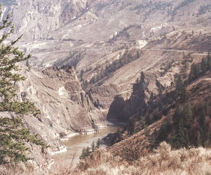
Fraser Canyon is a significant landform carved by the Fraser River as it descends through narrow rock gorges in British Columbia's Coast Mountains. Formed during the Miocene period by river erosion cutting into the uplifting Interior Plateau, it served as a crucial, albeit perilous, transportation corridor during the frontier era and continues to be a vital route for railways and highways. The canyon is characterized by its dramatic cliffs, deep gorges, and historically significant sites like Hells Gate, a major bottleneck for salmon migration and a former gold rush town.
Grand Coulee
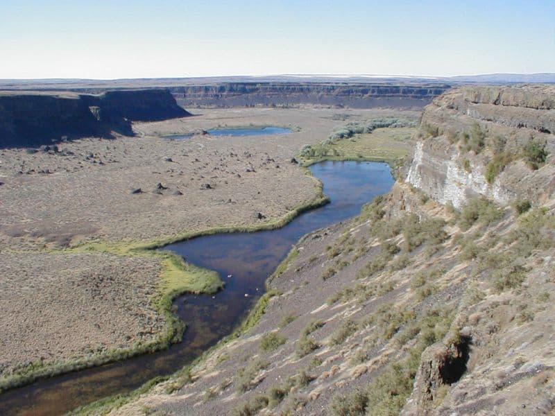
Grand Coulee is an ancient, 60-mile-long river bed in Washington State, U.S., bisected by Dry Falls into the Upper and Lower Grand Coulee. This immense geological feature was primarily carved by catastrophic glacial floods originating from Glacial Lake Missoula during the Pleistocene epoch, a process that stripped away soil and carved deep canyons. Today, the Upper Grand Coulee serves as Banks Lake, a vital part of the Columbia Basin Project for irrigation and recreation.