
Grand Coulee
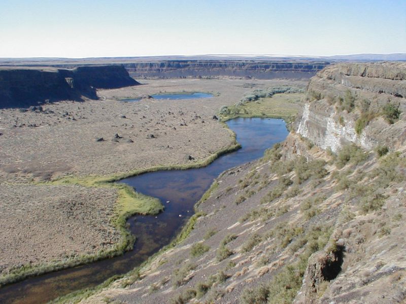
Grand Coulee is an ancient, 60-mile-long river bed in Washington State, U.S., bisected by Dry Falls into the Upper and Lower Grand Coulee. This immense geological feature was primarily carved by catastrophic glacial floods originating from Glacial Lake Missoula during the Pleistocene epoch, a process that stripped away soil and carved deep canyons. Today, the Upper Grand Coulee serves as Banks Lake, a vital part of the Columbia Basin Project for irrigation and recreation.
Key Facts
- ›Stretches approximately 60 miles (97 km) southwest from Grand Coulee Dam to Soap Lake.
- ›Bisected by Dry Falls into the Upper and Lower Grand Coulee.
- ›Formed by catastrophic glacial floods from Glacial Lake Missoula during the Pleistocene epoch.
- ›Walls of the coulee can reach up to 1,300 feet (400 M) in height.
- ›The Upper Grand Coulee is now filled with Banks Lake as part of the Columbia Basin Project.
- ›Dry Falls, one of the largest waterfalls ever known, is located at the head of the Lower Grand Coulee.
River Erosion, Glacial Floods, Cataract Recession
Dry Falls, Banks Lake, Steamboat Rock, Scabland Formations, Channeled Scablands
Bald Eagle
Shrub-Steppe Habitat
About Grand Coulee
Grand Coulee: An Ancient River Bed Carved by Cataclysm
Grand Coulee is a vast, ancient river bed located in the U.S. state of Washington, stretching approximately 60 miles (97 km) southwest from the Grand Coulee Dam to Soap Lake. This impressive geological formation is bisected by the dramatic Dry Falls into two distinct sections: the Upper Grand Coulee and the Lower Grand Coulee. Its formation is a testament to the immense power of nature, primarily shaped by colossal glacial floods during the Pleistocene epoch.
Geological Origins and Formation
The landscape of Grand Coulee lies upon underlying granite bedrock, which formed deep within the Earth's crust between 40 and 60 million years ago. This was later covered by extensive lava flows, some reaching up to 2,000 feet (2,000 m) thick, from volcanic eruptions in the Grand Ronde Rift approximately 10 to 18 million years ago. The defining geological event, however, occurred starting about two million years ago with repeated glaciation. During the Pleistocene, massive ice sheets advanced and retreated, leading to the formation of an enormous ice dam known as the Purcell lobe. This dam blocked the Clark Fork River, creating Glacial Lake Missoula. Periodically, the ice dam failed, releasing vast quantities of water—up to 500 cubic miles (2,100 km3) in mere days—in cataclysmic floods that scoured the Columbia Basin. These floods, traveling at speeds up to 65 miles per hour (105 km/h), stripped away soil, carved deep canyons, and deposited immense amounts of sediment and boulders, creating the unique scabland topography.
The Grand Coulee Today
Grand Coulee is a significant geological landmark, with canyon walls reaching up to 1,300 feet (400 m) in height. Dry Falls, a spectacular remnant of one of the largest waterfalls ever known, marks the head of the Lower Grand Coulee. The Upper Grand Coulee, once dry, was transformed in 1952 by the Columbia Basin Project. It was dammed to create Banks Lake, which serves as a vital irrigation distribution network and an equalizing reservoir, supplied by pumps from the Grand Coulee Dam. This transformation has turned the Upper Coulee and its surroundings into a haven for wildlife and a popular destination for recreation, including water sports, fishing, and hiking in areas like Sun Lakes and Steamboat Rock state parks. The ancient river bed, now a source of life-giving water for agriculture, continues to showcase the dramatic geological history of the region.
Source: Wikipedia ↗
Frequently Asked Questions
How was Grand Coulee formed?
Grand Coulee was primarily formed by colossal glacial floods originating from Glacial Lake Missoula during the Pleistocene epoch. These immense torrents of water and ice, released from ice dams, stripped away soil and carved deep canyons across the Columbia Basin.
What are the key geological features of Grand Coulee?
Key features include Dry Falls, one of the largest waterfalls ever known, which marks the divide between the Upper and Lower Grand Coulee. The coulee walls display evidence of massive erosion, including plunge basins and gravel deposits, and underlying granite bedrock is exposed in some areas.
What are the modern uses of Grand Coulee?
The Upper Grand Coulee now holds Banks Lake, which is a crucial part of the Columbia Basin Project for irrigation, supplying water to over 600,000 acres of farmland. The area also offers recreational opportunities, including water sports, fishing, and visiting state parks.
Can you visit Grand Coulee and what activities are available?
Yes, Grand Coulee is a significant tourist attraction, particularly for its geological wonders and recreational opportunities. Visitors can explore Dry Falls, enjoy the waters of Banks Lake for various water sports, and visit state parks like Sun Lakes and Steamboat Rock.
What is the geological history of the bedrock in the Grand Coulee area?
The underlying bedrock of the Grand Coulee area consists of granite, formed deep within the Earth's crust 40 to 60 million years ago. This was later overlaid by thick layers of volcanic basalt from eruptions that occurred between 10 to 18 million years ago.
Related Canyons

Moses Coulee
Moses Coulee is a significant canyon located in the Waterville Plateau region of Douglas County, Washington. It is the second-largest and westernmost canyon of the Channeled Scablands, believed to have been carved by immense glacial outburst floods during past ice ages, with discharges exceeding 600,000 m3/s. The coulee's formation is attributed to glacial meltwaters, though the precise origins and age of these floods remain debated among researchers, with theories pointing to floods from glacial Lake Missoula or subglacial floods from the Okanogan Lobe.

Columbia River Gorge
The Columbia River Gorge is a significant canyon carved by the Columbia River as it flows westward through the Cascade Range, forming the boundary between Washington and Oregon. This 130 km (80 mile) long and up to 1,200 m (4,000 ft) deep water gap is the sole navigable route through the Cascades and the only water connection between the Columbia Plateau and the Pacific Ocean. It is a popular recreational destination and federally protected as the Columbia River Gorge National Scenic Area.
Glenwood Canyon
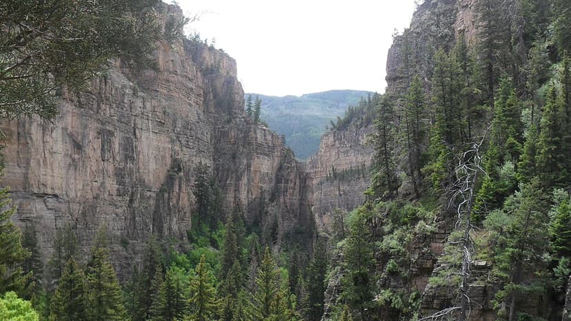
Glenwood Canyon is a rugged and scenic 20 km canyon in western Colorado, carved by the Colorado River. Its formation during the Pleistocene epoch involved the rapid erosion of sedimentary rock layers, including sandstone and Cambrian rock. Historically significant as a transportation corridor, it currently hosts Interstate 70 and a major railroad line, making it a notable natural feature on the U.S. Interstate Highway System.