
Gap of Dunloe
Mountain Pass·Ireland·Quaternary·River Loe
The Gap of Dunloe is a striking 11-kilometer mountain pass in County Kerry, Ireland, recognized for its dramatic scenery and popularity as a tourist destination. Formed approximately 25,000 years ago by glacial erosion during the last ice age, the pass carves a U-shaped valley between the Macgillycuddy's Reeks and the Purple Mountain Group mountain ranges.
Key Facts
- ›The Gap of Dunloe is approximately 11 kilometers (7 miles) long.
- ›It was formed by glacial erosion during the last ice age, approximately 25,000 years ago.
- ›The pass separates the Macgillycuddy's Reeks mountain range from the Purple Mountain Group range.
- ›The highest point in the pass is the Head of the Gap, reaching an elevation of 241 meters (791 feet).
- ›Five lakes are situated within the Gap: Coosaun Lough, Black Lake, Cushnavally Lake, Auger Lake, and Black Lough.
- ›The primary rock type in the mountain ranges flanking the Gap is Old Red Sandstone.

Dún Lóich, Bearna an Choimín
Glacial Erosion
Five Lakes, Wishing Bridge, U-Shaped Valley, Macgillycuddy's Reeks, Purple Mountain Group
DúN LóIch, Bearna An ChoimíN
About Gap of Dunloe
Overview
The Gap of Dunloe, known in Irish as Dún Lóich ('Lóich's stronghold') or Bearna an Choimín ('gap of the commonage' or 'gap of the little hollow'), is a prominent narrow mountain pass located in County Kerry, Ireland. This dramatic natural feature serves as a scenic boundary, separating the MacGillycuddy's Reeks mountain range to its west from the Purple Mountain Group range to its east. Its breathtaking landscapes have made it one of Ireland's most popular tourist destinations.
Formation and Geography
The formation of the Gap of Dunloe is attributed to glacial activity during the last ice age, approximately 25,000 years ago. A substantial glacier, estimated to be over 500 meters deep, originating from the Black Valley and part of the Templenoe Icecap, breached the Head of the Gap and carved out a distinctive U-shaped valley as it advanced northward. The pass lies predominantly on Old Red Sandstone geological formations.
The north-south oriented pass features a public road that runs from Kate Kearney's Cottage in the north to Lord Brandon's Cottage in the Black Valley to the south. The highest point along this route is the Head of the Gap, reaching an elevation of 241 meters (791 feet). The road itself spans approximately 11 kilometers (7 miles) with a total elevation change of 200 meters (650 feet). Within the confines of the Gap, a series of five interconnected lakes – Coosaun Lough, Black Lake, Cushnavally Lake, Auger Lake, and Black Lough – are linked by the River Loe. Notable landmarks within the pass include the Wishing Bridge, situated between Coosaun Lough and Black Lake, and several stone bridges that serve as lookout points.
Access and Activities
The road through the Gap of Dunloe is a public thoroughfare managed by Kerry County Council. While accessible by car, the road becomes narrow and winding, presenting challenges for passing vehicles and raising safety concerns, particularly for cyclists. The Gap is a hub for outdoor activities, including popular hill walking routes along the mountain ranges flanking the pass. Rock climbing is also practiced, with numerous routes graded for various skill levels on the Old Red Sandstone cliffs. Bouldering is another recognized activity within the area, with specific crags noted for their climbing challenges.
Naming and History
The name 'Dunloe' is believed to be an anglicisation of the Irish term 'Dún Lóich', signifying 'fort or stronghold of Lóich'. The River Loe, which flows through the valley, shares this etymological origin. According to Irish historical texts such as the Annals of Clonmacnois and the Lebor Gabála Érenn, Deala Mac Lóich was the father of five chieftains of the Fir Bolg who conquered Ireland. The Fir Bolg are recorded as having ruled Ireland for 37 years before their defeat by the Tuatha Dé Danann. The Gap has long been a destination for visitors, with informal traditions surrounding the Wishing Bridge suggesting that wishes made there will come true.
Source: Wikipedia ↗
Frequently Asked Questions
How was the Gap of Dunloe formed?
The Gap of Dunloe was formed approximately 25,000 years ago during Ireland's last ice age. It resulted from a 'glacial breach' where a deep glacier carved out a U-shaped valley as it moved northwards.
What are the main activities available at the Gap of Dunloe?
Popular activities include hill walking, cycling, and rock climbing. The scenic pass offers opportunities for exploring the surrounding mountain ranges and enjoying the natural landscape.
Is the road through the Gap of Dunloe publicly accessible?
Yes, the road through the Gap of Dunloe is a public road managed by Kerry County Council. While private jaunting car operators are present, tourists are permitted to drive or cycle through the pass.
What are the notable geological features within the Gap of Dunloe?
The Gap features a U-shaped valley carved by a glacier, separating two major mountain ranges. It also contains five connected lakes (Coosaun Lough, Black Lake, Cushnavally Lake, Auger Lake, and Black Lough) and is bordered by Old Red Sandstone cliffs used for climbing.
What is the significance of the Wishing Bridge?
The Wishing Bridge is a stone bridge located between Coosaun Lough and Black Lake within the Gap of Dunloe. It is a popular spot where visitors believe wishes made on the bridge are destined to come true.
Related Canyons
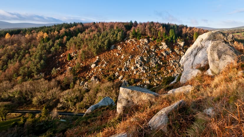
The Scalp
The Scalp is a deep natural chasm located west of Barnaslingan hill in County Dublin, Ireland. It was formed by powerful meltwater erosion during deglaciation approximately 12,000 years ago, serving as a subglacial and then surface channel for glacial outwash. This geological feature is recognized for its significance and is a habitat for various wildlife.
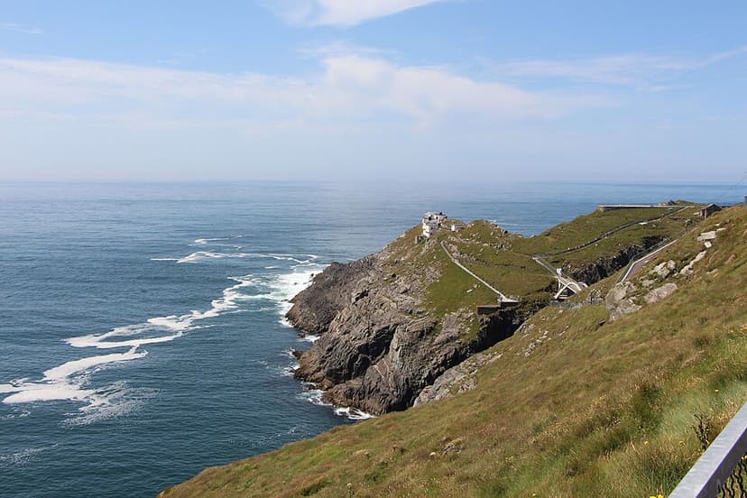
Mizen Head
Mizen Head is a prominent coastal promontory in County Cork, Ireland, traditionally considered the country's most southerly point, though Brow Head is geographically further south. Its dramatic cliffs and historical significance as a landmark for transatlantic voyagers make it a major tourist attraction. The site features an old signal station, now a museum, accessible via a bridge over a chasm and a series of steps and paths.
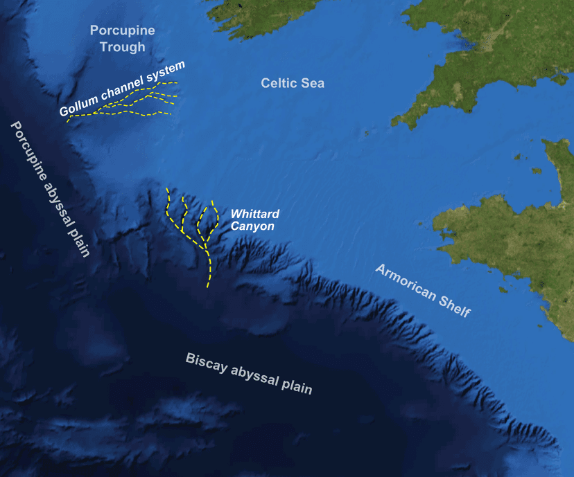
Whittard Canyon
Whittard Canyon is a significant submarine canyon located off the southwest coast of Ireland, situated between the Celtic Sea and the Atlantic Ocean. Its formation is attributed to deep-sea processes, and it has become a focal point for scientific research due to its rich biodiversity and sediment transport mechanisms.