
Mizen Head
Coastal Headland·Ireland
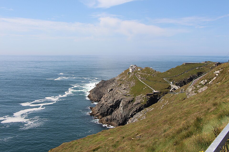
Mizen Head is a prominent coastal promontory in County Cork, Ireland, traditionally considered the country's most southerly point, though Brow Head is geographically further south. Its dramatic cliffs and historical significance as a landmark for transatlantic voyagers make it a major tourist attraction. The site features an old signal station, now a museum, accessible via a bridge over a chasm and a series of steps and paths.
Key Facts
- ›Traditionally regarded as the most southerly point of mainland Ireland.
- ›Located at the end of the Mizen Peninsula in County Cork.
- ›Features dramatic cliff scenery and is a major tourist attraction.
- ›Site of an old signal station, now a museum, accessible by a bridge.
- ›Historically a significant landmark for transatlantic shipping and communications.
Carn Uí Néid, Νότιον ἄκρον (Notion akron)
Coastal Erosion
Dramatic Cliff Scenery, Old Signal Station, Bridge Over A Chasm, "99 Steps"
Carn Uí NéId
About Mizen Head
Mizen Head is a significant coastal promontory located at the western extremity of the Mizen Peninsula in County Cork, Ireland. Traditionally regarded as the most southerly point of mainland Ireland, it is a place of dramatic natural beauty and considerable historical importance. While Brow Head, a nearby point, is geographically further south, Mizen Head has long held the symbolic distinction.
Geography and Scenery
The headland is characterized by its striking cliff scenery, offering expansive views of the Atlantic Ocean. It is a major tourist attraction, drawing visitors who come to experience its rugged coastline. The tip of the peninsula is notably separated from the mainland by a deep chasm, now spanned by a bridge, which provides access to the old signal station and lighthouse.
Historical and Strategic Significance
Mizen Head played a crucial role in transatlantic navigation and communication. For many seafarers, it represented the first or last glimpse of Europe. The site features an old signal station, which was once permanently staffed and is now a museum. This museum displays information about the station's strategic importance for transatlantic shipping and communications, including early efforts by Guglielmo Marconi.
Visitor Experience
Access to the signal station involves crossing the bridge and navigating a series of paths and viewing platforms, including the well-known "99 steps" that were part of the original route. Comprehensive visitor facilities are available at the entrance to the site. The surrounding Mizen Peninsula is home to villages such as Ballydehob, Crookhaven, Goleen, and Schull.
Mythology and Naming
In ancient times, the point was referred to as the "southern headland" (Notion akron) in Ptolemy's Geography. The Irish name, Carn Uí Néid, translates to "cairn of Néid's grandson." This name is linked to Irish mythology, specifically a tale from at least the 12th century where the god Lugh defeats Balor, a leader of the Fomorians, at Mizen Head.
Source: Wikipedia ↗
Frequently Asked Questions
What is Mizen Head known for?
Mizen Head is renowned for its dramatic cliff scenery and its historical role as a significant landmark for transatlantic shipping. It is also traditionally considered the most southerly point of mainland Ireland, making it a popular tourist destination.
What historical significance does Mizen Head hold?
Historically, Mizen Head was often the first or last sight of Europe for seafarers on transatlantic routes. The old signal station on the site housed displays related to its strategic importance for communications, including the pioneering work of Guglielmo Marconi.
What can visitors see and do at Mizen Head?
Visitors can explore the dramatic cliff scenery, visit the museum housed in the old signal station which details the site's maritime and communication history, and walk along the paths and viewing platforms. The access involves crossing a bridge over a chasm and navigating the "99 steps" and other pathways.
Is Mizen Head the actual southernmost point of Ireland?
While traditionally regarded as the most southerly point of mainland Ireland, Brow Head, located a short distance to the east on the same peninsula, is geographically several metres further south.
What is the Irish name for Mizen Head and its meaning?
The Irish name for Mizen Head is Carn Uí Néid, which translates to 'cairn of Néid's grandson'. This name refers to Balor, a figure from Irish mythology.
Related Canyons

Gap of Dunloe
The Gap of Dunloe is a striking 11-kilometer mountain pass in County Kerry, Ireland, recognized for its dramatic scenery and popularity as a tourist destination. Formed approximately 25,000 years ago by glacial erosion during the last ice age, the pass carves a U-shaped valley between the Macgillycuddy's Reeks and the Purple Mountain Group mountain ranges.
The Scalp
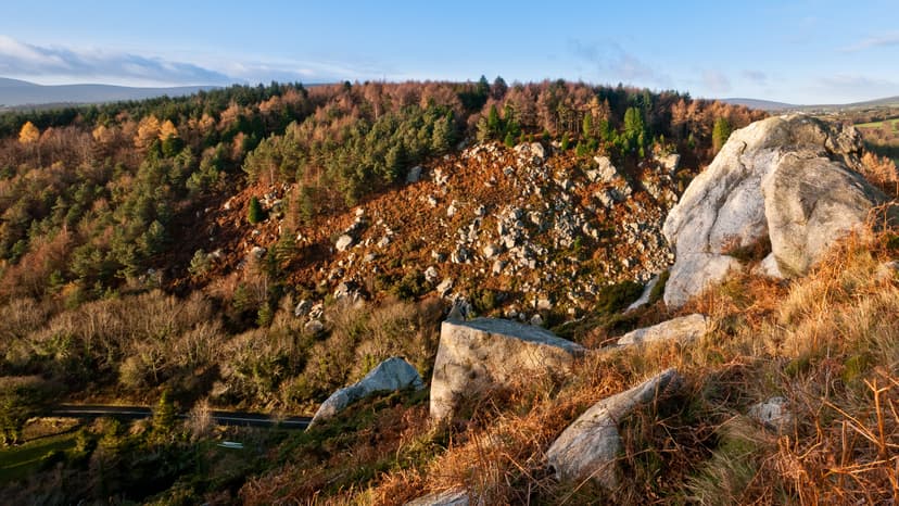
The Scalp is a deep natural chasm located west of Barnaslingan hill in County Dublin, Ireland. It was formed by powerful meltwater erosion during deglaciation approximately 12,000 years ago, serving as a subglacial and then surface channel for glacial outwash. This geological feature is recognized for its significance and is a habitat for various wildlife.
Whittard Canyon
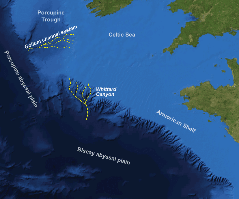
Whittard Canyon is a significant submarine canyon located off the southwest coast of Ireland, situated between the Celtic Sea and the Atlantic Ocean. Its formation is attributed to deep-sea processes, and it has become a focal point for scientific research due to its rich biodiversity and sediment transport mechanisms.