
Glenwood Canyon
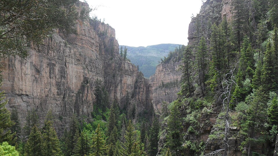
Glenwood Canyon is a rugged and scenic 20 km canyon in western Colorado, carved by the Colorado River. Its formation during the Pleistocene epoch involved the rapid erosion of sedimentary rock layers, including sandstone and Cambrian rock. Historically significant as a transportation corridor, it currently hosts Interstate 70 and a major railroad line, making it a notable natural feature on the U.S. Interstate Highway System.
Key Facts
- ›Located in western Colorado, stretching 20 km (12.5 miles) along the Colorado River.
- ›Canyon walls ascend up to 400 meters (1,300 feet) above the river.
- ›Formed during the Pleistocene epoch through rapid erosion by the Colorado River.
- ›Geological layers include Pennsylvanian, Mississippian (Leadville Formation), and Cambrian sedimentary rocks.
- ›Serves as a vital transportation route for Interstate 70 and the Union Pacific's Central Corridor.
- ›Recognized as one of the most scenic natural features on the U.S. Interstate Highway System.
River Erosion
Hanging Lake Tunnel, Colorado River
About Glenwood Canyon
Glenwood Canyon is a significant natural landmark located in western Colorado, United States. This rugged and scenic canyon stretches approximately 20 kilometers (12.5 miles) along the Colorado River, with its walls rising as high as 400 meters (1,300 feet) above the water. It represents the largest such canyon on the Upper Colorado River and is renowned for its dramatic geological features and its historical importance as a transportation route.
Geology and Formation
The canyon's formation is relatively recent, dating back to the Pleistocene epoch. It was primarily shaped by the rapid erosive power of the Colorado River cutting through layers of sedimentary rock. The geological strata visible in the canyon walls include sandstone from the Pennsylvanian and Mississippian periods, with the Mississippian layer prominently featured as part of the Leadville Formation along much of the upper rim. Sections of the lower canyon walls are composed of older Cambrian rock, showcasing a significant geological history.
Transportation Corridor
Glenwood Canyon has long served as a vital passageway through the Colorado Rockies. In 1906, it accommodated the Taylor State Road, the first road designed for automobiles traversing the region. The canyon also provided the path for the Denver and Rio Grande Western Railroad in the late 19th century, which is now part of the Union Pacific's Central Corridor. Today, it is most notably recognized for hosting a segment of Interstate 70, a major transcontinental highway. This section of I-70 is widely regarded as one of the most scenic natural features along the entire U.S. Interstate Highway System.
Access and Features
Foot access to the canyon is provided through four rest areas situated along Interstate 70 within its boundaries. The Hanging Lake Rest Area, accessible via exit 125, offers entry to a part of the canyon where I-70 is concealed within the Hanging Lake Tunnel. The canyon's natural beauty and its role as a critical transportation artery make it a point of interest, though the freeway is also subject to natural challenges such as rockslides, which have necessitated closures in the past.
Source: Wikipedia ↗
Frequently Asked Questions
How was Glenwood Canyon formed?
Glenwood Canyon was formed relatively recently in Pleistocene time. The rapid cutting of the Colorado River through layers of sedimentary rock created the canyon's rugged topography.
What are the main geological features of Glenwood Canyon?
The canyon walls are composed of various sedimentary rocks. The upper layers include sandstone from the Pennsylvanian and Mississippian periods, with sections of the lower canyon walls made of Cambrian rock. The Mississippian layer is notably part of the Leadville Formation.
What transportation routes are found in Glenwood Canyon?
Glenwood Canyon historically provided routes for railroads and highways. Today, it is a critical corridor for Interstate 70 and the Union Pacific's Central Corridor railroad line, connecting Denver and Grand Junction.
Can visitors access Glenwood Canyon?
Yes, foot access to the canyon is available at four rest areas along Interstate 70 within the canyon. The Hanging Lake Rest Area (exit 125) offers access, including to a segment where I-70 passes through the Hanging Lake Tunnel.
Are there any notable geological events in Glenwood Canyon?
The freeway through the canyon is susceptible to rockslides. Significant rockslides have occurred, leading to closures, such as those in February 2016 and July 2021.
Related Canyons

Ruby Canyon
Ruby Canyon is a prominent canyon carved by the Colorado River, stretching approximately 40 kilometers (25 miles) along the border of Colorado and Utah in the western United States. Its name derives from the striking ruby-red sandstone cliffs that define its dramatic landscape. The canyon is a favored location for river expeditions, including rafting and overnight camping, and is accessible by train via the Union Pacific Railroad.
Grand Coulee
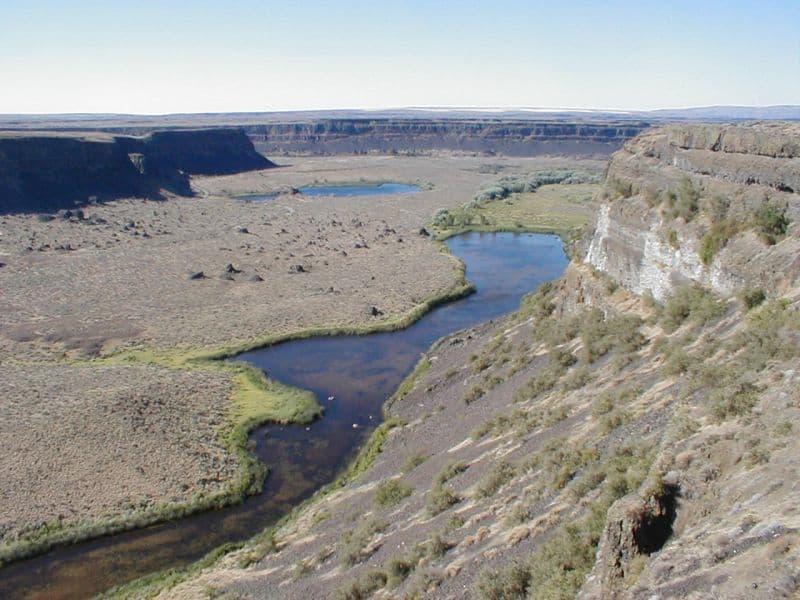
Grand Coulee is an ancient, 60-mile-long river bed in Washington State, U.S., bisected by Dry Falls into the Upper and Lower Grand Coulee. This immense geological feature was primarily carved by catastrophic glacial floods originating from Glacial Lake Missoula during the Pleistocene epoch, a process that stripped away soil and carved deep canyons. Today, the Upper Grand Coulee serves as Banks Lake, a vital part of the Columbia Basin Project for irrigation and recreation.

Moses Coulee
Moses Coulee is a significant canyon located in the Waterville Plateau region of Douglas County, Washington. It is the second-largest and westernmost canyon of the Channeled Scablands, believed to have been carved by immense glacial outburst floods during past ice ages, with discharges exceeding 600,000 m3/s. The coulee's formation is attributed to glacial meltwaters, though the precise origins and age of these floods remain debated among researchers, with theories pointing to floods from glacial Lake Missoula or subglacial floods from the Okanogan Lobe.