
Moses Coulee
Moses Coulee is a significant canyon located in the Waterville Plateau region of Douglas County, Washington. It is the second-largest and westernmost canyon of the Channeled Scablands, believed to have been carved by immense glacial outburst floods during past ice ages, with discharges exceeding 600,000 m3/s. The coulee's formation is attributed to glacial meltwaters, though the precise origins and age of these floods remain debated among researchers, with theories pointing to floods from glacial Lake Missoula or subglacial floods from the Okanogan Lobe.
Key Facts
- ›It is the second-largest and westernmost canyon of the Channeled Scablands.
- ›Carved by glacial outburst floods with discharges greater than 600,000 m3/s.
- ›Features two National Natural Landmarks: the Great Gravel Bar and Withrow Moraine and Jameson Lake Drumlin Field.
- ›The canyon is named after Chief Moses (1829–99).
- ›Its mouth discharges into the Columbia River.
- ›Today, it supports a well-preserved shrub-steppe ecoregion.

Glacial Outburst Floods, River Erosion
- the Great Gravel Bar of Moses Coulee
- Withrow Moraine and Jameson Lake Drumlin Field
- Truncated Streambeds
- Gable-Like Highlands
Lazuli Bunting, Common Goldeneye, Sage Thrasher, Sage Sparrow, Poorwill, Mountain Bluebird, Loggerhead Shrike, Canyon Wren, White-Throated Swift, Golden Eagle, Mule Deer, Least Chipmunk, Bats, Marmot
Shrub-Steppe, Sagebrush, Rabbitbrush, Greasewood, Hopsage, Bitterbrush, Bunchgrass, Buckwheat, Sagebrush Buttercup, Shooting Star, Sulphur Lupine, Serviceberry, Mock Orange, Slender Cryptantha, Tiehm's Rush, Big Sagebrush, Bluebunch Wheatgrass, Sego Lily
About Moses Coulee
Moses Coulee is a large, dry canyon situated in the Waterville Plateau region of Douglas County, Washington. It stands as the second-largest and westernmost canyon within the Channeled Scablands, lying approximately 30 kilometers west of the more widely known Grand Coulee. The coulee's dramatic landscape was shaped by colossal glacial outburst floods during past ice ages, with estimated discharges exceeding 600,000 cubic meters per second. While the erosive power of these ancient floodwaters is evident, the precise age and origins of the floods that carved Moses Coulee remain a subject of geological inquiry, with theories proposing contributions from glacial Lake Missoula or subglacial meltwaters from the Okanogan Lobe.
Geological History and Features
The coulee cuts through the Waterville Plateau, which is part of the extensive Columbia River Basalt Group. These ancient lava flows, deposited between 17 and 6 million years ago, have been significantly exposed by the erosional forces that formed the coulee. Evidence of Pleistocene glaciation is present in the area, including the Withrow Moraine complex, marking the southern extent of the Okanogan Lobe.
Two areas within and around Moses Coulee have been recognized as National Natural Landmarks. The Great Gravel Bar of Moses Coulee is celebrated as the largest and most exemplary pendant river bar formed by catastrophic glacial outburst floods. Complementing this is the Withrow Moraine and Jameson Lake Drumlin Field, which showcases prime examples of drumlins and an illustrative segment of a Pleistocene terminal moraine, notable for its direct geological relationship to catastrophic flooding events.
Modern Significance
Today, Moses Coulee is a vital habitat for a well-preserved shrub-steppe ecoregion. This ecosystem supports a diverse array of native vegetation, including various species of sagebrush, grasses, and wildflowers, alongside a rich variety of bird and animal life. The Moses Coulee Preserve, managed by The Nature Conservancy, encompasses a significant portion of this intact habitat, aiming to protect its unique biodiversity. Despite its ecological importance, the shrub-steppe environment faces ongoing threats from development, wildfires, and the introduction of non-native species.
Source: Wikipedia ↗
Frequently Asked Questions
How was Moses Coulee formed?
Moses Coulee was primarily formed by massive glacial outburst floods during past ice ages. These floods, with discharges estimated to be over 600,000 m3/s, carved the dry channel through the Waterville Plateau. While glacial floodwaters are confirmed, the exact source and age of these floods are subjects of ongoing research, with theories suggesting origins from glacial Lake Missoula or subglacial melting.
What are the notable geological features of Moses Coulee?
Two areas within and around Moses Coulee have been designated as National Natural Landmarks. The Great Gravel Bar of Moses Coulee is recognized as the largest and best example of a pendant river bar formed by catastrophic glacial outburst floods. The Withrow Moraine and Jameson Lake Drumlin Field showcases excellent examples of drumlins and a significant segment of a Pleistocene terminal moraine, demonstrating a clear geological link to catastrophic flooding.
What is the significance of the name Moses Coulee?
The canyon is named in honor of Chief Moses (1829–99), a prominent leader of the Colville Native American tribe. His legacy is tied to the region where the coulee is located.
What kind of ecosystem can be found in Moses Coulee today?
Presently, Moses Coulee is home to an excellent example of a shrub-steppe ecoregion. This habitat supports a variety of native vegetation such as sagebrush, rabbitbrush, and bunchgrass, along with diverse bird and animal species. However, this ecosystem is vulnerable to threats like development, wildfires, and invasive species.
Is Moses Coulee an active river or a dry canyon?
Moses Coulee is a dry canyon today. During glacial periods, it served as a major water channel for immense outburst floods, but these flows ceased with the melting of glaciers, leaving the coulee dry.
Related Canyons
Grand Coulee
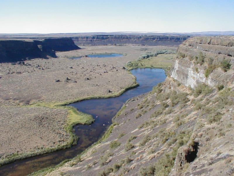
Grand Coulee is an ancient, 60-mile-long river bed in Washington State, U.S., bisected by Dry Falls into the Upper and Lower Grand Coulee. This immense geological feature was primarily carved by catastrophic glacial floods originating from Glacial Lake Missoula during the Pleistocene epoch, a process that stripped away soil and carved deep canyons. Today, the Upper Grand Coulee serves as Banks Lake, a vital part of the Columbia Basin Project for irrigation and recreation.

Columbia River Gorge
The Columbia River Gorge is a significant canyon carved by the Columbia River as it flows westward through the Cascade Range, forming the boundary between Washington and Oregon. This 130 km (80 mile) long and up to 1,200 m (4,000 ft) deep water gap is the sole navigable route through the Cascades and the only water connection between the Columbia Plateau and the Pacific Ocean. It is a popular recreational destination and federally protected as the Columbia River Gorge National Scenic Area.
Glenwood Canyon
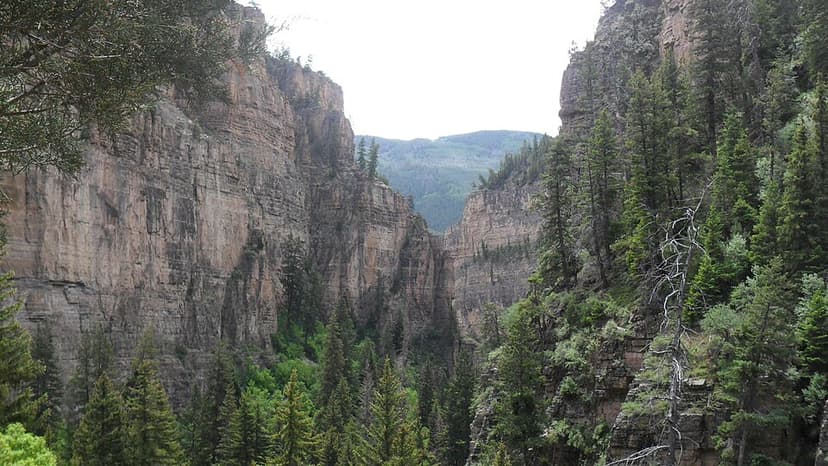
Glenwood Canyon is a rugged and scenic 20 km canyon in western Colorado, carved by the Colorado River. Its formation during the Pleistocene epoch involved the rapid erosion of sedimentary rock layers, including sandstone and Cambrian rock. Historically significant as a transportation corridor, it currently hosts Interstate 70 and a major railroad line, making it a notable natural feature on the U.S. Interstate Highway System.