
Glen Canyon
Glen Canyon is a natural canyon carved by the Colorado River, primarily located in southeastern Utah and extending into northern Arizona. Its formation is a result of the river's erosive power over millennia, with significant prehistoric human occupation. In 1963, the construction of Glen Canyon Dam created the artificial reservoir Lake Powell, which inundated much of the canyon, making it a focal point for modern environmentalist movements concerned with dam removal and river restoration.
Key Facts
- ›Carved by a 169.6-mile (272.9 km) stretch of the Colorado River.
- ›Extends mostly through Utah, with a small portion in northern Arizona ending at Lee's Ferry.
- ›Inundated by Lake Powell, created by the Glen Canyon Dam in 1963.
- ›Has a documented prehistoric cultural history dating from pre-A.D. 1 to the 15th century.
- ›Archaeological surveys identified 250 sites within the canyon prior to flooding.
- ›A significant site for modern environmentalist movements advocating for dam removal.

River Erosion
Lake Powell, Glen Canyon Dam, Crossing of the Fathers, Talus Ruin, Navajo Canyon, Cummings Mesa, Paiute Mesa
About Glen Canyon
Glen Canyon is a significant natural canyon carved by the Colorado River, predominantly located in southeastern Utah, with a smaller section extending into northern Arizona. Its formation is the result of the relentless erosive power of the Colorado River over vast geological timescales. The canyon begins at the confluence of the Colorado River and the Dirty Devil River and terminates at Lee's Ferry near the Vermilion Cliffs.
Pre-Dam Era and Indigenous History
Before the construction of the Glen Canyon Dam, the canyon held a rich prehistoric cultural history. Archaeological studies indicate a chronology from pre-A.D. 1 to the 15th century, with evidence of various cultural periods including Late Basketmaker II, Pueblo I, Pueblo II, and early Pueblo III. These ancient inhabitants are believed to have seasonally occupied the canyon for farming, hunting, and gathering resources, utilizing an extensive trail system and leaving behind numerous archaeological sites. Stone tool manufacturing was a notable industry in the region, with artifacts found throughout the canyon.
Exploration and Early Recorded History
The recorded history of Glen Canyon commences with the Dominguez–Escalante expedition in 1776, which documented the existence of the canyon and crossed the Colorado River at the site now known as the Crossing of the Fathers. Later, in the 1869 and 1871 expeditions, John Wesley Powell led scientific journeys through Glen Canyon, conducting the first formal surveys of its main channel and side canyons. The late 19th century saw a period of gold prospecting, with miners panning for flour gold, establishing camps like Dandy Crossing (Hite).
The Glen Canyon Dam and Lake Powell
In the 1950s, the proposal to construct a dam upstream of the Grand Canyon for water storage and hydroelectric power generation led to a significant environmental debate. Despite widespread citizen efforts to protect canyons like Echo Park, Glen Canyon lacked specific protection and the Glen Canyon Dam was authorized and built. Completed in 1963, the dam created the artificial reservoir Lake Powell, which inundated much of the natural beauty and archaeological heritage of Glen Canyon by hundreds of feet of water. This event profoundly impacted the canyon and has since made it a central focus for modern environmentalist movements advocating for the dam's removal and the restoration of the natural river ecosystem.
Modern Management and Significance
Today, Glen Canyon and Lake Powell are managed by the U.S. Department of the Interior as part of the Glen Canyon National Recreation Area. The canyon's transformation by the dam continues to be a subject of discussion and concern among conservationists and the public, highlighting the complex interplay between resource management, environmental preservation, and human history.
Source: Wikipedia ↗
Frequently Asked Questions
What is Glen Canyon?
Glen Canyon is a natural canyon carved by the Colorado River, primarily situated in southeastern Utah and extending into northern Arizona. It is known for its significant prehistoric cultural history and, more recently, for being largely inundated by Lake Powell due to the Glen Canyon Dam.
How was Glen Canyon formed?
Glen Canyon was formed by the erosive action of the Colorado River over an extended period. This process carved through the landscape, creating the deep and extensive canyon system.
What is the significance of Glen Canyon Dam?
The Glen Canyon Dam, completed in 1963, created the reservoir known as Lake Powell, which submerged a large portion of the natural canyon. The dam's construction and its impact on the canyon have made it a central issue for modern environmentalist movements.
What kind of prehistoric cultures inhabited Glen Canyon?
Evidence suggests habitation by various prehistoric cultures, including Late Basketmaker II Era, Pueblo I, Pueblo II, and early Pueblo III periods. These inhabitants likely utilized the canyon for seasonal farming, hunting, and gathering raw materials.
What archaeological discoveries were made in Glen Canyon?
Prior to the flooding by Lake Powell, extensive archaeological surveys identified 250 sites containing artifacts such as chipped stone tools, pottery sherds, and petroglyph panels. These findings provided insights into the seasonal occupation and resource use by prehistoric peoples.
What is the current status of Glen Canyon?
Today, Glen Canyon and Lake Powell are managed by the U.S. Department of the Interior within the Glen Canyon National Recreation Area. The canyon remains a subject of debate regarding environmental preservation and the future of the dam.
Related Canyons
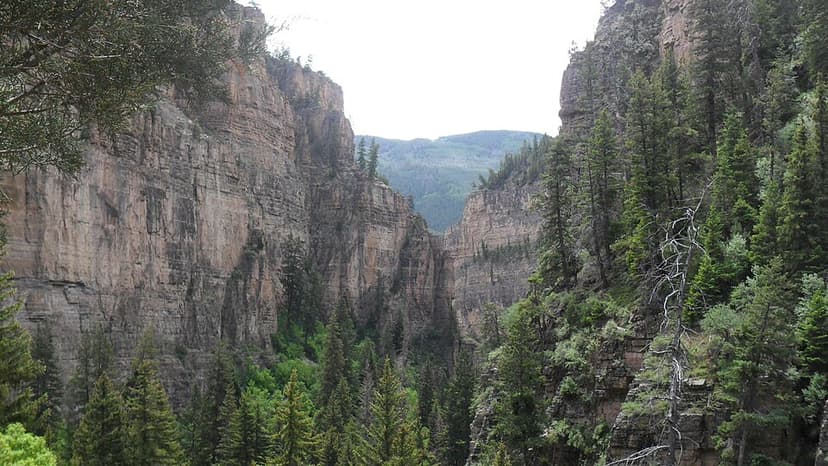
Glenwood Canyon
Glenwood Canyon is a rugged and scenic 20 km canyon in western Colorado, carved by the Colorado River. Its formation during the Pleistocene epoch involved the rapid erosion of sedimentary rock layers, including sandstone and Cambrian rock. Historically significant as a transportation corridor, it currently hosts Interstate 70 and a major railroad line, making it a notable natural feature on the U.S. Interstate Highway System.

Ruby Canyon
Ruby Canyon is a prominent canyon carved by the Colorado River, stretching approximately 40 kilometers (25 miles) along the border of Colorado and Utah in the western United States. Its name derives from the striking ruby-red sandstone cliffs that define its dramatic landscape. The canyon is a favored location for river expeditions, including rafting and overnight camping, and is accessible by train via the Union Pacific Railroad.

Cataract Canyon
Cataract Canyon is a significant 74 km stretch of the Colorado River in southern Utah, known for its powerful whitewater rapids. Carved into the Colorado Plateau, its lower half is submerged under Lake Powell, impacting its historical geology and accessibility. The canyon holds historical importance for indigenous peoples and early European explorers, and remains a popular destination for whitewater rafting.