
Gulf Hagas
River Canyon·North America·Paleozoic·West Branch of the Pleasant River
Gulf Hagas is a significant gorge in the northern Maine woods, often called the "Grand Canyon of Maine." Carved by the West Branch of the Pleasant River, its three-mile length features vertically walled slate and numerous waterfalls, with walls reaching up to 130 feet. Designated a National Natural Landmark, it is a popular destination for hiking and challenging whitewater kayaking.
Key Facts
- ›The gorge is approximately 4.8 kilometers (3 miles) long.
- ›Its walls can reach a depth of up to 40 meters (130 feet).
- ›The bedrock is primarily slate from the Carrabassett formation, formed about 400 million years ago.
- ›It is part of the Appalachian Trail's "Hundred-Mile Wilderness" section.
- ›Gulf Hagas is recognized as a National Natural Landmark in Maine.
- ›The area is known for its old-growth eastern white pine forest, including a section called the Hermitage.

Grand Canyon of Maine
River Erosion, Glacial Lake Outburst Flood
Numerous Waterfalls, Vertically Walled Slate Gorge, Potholes, the Hermitage, Billings Falls, Buttermilk Falls, Jaws
Moose, White-Tailed Deer, Snowshoe Hare, Brook Trout
Old-Growth Forest, Eastern White Pine, Black Spruce, Eastern Hemlock, Balsam Fir
About Gulf Hagas
Gulf Hagas is a dramatic gorge situated in the mountains of the northern Maine woods, earning it the moniker "Grand Canyon of Maine." This impressive natural feature is carved by the West Branch of the Pleasant River, which has sculpted a three-mile-long, vertically walled slate gorge marked by numerous waterfalls. With walls reaching up to 130 feet high and a total drop of 370 feet along its length, Gulf Hagas is a significant geological formation.
Geology and Formation
The bedrock of Gulf Hagas is primarily slate, part of the Carrabassett formation. This slate was created approximately 400 million years ago when converging tectonic plates uplifted the seabed, compressing mud deposits into metamorphic rock. While slate fractures into sharp edges, the relentless action of the river, carrying water and pebbles, has polished the gorge walls to a smooth, vertical finish. Potholes, spherical depressions in the rock, are also a common sight, formed by the swirling water. It is believed that the gorge was carved towards the end of the last ice age when a massive glacial lake breached its dam, releasing enormous volumes of water that eroded the landscape.
Flora and Fauna
The area surrounding Gulf Hagas is notable for its rich ecosystems. The Gulf Hagas Rim Trail passes through "The Hermitage," a rare stand of virgin old-growth forest in New England, featuring towering eastern white pine trees that can reach 150 feet in height with diameters up to 10 feet. Common trees along the rim include black spruce, eastern hemlock, and balsam fir. Wildlife is also abundant, with frequent sightings of moose, white-tailed deer, and snowshoe hare. Within the gorge itself, brook trout are plentiful.
Human History and Access
Native American peoples, including the ancient "Red Paint People" whose burial sites date back 7,500 years, have inhabited the region around Gulf Hagas. Historically, the gorge played a role in the timber industry, with logs driven through its narrow passages, sometimes requiring dynamite to clear jams in sections known as "the Jaws." Pulp wood was also floated through for paper production. Log drivers are credited with naming many of the gorge's waterfalls and rapids. Today, Gulf Hagas is managed by KI Jo-Mary, a group of private landowners who collect fees for access and road maintenance. It is also integrated into the Appalachian Trail (AT) Corridor, with a section of the AT known as the "Hundred-Mile Wilderness" passing through.
Recreation
Gulf Hagas is a popular destination for outdoor recreation. Hiking is a primary activity, with the Gulf Hagas Rim Trail offering an 8-mile loop that takes up to 8 hours to complete, providing stunning views of the falls and geology. A shorter, more moderate hike is available by visiting The Hermitage and Gulf Hagas Brook. For experienced whitewater enthusiasts, Gulf Hagas is considered one of Maine's premier Class V creek runs, offering unique and high-quality whitewater challenges due to its deep gorge and waterfalls. Fishing is permitted, but camping and fires are not allowed within the gorge itself. Visitors should be prepared for primitive conditions, as there are no trash disposal services, and insect repellent and appropriate clothing are recommended due to the prevalence of black flies and mosquitoes in warmer months.
Source: Wikipedia ↗
Frequently Asked Questions
How was Gulf Hagas formed?
Gulf Hagas was likely carved towards the end of the last ice age. A massive volume of water from a glacial lake, when released, flowed through the area, eroding the rock to form the gorge. The bedrock itself, slate, was formed around 400 million years ago from compressed mud deposits.
What are the best activities to do at Gulf Hagas?
The most popular activity is hiking the Gulf Hagas Rim Trail, which offers views of the falls and the gorge. For experienced paddlers, Gulf Hagas is considered an excellent, challenging Class V whitewater kayaking run due to its steep walls and waterfalls.
How do I access Gulf Hagas?
Access is typically gained by driving through Katahdin Iron Works. Visitors pay a fee to enter the private land managed by KI Jo-Mary. The main trailhead is reached after navigating dirt roads, and crossing the West Branch of the Pleasant River may be required, though an alternative route with a bridge exists.
What kind of geology can be seen at Gulf Hagas?
The gorge is primarily composed of slate, which has fractured edges but is smoothed by erosion, creating vertical, smooth walls. The river's action has also formed potholes, which are spherical depressions in the rock. The overall formation is attributed to significant water flow during the end of the last ice age.
What is the significance of the Hundred-Mile Wilderness section of the Appalachian Trail?
The Hundred-Mile Wilderness is the final 160-kilometer (100-mile) stretch of the Appalachian Trail before its northern terminus. It is considered one of the most remote and challenging segments of the trail, and Gulf Hagas lies within this demanding area.
Related Canyons

Keystone Canyon
Keystone Canyon is a narrow gorge in Alaska, characterized by its nearly perpendicular slate walls. Carved by the Lowe River, it stretches for approximately 3 miles and serves as a dramatic passage connecting the river's upper and lower valleys. The canyon is notable for its impressive waterfalls, including Horsetail Falls and Bridal Veil Falls, and holds historical significance related to early Alaskan exploration and proposed railroad routes.
Canyon Sainte-Anne
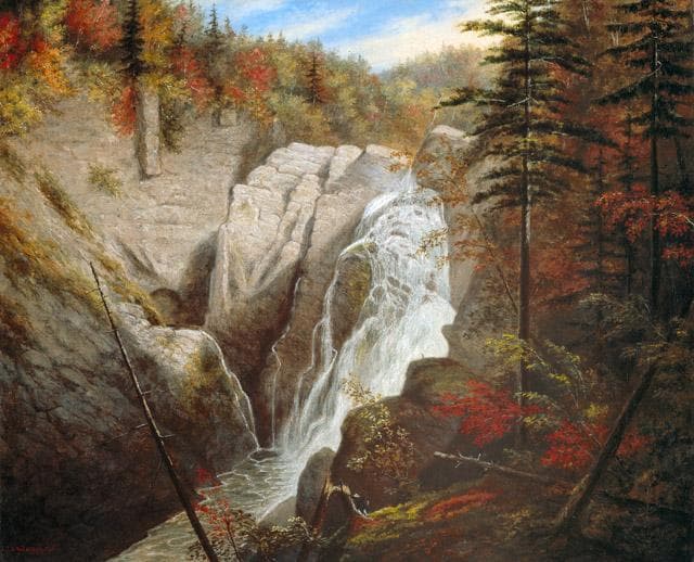
Canyon Sainte-Anne is a steep-sided gorge located east of Beaupré, Quebec, Canada, carved by the Sainte-Anne-du-Nord River. The canyon features a prominent 74-meter waterfall and is situated within the ancient geological formations of the Canadian Shield. It has been a site of natural and cultural interest, drawing visitors for its scenic beauty and recreational activities.

Rhine Gorge
The Rhine Gorge, also known as the Upper Middle Rhine Valley, is a 65 km long section of the Middle Rhine River in Germany. It was designated a UNESCO World Heritage Site in 2002 due to its stunning cultural landscape, its historical significance as a European transport route, and the unique architectural adaptations to the steep valley slopes. The gorge was carved by the Rhine River during a recent geological uplift, revealing ancient Devonian sedimentary rocks, primarily slate, which are rich in fossils.