
Keystone Canyon
Gorge·North America·Lowe River·Slate
Keystone Canyon is a narrow gorge in Alaska, characterized by its nearly perpendicular slate walls. Carved by the Lowe River, it stretches for approximately 3 miles and serves as a dramatic passage connecting the river's upper and lower valleys. The canyon is notable for its impressive waterfalls, including Horsetail Falls and Bridal Veil Falls, and holds historical significance related to early Alaskan exploration and proposed railroad routes.
Key Facts
- ›Measures 3 miles (4.8 km) in length.
- ›Walls are composed primarily of slate with nearly vertical cleavage.
- ›Bed width varies between 100–500 feet (30–152 M).
- ›Features prominent waterfalls such as Horsetail Falls and Bridal Veil Falls.
- ›Was named by William R. Abercrombie after Pennsylvania, the 'Keystone State'.
- ›Contains a hand-cut tunnel, a remnant of early railroad construction attempts.

River Erosion
Horsetail Falls, Bridal Veil Falls, Hand-Cut Tunnel, Nearly Perpendicular Slate Walls
Grass, Brush, Trees
About Keystone Canyon
Keystone Canyon is a significant gorge located near Valdez in the U.S. state of Alaska. Characterized by its almost perpendicular walls, the canyon is carved primarily from slate rock, which exhibits a nearly vertical cleavage, though small quartz seams can present drilling challenges. The canyon's geology is exposed to good advantage, with the slate on the south side of the summit generally being firm, while the north side is more disintegrated.
Geography and Dimensions
The gorge extends for approximately 3 miles (4.8 km) and connects the upper and lower valleys of the Lowe River. The bed of the canyon varies considerably in width, ranging from 100 to 500 feet (30 to 152 meters). Vegetation on the low bottoms, including grass, brush, and trees, suggests that the river's water level typically does not exceed 4 feet (1.2 meters) for most of the canyon's length. The east wall of the canyon is more abrupt than the west wall. While side drainage is minimal, Waterfall Creek forms a notable cascade with falls of several hundred feet, disappearing into loose rock at the canyon's base. About midway through the canyon, narrow sections are formed where the walls draw closer, featuring abrupt heights of 50 to 75 feet (15 to 23 meters).
Notable Features
Keystone Canyon is renowned for its dramatic waterfalls. Among the most spectacular are:
- Horsetail Falls: A picturesque waterfall measuring about 328 feet (100 meters) in height, which flows into the Lowe River. It is visible and photographable from a road turnout along the Richardson Highway.
- Bridal Veil Falls: Located a short distance north of Horsetail Falls, this waterfall can be viewed from another turnout. This area also serves as the trailhead for the "Valdez Goat Trail," a segment of the historic Trans Alaska Military Packtrain Trail.
Additionally, a remnant of early industrial efforts can be found within the canyon: a short section of hand-cut tunnel. This feature is a solitary reminder of ambitious but ultimately unsuccessful attempts to construct a railroad through the region.
Historical Context
The canyon was named by William R. Abercrombie. His naming choice honored Pennsylvania, the "Keystone State." The canyon's potential for transportation and resource access led to significant interest in the early 20th century, with nine companies proposing railroad routes. The efforts to build such a railway were fraught with conflict, culminating in a gunfight and the eventual abandonment of the project. The era of these railroad ambitions was later depicted in the silent film "The Iron Trail."
Access and Significance
Keystone Canyon is situated at an elevation of 307 feet (94 meters). The Richardson Highway passes through the canyon, providing scenic access to its features. The Valdez-Eagle Trail also traverses the canyon's southern end. The canyon's geological formations and natural beauty make it a point of interest for visitors exploring the Valdez area.
Source: Wikipedia ↗
Frequently Asked Questions
What geological material forms the walls of Keystone Canyon?
The mother rock of Keystone Canyon is slate. This slate has a nearly vertical cleavage, which makes it easy to drill, though small seams of quartz can present challenges. The slate is generally firm on the south side of the summit but is significantly more disintegrated on the north side.
How wide is Keystone Canyon?
The bed of Keystone Canyon varies in width, ranging from 100 to 500 feet (30 to 152 meters). In some sections, particularly in the middle of the canyon, the walls narrow significantly, creating abrupt walls that are 50 to 75 feet (15 to 23 meters) high.
What are the main waterfalls in Keystone Canyon?
Keystone Canyon is home to two spectacular waterfalls: Horsetail Falls and Bridal Veil Falls. Horsetail Falls is a picturesque waterfall about 328 feet (100 meters) high that flows into the Lowe River. Bridal Veil Falls is located a short distance north of Horsetail Falls and can be viewed from a turnout along the highway.
Is there any historical human infrastructure within Keystone Canyon?
Yes, Keystone Canyon contains a short section of a hand-cut tunnel. This tunnel is a remnant of early 20th-century efforts to build a railroad to access the mineral resources of Interior Alaska. These ambitious plans were ultimately abandoned after disputes and a gunfight.
What is the elevation of Keystone Canyon?
Keystone Canyon is situated at an elevation of 307 feet (94 meters). The canyon's walls are described as almost perpendicular, and the river within it is sharply deflected at the head of the canyon by a perpendicular wall of rock.
Related Canyons
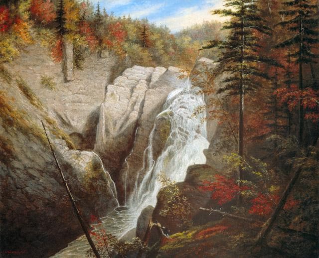
Canyon Sainte-Anne
Canyon Sainte-Anne is a steep-sided gorge located east of Beaupré, Quebec, Canada, carved by the Sainte-Anne-du-Nord River. The canyon features a prominent 74-meter waterfall and is situated within the ancient geological formations of the Canadian Shield. It has been a site of natural and cultural interest, drawing visitors for its scenic beauty and recreational activities.

Gulf Hagas
Gulf Hagas is a significant gorge in the northern Maine woods, often called the "Grand Canyon of Maine." Carved by the West Branch of the Pleasant River, its three-mile length features vertically walled slate and numerous waterfalls, with walls reaching up to 130 feet. Designated a National Natural Landmark, it is a popular destination for hiking and challenging whitewater kayaking.

Rhine Gorge
The Rhine Gorge, also known as the Upper Middle Rhine Valley, is a 65 km long section of the Middle Rhine River in Germany. It was designated a UNESCO World Heritage Site in 2002 due to its stunning cultural landscape, its historical significance as a European transport route, and the unique architectural adaptations to the steep valley slopes. The gorge was carved by the Rhine River during a recent geological uplift, revealing ancient Devonian sedimentary rocks, primarily slate, which are rich in fossils.