
Horseshoe Canyon
Badlands Canyon·Canada·Late Cretaceous·Red Deer River
Horseshoe Canyon is a notable badlands region in Alberta, Canada, characterized by its distinctive horseshoe shape carved by coulees flowing into Kneehill Creek. Its geological significance is highlighted by the discovery of dinosaur fossils dating back millions of years, contributing to the naming of the Horseshoe Canyon Formation.
Key Facts
- ›Located in Alberta, Canada, approximately 17 km west of Drumheller.
- ›Named for its horseshoe shape, formed by two coulees leading to Kneehill Creek.
- ›Each arm of the canyon extends approximately 5 km from Highway 9 to Kneehill Creek.
- ›The canyon gives its name to the Horseshoe Canyon Formation.
- ›A dinosaur fossil dating back 69 million years was discovered here in 2020.

River Erosion, Coulee Erosion
Horseshoe Shape, Two Coulees, Fossil Discoveries
Prairie Grasses
About Horseshoe Canyon
Horseshoe Canyon is a striking natural landmark located in the province of Alberta, Canada, celebrated for its dramatic badlands topography. Situated approximately 11 miles (17 km) west of the town of Drumheller, along Highway 9, the canyon is a significant feature of the Albertan prairie landscape.
Formation and Geology
The canyon derives its distinctive name from its prominent horseshoe shape, a geological formation sculpted by the erosive forces of two coulees. These coulees converge and flow into Kneehill Creek, which is itself a tributary of the Red Deer River. Each arm of the horseshoe measures approximately 5 km in length, extending from the highway to the creek. The geological importance of the region is further underscored by the Horseshoe Canyon Formation, a geological unit named after this area. In 2020, a significant paleontological discovery was made when a boy named Nathan Hrushkin unearthed a dinosaur fossil within the canyon, estimated to be 69 million years old, attesting to the area's ancient history.
Access and Features
Horseshoe Canyon is a recognized tourist attraction, drawing visitors to its unique landscape. The two former mining communities of Dunphy and Gatine are situated along the canyon's arms, offering a glimpse into the region's industrial past. While specific details on canyon floor elevation and maximum width are not extensively documented, its characteristic badlands terrain, shaped by water erosion over millennia, is its most defining visual feature. The surrounding prairie environment suggests a climate typical of the region, with associated flora and fauna adapted to such conditions.
Source: Wikipedia ↗
Frequently Asked Questions
Where is Horseshoe Canyon located?
Horseshoe Canyon is situated in the province of Alberta, Canada. It is found approximately 11 miles (17 km) west of the town of Drumheller, accessible via Highway 9.
What gives Horseshoe Canyon its name?
The canyon is named for its distinctive horseshoe shape. This shape is defined by two coulees that converge and flow into Kneehill Creek.
What is the geological significance of Horseshoe Canyon?
Horseshoe Canyon is geologically significant as it lent its name to the Horseshoe Canyon Formation. Furthermore, it is a site where ancient fossils have been discovered, including a dinosaur fossil dating back 69 million years.
What are the dimensions of Horseshoe Canyon?
The canyon features two arms, each approximately 5 km in length. These arms extend from Highway 9 to Kneehill Creek.
Related Canyons

Horsethief Canyon
Horsethief Canyon is a prominent feature of the badlands in central Alberta, Canada, located northwest of Drumheller. Its name is believed to stem from historical illegal horse trading activities, though the exact origin is unclear. The canyon is carved by a tributary of the Red Deer River and is a distinctive landscape within the region.

Agawa Canyon
Agawa Canyon is a shallow canyon in Ontario, Canada, formed approximately 1.2 billion years ago by faulting and later carved by the Agawa River. It is now a popular tourist destination within the Agawa Canyon Wilderness Park, accessible by train or hiking trail, and is renowned for its natural beauty, waterfalls, and seasonal foliage.
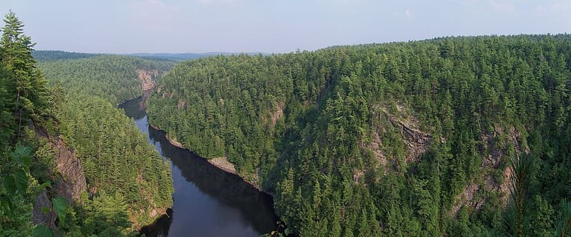
Barron River (Ontario)
The Barron River is a significant waterway in Ontario, Canada, flowing through Algonquin Provincial Park and forming the southern branch of the Petawawa River. It was primarily formed by glacial meltwater approximately 10,000 years ago, carving out the impressive Barron Canyon. Historically, it served as a crucial route for timber transport, with the canyon's towering cliffs known as the "Capes" by loggers.