
Horsethief Canyon
Horsethief Canyon is a prominent feature of the badlands in central Alberta, Canada, located northwest of Drumheller. Its name is believed to stem from historical illegal horse trading activities, though the exact origin is unclear. The canyon is carved by a tributary of the Red Deer River and is a distinctive landscape within the region.
Key Facts
- ›Located 16 kilometers northwest of Drumheller, Alberta, Canada.
- ›Situated on the east bank of the Red Deer River.
- ›Part of the distinctive badlands landscape of central Alberta.
- ›Carved by a tributary of the Red Deer River, distinct from Horseshoe Canyon.
- ›The name is associated with historical illegal horse trading.

River Erosion
Badlands Landscape
About Horsethief Canyon
Horsethief Canyon is a significant geological formation located within the distinctive badlands of central Alberta, Canada. Situated approximately 16 kilometers northwest of the town of Drumheller in Starland County, it lies on the eastern bank of the Red Deer River, accessible via Highway 838.
Formation and Landscape
The canyon was carved by a tributary of the Red Deer River, contributing to the unique eroded landscape characteristic of Alberta's badlands. While visually similar to the nearby Horseshoe Canyon, Horsethief Canyon was formed by a separate river tributary and is located several kilometers away.
Naming and Historical Context
The name "Horsethief" is associated with historical activities involving illegal horse trading. It is believed that horses being smuggled between the United States and Alberta were hidden within this canyon. However, the precise origin and definitive confirmation of this naming convention remain unclear in historical records.
Source: Wikipedia ↗
Frequently Asked Questions
Where is Horsethief Canyon located?
Horsethief Canyon is located in Starland County, Alberta, Canada, approximately 16 kilometers northwest of the town of Drumheller. It lies on the east bank of the Red Deer River along Highway 838.
What is the origin of the name 'Horsethief Canyon'?
The name 'Horsethief' is thought to be derived from an illegal horse trade network that operated in the area during the last century. Horses being smuggled between the United States and Alberta were allegedly hidden in this canyon, although the precise origin of the name is not definitively clear.
How was Horsethief Canyon formed?
Horsethief Canyon was formed by erosion from a tributary of the Red Deer River. It is one of the distinctive features of the surrounding badlands landscape in central Alberta.
How does Horsethief Canyon differ from Horseshoe Canyon?
While both Horsethief Canyon and Horseshoe Canyon are distinctive features of Alberta's badlands and appear similar, they were created by different tributaries of the Red Deer River and are separated by several kilometers.
Related Canyons

Horseshoe Canyon
Horseshoe Canyon is a notable badlands region in Alberta, Canada, characterized by its distinctive horseshoe shape carved by coulees flowing into Kneehill Creek. Its geological significance is highlighted by the discovery of dinosaur fossils dating back millions of years, contributing to the naming of the Horseshoe Canyon Formation.

Agawa Canyon
Agawa Canyon is a shallow canyon in Ontario, Canada, formed approximately 1.2 billion years ago by faulting and later carved by the Agawa River. It is now a popular tourist destination within the Agawa Canyon Wilderness Park, accessible by train or hiking trail, and is renowned for its natural beauty, waterfalls, and seasonal foliage.
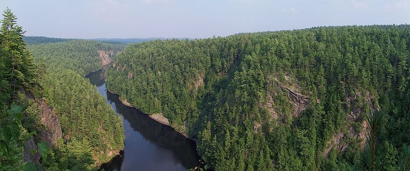
Barron River (Ontario)
The Barron River is a significant waterway in Ontario, Canada, flowing through Algonquin Provincial Park and forming the southern branch of the Petawawa River. It was primarily formed by glacial meltwater approximately 10,000 years ago, carving out the impressive Barron Canyon. Historically, it served as a crucial route for timber transport, with the canyon's towering cliffs known as the "Capes" by loggers.