
Komati Gorge
River Canyon·South Africa·Komati River·Sandstone
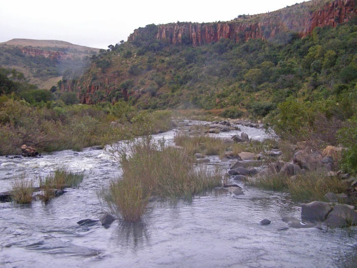
Komati Gorge is a significant river valley in Mpumalanga Province, South Africa, characterized by its striking vertical sandstone cliffs. These geological formations provide a crucial habitat for a diverse array of wildlife, including numerous plant and animal species, some of which are endemic and endangered. The gorge's unique geology, with exposures of ancient formations like the Kromberg Formation, and its rich biodiversity make it a notable natural area.
Key Facts
- ›Features vertical sandstone cliffs with colorful mineralized exposures.
- ›Habitat for a wide diversity of wildlife, including endemic endangered species and big game animals.
- ›Exhibits geological formations from the Kromberg and Hooggenoeg Formations.
- ›Supports a specialized ecosystem with vegetation adapted to steep rocky sides.
- ›The Komati River flows through the gorge, supporting riparian zones and a trout fishery.
- ›Underlying geological formations took shape approximately three million years ago.
River Erosion
Vertical Sandstone Cliffs, Colorful Mineralized Exposures, Kromberg Formation Exposures, Hooggenoeg Formation Exposures, Banded Iron Formation, Riparian Zone, Bluff Habitat, Thorn Bushveld, Highveld Grassland
Zebra, Giraffe, Eland, Impala, Southern Bald Ibis, Big Game Animals, Smaller Fauna, Aquatic Vegetation
- Riparian Zone Vegetation
- Vegetation Adapted To Steep Rocky Vertical Landform
- Thorn Bushveld
- Highveld Grassland
- Ancient Grasslands of Africa
- Bushveld
About Komati Gorge
Komati Gorge is a prominent river valley situated in the Mpumalanga Province of central South Africa. It is distinguished by its striking vertical sandstone cliffs, which create a unique geological landscape and provide essential habitat for a diverse range of wildlife. The gorge is located in proximity to the communities of Carolina and Machadodorp, serving as a natural corridor for the Komati River.
Geology and Ecology
The geological makeup of the gorge includes exposures from the Kromberg Formation and the upper Hooggenoeg Formation of the Onverwacht Series. These strata reveal ancient geological processes such as debris flows, turbidites, and thin chert units. Additionally, the gorge displays black and white banded cherts interbedded with basalt flows, as well as a visible banded iron formation, contributing to the colorful and diverse mineralized cliff faces.
The ecological significance of Komati Gorge is substantial. It harbors a great diversity of flora and fauna, encompassing not only large mammalian species but also specialized ecosystems adapted to its varied habitats. These include riparian zones, bluff environments, thorn bushveld, and highveld grassland. The Komati River sustains aquatic vegetation and supports a robust riverine trout fishery. The specialized cliff ecosystems are home to flora and fauna adapted to the steep, rocky terrain, and the gorge offers favorable conditions for bird habitats, notably supporting the threatened southern bald ibis.
Approximately three million years ago, the underlying geological formations that shaped the Komati Gorge area took shape, leading to the development of what is considered one of the Earth's rarest and most endangered ecosystems: the ancient grasslands of Africa. With increased rainfall in the lowlands, tree invasion occurred, leading to the formation of the bushveld ecosystems present in the region today.
Access and Condition
Access to Komati Gorge is typically from the north, facilitated by the towns of Carolina and Machadodorp, which are conveniently located near the main highway connecting to Johannesburg. Historically, much of the gorge area has been under private ownership as wilderness. In the latter half of the 20th century, some ranching activities were introduced, and since the late 20th century, there has been limited development of lodges and country homes.
As of 2006, visitation to Komati Gorge was not intense. However, instances of geo-vandalism, characterized by illegal drilling into rock outcrops, have been reported. Geo-vandalism encompasses the defacement, alteration, or drilling of significant rock formations, often for unauthorized fossil collection, mineral exploration, or malicious destruction.
Source: Wikipedia ↗
Frequently Asked Questions
What is the geology of Komati Gorge?
Komati Gorge features exposures of the Kromberg Formation and upper Hooggenoeg Formation, displaying debris flows, turbidites, and chert units. Banded iron formations and basalt flows are also present, contributing to the colorful mineralized cliffs.
What kind of wildlife can be found in Komati Gorge?
The gorge hosts a great diversity of flora and fauna, including big game animals like zebra and giraffe, as well as eland and impala. The bluffs provide habitat for specialized ecosystems, and the southern bald ibis is a notable threatened species present.
How can I access Komati Gorge?
Access to Komati Gorge is primarily from the north, via the towns of Carolina or Machadodorp, which are situated near the main highway leading to Johannesburg. Much of the area has historically been privately owned wilderness.
What is the ecological significance of Komati Gorge?
Komati Gorge is home to one of the Earth's rarest and most endangered ecosystems, the ancient grasslands of Africa, which have evolved into bushveld ecosystems. The river supports riparian zones and a trout fishery, while the bluffs host specialized flora and fauna.
Are there any threats to Komati Gorge?
As of 2006, geo-vandalism, which involves illegal drilling or defacing of rock formations, has been a concern in Komati Gorge. This activity can be for unauthorized fossil collection, mineral exploration, or malicious destruction.
Related Canyons
Oribi Gorge
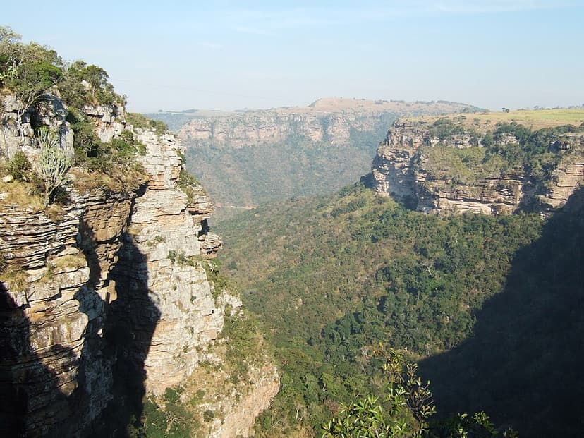
Oribi Gorge is a significant canyon in Kwazulu-Natal, South Africa, carved by the Mzimkulwana River and forming the eastern of two gorges through the Oribi Flats. Its dramatic depths and crags, covered in subtropical vegetation, reveal ancient geological formations, including over a billion-year-old basement rock and sandstone cliffs deposited approximately 365 million years ago. The gorge is named after the oribi antelope and is a protected nature reserve.

Blyde River Canyon
The Blyde River Canyon, located in Mpumalanga, South Africa, is a significant natural wonder renowned as the third-largest canyon globally. Unlike other major canyons, it is characterized as a "green canyon" due to its lush subtropical vegetation. The canyon forms a key part of the Blyde River Canyon Nature Reserve and is a prominent feature along the popular Panorama Route.
Blackhand Gorge
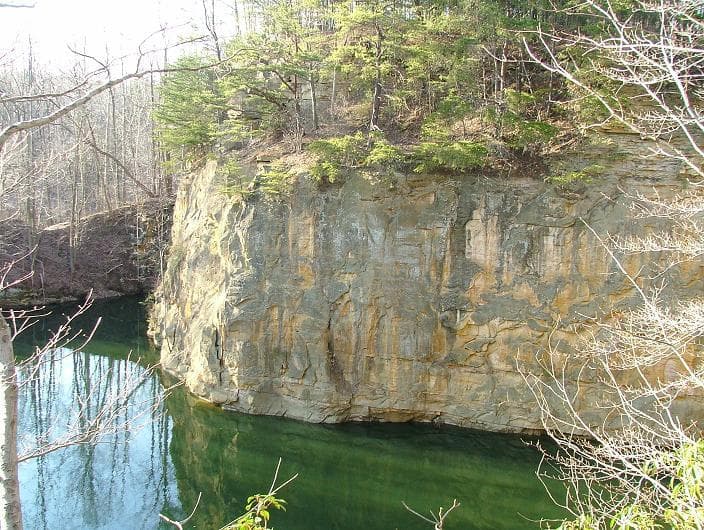
Blackhand Gorge is a 4-mile-long sandstone formation in Licking County, Ohio, carved by the Licking River. Named for a prehistoric petroglyph of a black hand, the gorge has served as a vital transportation corridor for centuries, hosting canal boats, railroads, interurban cars, and automobiles. Designated an Ohio Nature Preserve in 1975, it preserves a unique geological and historical landscape.