
Lava Canyon
River Canyon·Canada·Chilko River·Basalt
Lava Canyon is a striking geological feature located on the Chilko River in British Columbia, Canada. It is characterized by its impressive columnar basalt cliffs, a direct result of past volcanic activity in the region. The canyon plays a role in the natural landscape of the Chilcotin District, situated downstream from Chilko Lake.
Key Facts
- ›Located on the Chilko River in the Chilcotin District of British Columbia, Canada.
- ›Named for its prominent columnar basalt cliffs.
- ›Formed by extensive former volcanic activity in the region.
- ›Situated approximately 35 kilometers below the outflow of Chilko Lake.
- ›Part of the broader geological context of the Anahim Volcanic Belt.

Volcanic Activity, River Erosion
Columnar Basalt Cliffs
About Lava Canyon
Lava Canyon is a significant geological formation located along the Chilko River in the Chilcotin District of British Columbia, Canada. Its defining characteristic is the presence of striking columnar basalt cliffs, which owe their existence to extensive past volcanic activity in the region. The canyon lies approximately 35 kilometers downstream from the outflow of Chilko Lake, contributing to the dramatic landscape of the Interior of British Columbia.
Geological Significance
The name "Lava Canyon" directly references the prominent columnar basalt formations that line its walls. These visually arresting structures are a result of ancient lava flows cooling and contracting, a process that leads to the formation of polygonal columns. The presence of these formations links Lava Canyon to the broader geological context of the Anahim Volcanic Belt, an area known for its significant volcanic history.
Location and Context
Situated within the vast Chilcotin District, Lava Canyon is a natural feature carved by the Chilko River. Its placement relative to Chilko Lake underscores its position within a river system shaped by both glacial and volcanic influences. While specific details on visitor access or recreational activities are not extensively documented, the canyon's unique geology makes it a point of interest within the natural heritage of British Columbia.
Source: Wikipedia ↗
Frequently Asked Questions
What is Lava Canyon named after?
Lava Canyon is named for the distinctive columnar basalt cliffs that define its landscape. These formations are a testament to the region's significant past volcanic activity.
Where is Lava Canyon located?
Lava Canyon is situated on the Chilko River in the Chilcotin District, within the Interior of British Columbia, Canada. It is found about 35 kilometers downstream from where the Chilko River exits Chilko Lake.
What geological processes formed Lava Canyon?
The canyon's formation is attributed to extensive volcanic activity that occurred in the region previously. This activity resulted in the creation of the characteristic columnar basalt cliffs.
What is the significance of the columnar basalt at Lava Canyon?
The columnar basalt cliffs are the defining feature of Lava Canyon and give it its name. These formations are a direct result of ancient volcanic processes, where lava cooled and contracted to form these striking geological structures.
Related Canyons
Grand Coulee
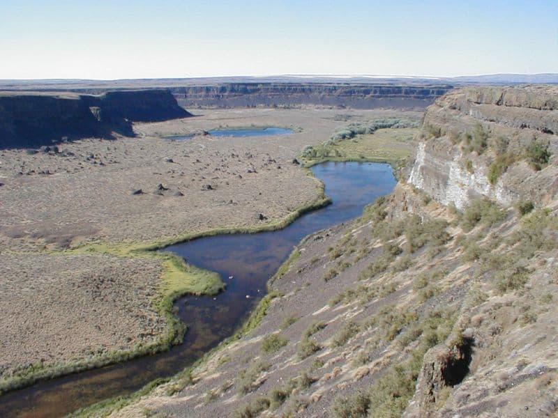
Grand Coulee is an ancient, 60-mile-long river bed in Washington State, U.S., bisected by Dry Falls into the Upper and Lower Grand Coulee. This immense geological feature was primarily carved by catastrophic glacial floods originating from Glacial Lake Missoula during the Pleistocene epoch, a process that stripped away soil and carved deep canyons. Today, the Upper Grand Coulee serves as Banks Lake, a vital part of the Columbia Basin Project for irrigation and recreation.

Moses Coulee
Moses Coulee is a significant canyon located in the Waterville Plateau region of Douglas County, Washington. It is the second-largest and westernmost canyon of the Channeled Scablands, believed to have been carved by immense glacial outburst floods during past ice ages, with discharges exceeding 600,000 m3/s. The coulee's formation is attributed to glacial meltwaters, though the precise origins and age of these floods remain debated among researchers, with theories pointing to floods from glacial Lake Missoula or subglacial floods from the Okanogan Lobe.

Rio Grande Gorge
The Rio Grande Gorge is a deep, eroded chasm in northern New Mexico, carved by the Rio Grande River through the basalt flows of the Taos Plateau. Formed over millions of years by a combination of volcanic activity, tectonic plate shifts, and erosion, it is now a significant geological feature and a protected natural area. The gorge is notable for its diverse ecosystem, historical petroglyphs, and recreational opportunities, including whitewater rafting and hiking.