
Rio Grande Gorge
River Canyon·North America·Rio Grande·Basalt
The Rio Grande Gorge is a deep, eroded chasm in northern New Mexico, carved by the Rio Grande River through the basalt flows of the Taos Plateau. Formed over millions of years by a combination of volcanic activity, tectonic plate shifts, and erosion, it is now a significant geological feature and a protected natural area. The gorge is notable for its diverse ecosystem, historical petroglyphs, and recreational opportunities, including whitewater rafting and hiking.
Key Facts
- ›The gorge is approximately 50 miles (80 km) long.
- ›Its depth reaches up to 800 feet (240 M).
- ›It was formed by erosion within the Rio Grande Rift, influenced by volcanic activity and tectonic shifts.
- ›The Rio Grande Gorge is part of the Rio Grande del Norte National Monument.
- ›The gorge features Class II to Class V whitewater rapids managed by the Bureau of Land Management.
- ›It is a site of ancient petroglyphs and historic ruins.

River Erosion, Volcanic Activity, Tectonic Activity
Taos Plateau Volcanic Field, Rio Grande Rift, Petroglyphs, Ancient Ruins, Hot Springs
Mule Deer, Red-Tailed Hawk, Mountain Blue-Bird, Prairie Dog, Big Horn Sheep
PiñOn Forests, Juniper Forests
About Rio Grande Gorge
The Rio Grande Gorge is a dramatic geological feature located in northern New Mexico, where the Rio Grande river has carved a deep chasm through the landscape. Stretching approximately 50 miles (80 km) from near the Colorado border southwest of Taos, New Mexico, the gorge cuts through the basalt flows of the Taos Plateau volcanic field. Its immense depth, reaching up to 800 feet (240 m) in places, showcases millions of years of geological processes.
Geology and Formation
Geologically, the Rio Grande Gorge is a testament to the interplay of powerful natural forces. It is situated within the larger Rio Grande Rift, a complex geological zone characterized by volcanic activity and shifting tectonic plates. Over eons, the erosive power of the Rio Grande, combined with these tectonic movements and the breakdown of ancient gravels and lava layers, has sculpted the distinct, narrow, and deep gorge visible today.
Ecosystem and Climate
The considerable depth of the gorge, descending 800 feet (240 m) from rim to river, creates a unique microclimate and fosters a diverse ecosystem. Ancient piñon and juniper forests thrive along its edges, with some trees dating back 500 years. The area supports a variety of wildlife, including mule deer, red-tailed hawks, mountain bluebirds, prairie dogs, and bighorn sheep. The climate is semi-arid, with hot summers often punctuated by thunderstorms and winters that can bring snow, with temperatures ranging significantly between seasons.
Protection and Recreation
Recognizing its outstanding natural and cultural resources, the Rio Grande Gorge and its surrounding lands have received significant protection. In 1968, the Rio Grande was designated as one of the first National Wild and Scenic Rivers. More recently, in 2013, the gorge and 242,500 acres of adjacent land were designated as the Rio Grande del Norte National Monument. These designations help preserve the area for both its ecological value and for public enjoyment. The gorge offers numerous recreational opportunities, including hiking, boating, fishing, and camping within designated recreation areas managed by the Bureau of Land Management. The river itself is renowned for its whitewater sections, particularly the Taos Box and the Racecourse Run, offering challenges for rafters of varying skill levels.
Historical and Cultural Significance
Beyond its natural beauty and recreational appeal, the Rio Grande Gorge holds significant historical and cultural importance. The canyon walls are adorned with ancient petroglyphs, offering insights into the lives of early inhabitants. Ruins discovered at the bottom of the gorge further attest to its long human history. Notably, the gorge's striking geological features led NASA to select it as a training site for Apollo astronauts in the early 1970s, due to its geological similarities to the Apollo 15 lunar landing site.
Source: Wikipedia ↗
Frequently Asked Questions
How was the Rio Grande Gorge formed?
The Rio Grande Gorge was carved out by erosion over the last several million years. Its formation is attributed to a combination of volcanic activity from the Taos Plateau volcanic field, shifting tectonic plates within the Rio Grande Rift, and the erosion of layers of gravel and lava by the Rio Grande River.
What are the main recreational activities in the Rio Grande Gorge?
The gorge offers various recreational activities, including hiking, boating, fishing, and camping. The U.S. Bureau of Land Management manages two developed recreation areas that provide opportunities for hiking and biking. Whitewater rafting is also popular, with sections like the Taos Box known for challenging rapids.
Is the Rio Grande Gorge a protected area?
Yes, the Rio Grande Gorge and its surrounding lands are designated as the Rio Grande del Norte National Monument, established in 2013. Additionally, the Rio Grande itself is recognized as a National Wild and Scenic River, protected for its outstanding resources.
What kind of wildlife can be found in the Rio Grande Gorge?
The canyon's ecosystem supports diverse plant and animal life due to its significant elevation change. Wildlife commonly found include mule deer, red-tailed hawks, mountain bluebirds, prairie dogs, and bighorn sheep.
Are there any historical or cultural significances to the Rio Grande Gorge?
The gorge is rich in history, featuring numerous ancient petroglyphs along its walls and ruins at the bottom. Historically, it also served as a training site for NASA astronauts preparing for lunar missions due to its geological similarities to the Apollo 15 landing site.
Related Canyons
Grand Coulee
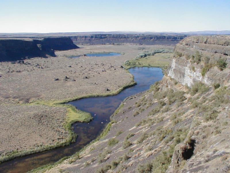
Grand Coulee is an ancient, 60-mile-long river bed in Washington State, U.S., bisected by Dry Falls into the Upper and Lower Grand Coulee. This immense geological feature was primarily carved by catastrophic glacial floods originating from Glacial Lake Missoula during the Pleistocene epoch, a process that stripped away soil and carved deep canyons. Today, the Upper Grand Coulee serves as Banks Lake, a vital part of the Columbia Basin Project for irrigation and recreation.

Moses Coulee
Moses Coulee is a significant canyon located in the Waterville Plateau region of Douglas County, Washington. It is the second-largest and westernmost canyon of the Channeled Scablands, believed to have been carved by immense glacial outburst floods during past ice ages, with discharges exceeding 600,000 m3/s. The coulee's formation is attributed to glacial meltwaters, though the precise origins and age of these floods remain debated among researchers, with theories pointing to floods from glacial Lake Missoula or subglacial floods from the Okanogan Lobe.
Hells Canyon
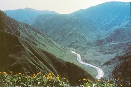
Hells Canyon is North America's deepest river gorge, carved by the Snake River along the borders of Oregon, Idaho, and Washington. Its dramatic landscape features immense depth and a diverse geological history spanning millions of years, from ancient volcanoes to basalt lava flows. The canyon is a significant natural area, offering abundant recreational opportunities and holding historical importance for indigenous tribes and early explorers.