
Mather Gorge
River Canyon·North America·Potomac River
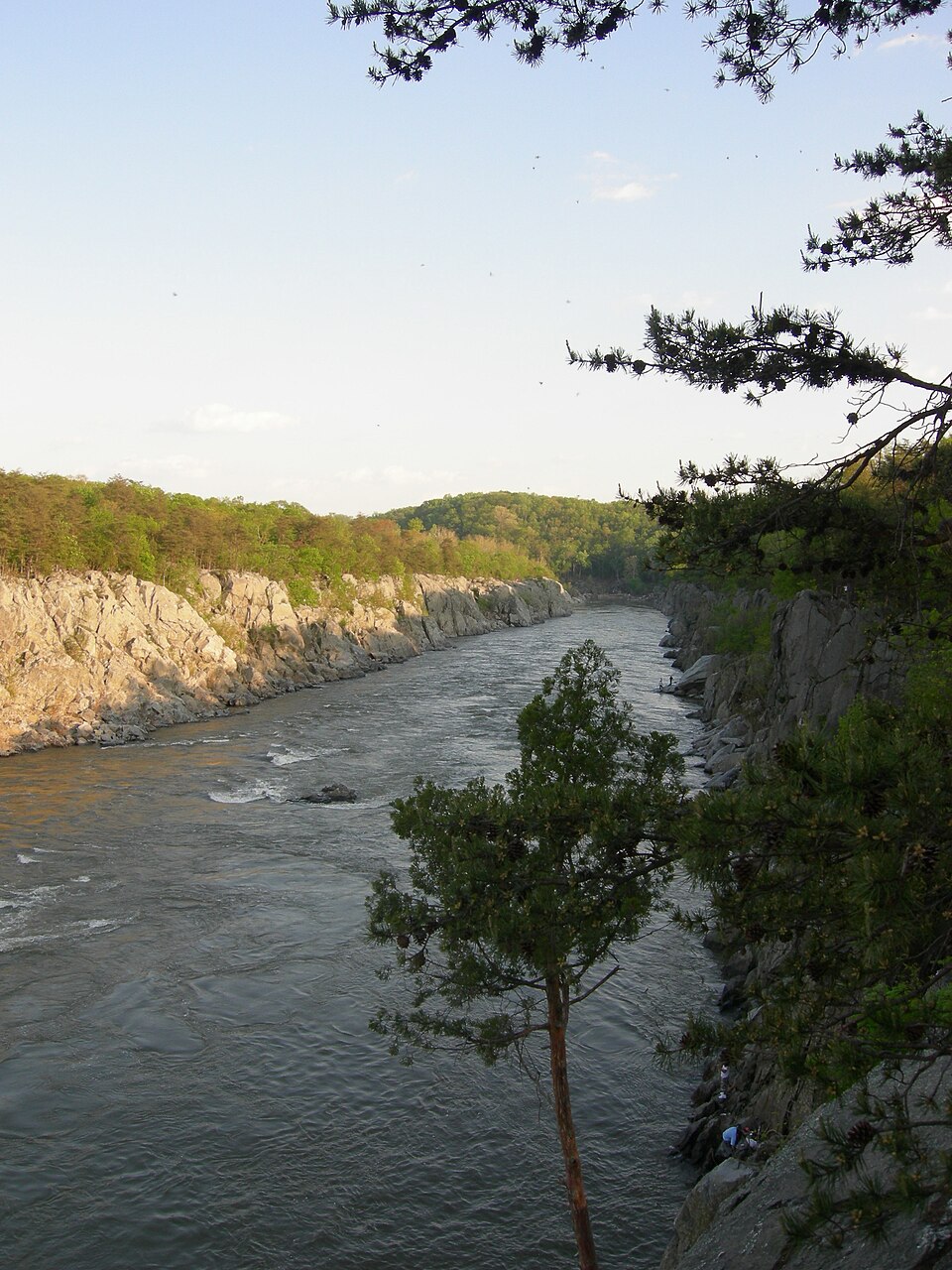
Mather Gorge is a significant river gorge located south of Great Falls on the Potomac River, bordering Maryland and Virginia. It is carved by the Potomac River and characterized by steep, cliff-lined walls, becoming tree-lined bluffs towards its southern end as it widens into the Potomac Gorge. Named after Stephen Mather, the first director of the National Park Service, the gorge is a popular destination for outdoor recreation, including hiking, rock climbing, and whitewater kayaking.
Key Facts
- ›Bordered by Bear Island (Maryland side) and Great Falls Park (Virginia side).
- ›Part of the Chesapeake and Ohio Canal National Historical Park (Maryland) and Great Falls Park (Virginia).
- ›Named after Stephen Mather, the first director of the National Park Service.
- ›Characterized by cliffs, transitioning to tree-lined bluffs at its southern end.
- ›Features Class I to Class VI whitewater rapids from Great Falls to Difficult Run Rapids.
- ›Popular for hiking, rock climbing, whitewater kayaking, and canoeing.
River Erosion
Cliffs, Tree-Lined Bluffs, Fall Line Crossing
Tree-Lined Bluffs
About Mather Gorge
Mather Gorge is a prominent river gorge carved by the Potomac River, situated just south and downriver of Great Falls. It forms a natural boundary between the state of Maryland and the Commonwealth of Virginia. The Maryland side of the gorge is encompassed by Bear Island, a part of the Chesapeake and Ohio Canal National Historical Park, while the Virginia side is within the boundaries of Great Falls Park. Both of these parks are administered by the National Park Service.
The gorge is named in honor of Stephen Mather, who was instrumental as the first director of the National Park Service, highlighting its connection to protected natural landscapes.
Geology and Formation
The Potomac River is the primary agent responsible for the formation of Mather Gorge, with its erosive power cutting through the landscape over time. The gorge is largely characterized by steep, imposing cliffs that line both sides of the river. As the gorge progresses southward, these dramatic cliffs gradually transform into more gentle, tree-lined bluffs. This transition marks the widening of the gorge into the broader Potomac Gorge. A significant geological event occurs near Little Falls, where the Potomac River crosses the Fall Line, transitioning from the Appalachian Piedmont region into the Atlantic Coastal Plain.
Recreation and Activities
Mather Gorge is a highly sought-after destination for a variety of outdoor recreational pursuits. Hiking is a particularly popular activity, with numerous trails offering scenic views. On the Maryland side, within the C&O Canal National Historical Park, Section A of the Billy Goat Trail closely follows the gorge from below Great Falls to the Anglers Inn river access point. The River Trail in Great Falls Park provides similar access and vistas on the Virginia side.
The gorge's dramatic terrain also makes it a prime location for rock climbing. The vertical cliffs, especially on the Virginia side below the Observation Decks and above a sharp 90-degree bend in the river, are well-suited for top-rope climbing. For those seeking aquatic adventures, whitewater kayaking and canoeing are extremely popular. The stretch of the gorge from Great Falls down to the Difficult Run Rapids features a challenging sequence of whitewater rapids, classified from Class I to Class VI, including distinct sections like the Maryland Chute, Virginia Chute, and Center Chute.
Source: Wikipedia ↗
Frequently Asked Questions
Where is Mather Gorge located?
Mather Gorge is situated south and downriver of Great Falls, along the border of Maryland and Virginia. The Maryland side is part of the Chesapeake and Ohio Canal National Historical Park, while the Virginia side is within Great Falls Park.
What geological features define Mather Gorge?
The gorge is primarily defined by steep, cliff-lined walls carved by the Potomac River. Towards its southern end, these cliffs transition into tree-lined bluffs as the gorge widens into the larger Potomac Gorge. The Potomac River crosses the Fall Line as it exits the Appalachian Piedmont and enters the Atlantic Coastal Plain near Little Falls.
What activities can be enjoyed at Mather Gorge?
Mather Gorge is a popular destination for a variety of outdoor activities. Hiking is common on trails like the Billy Goat Trail (Maryland side) and the River Trail (Virginia side). The gorge also offers opportunities for rock climbing, particularly on the vertical cliffs of the Virginia side, and is well-known for whitewater kayaking and canoeing with rapids ranging from Class I to Class VI.
What is the significance of Mather Gorge's name?
The gorge is named in honor of Stephen Mather, who served as the first director of the National Park Service. His role in establishing and shaping the National Park Service is recognized by this naming.
What kind of whitewater can be found in Mather Gorge?
Mather Gorge contains a range of whitewater rapids, classified from Class I to Class VI. These rapids extend from Great Falls down to the Difficult Run Rapids, encompassing sections known as the Maryland Chute, Virginia Chute, and Center Chute.
Related Canyons

Big Bend National Park
Big Bend National Park is a vast protected area in West Texas, notable for its extensive Chihuahuan Desert topography and ecology. Formed by the erosive power of the Rio Grande and significant geological uplift, the park preserves a rich tapestry of life, including over 1,200 plant species and hundreds of animal species, as well as ancient fossils and diverse rock formations. Its remote location and dramatic landscapes, including the Chisos Mountains and deep river canyons, make it a significant destination for naturalists and adventurers.
Big South Fork of the Cumberland River
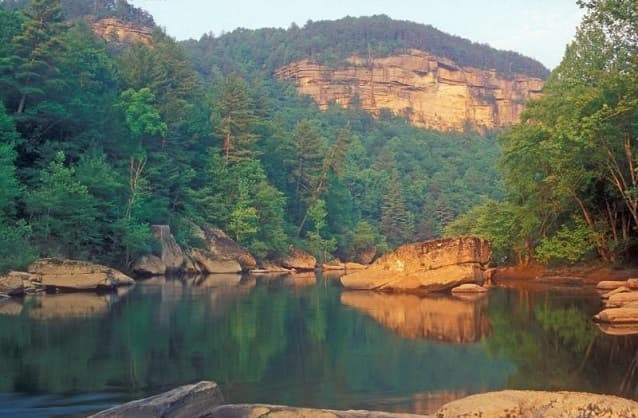
The Big South Fork of the Cumberland River is a significant river system in Tennessee and Kentucky, carved into the Cumberland Plateau. This 76-mile waterway is characterized by rugged terrain with deep gorges, natural arches, and rock shelters, and is the central feature of the Big South Fork National River and Recreation Area. Its formation by river erosion has created a diverse ecosystem and a popular destination for outdoor recreation.

Black Canyon of the Gunnison
The Black Canyon of the Gunnison is a dramatic gorge in western Colorado, carved by the Gunnison River. Its name derives from the fact that its sheer walls receive very little sunlight, often appearing black. The canyon is renowned for its extreme depth, steepness, and narrowness, combining these features into a formidable and awe-inspiring landscape.