
Mckittrick Canyon
Mckittrick Canyon is a significant geological and ecological feature located in the Guadalupe Mountains of West Texas and Eddy County, New Mexico. Its towering walls create a protected riparian oasis within the arid Chihuahuan Desert, supporting a unique blend of desert and deciduous flora. The canyon is renowned for its scenic beauty, particularly its vibrant autumn foliage, and holds historical importance due to its past ownership by petroleum geologist Wallace Pratt.
Key Facts
- ›The canyon features a riparian oasis that contrasts sharply with the surrounding Chihuahuan Desert.
- ›It is primarily managed as a day-use area within Guadalupe Mountains National Park.
- ›The canyon's vegetation transitions from desert species at the lower elevations to deciduous trees like maple and oak further up.
- ›Wallace Pratt, a petroleum geologist, once owned a significant portion of the canyon and donated it to the National Park Service.
- ›A portion of Mckittrick Canyon was listed on the National Register of Historic Places for its archeological importance.
- ›The canyon is accessible via a gated side road from U.S. Route 62/180.

River Erosion
Riparian Oasis, Wallace Pratt Lodge, the Notch
Chihuahuan Desert Flora, Riparian Vegetation, Deciduous Trees
About Mckittrick Canyon
Mckittrick Canyon is a prominent geological and ecological feature situated within the Guadalupe Mountains, straddling the border of West Texas and Eddy County, New Mexico. Its imposing, steep walls serve to shield a vibrant riparian oasis, creating a unique and verdant sanctuary amidst the arid expanse of the Chihuahuan Desert.
Formation and Geography
The canyon's formation is primarily attributed to river erosion, carving its distinctive path through the mountainous terrain. While the majority of McKittrick Canyon falls within Guadalupe Mountains National Park, it is managed as a separate, day-use area with restricted visitation hours, distinct from the main park boundaries. A significant portion of North McKittrick Canyon extends into the Guadalupe Ranger District of the Lincoln National Forest in New Mexico.
Flora and Ecology
The canyon's ecosystem showcases a remarkable transition in vegetation. The lower reaches are characterized by typical Chihuahuan Desert flora, including various species of yucca, agave, ocotillo, and cacti. As the canyon ascends, the presence of a clear, flowing stream supports a denser riparian environment. Here, deciduous trees such as oak, ash, and bigtooth maple flourish, creating a stunning display of color during the autumn months, which stands in vivid contrast to the surrounding desert landscape.
Historical Significance
Mckittrick Canyon holds historical importance, notably through its association with Wallace Everette Pratt (1885–1981). Pratt, a prominent petroleum geologist, once owned a considerable tract of the canyon. In 1959, he generously donated 4,988 acres of his ranch to the National Park Service. This pivotal donation contributed significantly to the eventual establishment of Guadalupe Mountains National Park, which was formally dedicated and opened to the public in 1972.
Accessibility and Features
Access to McKittrick Canyon is facilitated by a 4.2-mile (6.8 km) gated side road leading from U.S. Route 62/180. This road terminates at a parking area, complete with restroom facilities and a visitor center often staffed by volunteers. The McKittrick Canyon Trail begins at the visitor center, initially following a dry stream bed and crossing it multiple times. After approximately 2.4 miles (3.9 km), the trail reaches the Wallace Pratt Lodge. Further exploration involves a steeper ascent via switchbacks, climbing nearly 2,000 feet (610 m) over two miles (3.2 km) to reach 'the Notch,' an elevated point offering expansive views.
Recognition
Reflecting its cultural and historical value, a portion of McKittrick Canyon was recognized for its archeological importance and listed on the National Register of Historic Places on September 26, 1991.
Source: Wikipedia ↗
Frequently Asked Questions
What is McKittrick Canyon?
McKittrick Canyon is a scenic canyon located in the Guadalupe Mountains of West Texas and New Mexico. It is known for its steep walls that protect a rich riparian oasis, offering a striking contrast to the surrounding Chihuahuan Desert environment.
How is McKittrick Canyon accessed?
Access to McKittrick Canyon is provided by a 4.2-mile (6.8 km) gated side road originating from U.S. Route 62/180. This road leads to a parking area, visitor center, and restroom facilities managed by the National Park Service.
What kind of vegetation can be found in McKittrick Canyon?
The vegetation varies with elevation. At lower elevations, typical Chihuahuan Desert plants like yucca, agave, and cacti are prevalent. As one ascends, a flowing stream supports more abundant riparian vegetation, including deciduous trees such as oak, ash, and bigtooth maple.
What is the significance of Wallace Pratt to McKittrick Canyon?
Wallace Pratt, a petroleum geologist, once owned a substantial portion of McKittrick Canyon. In 1959, he donated nearly 5,000 acres of his ranch to the National Park Service, contributing significantly to the establishment of Guadalupe Mountains National Park.
Is McKittrick Canyon a good place to visit in the fall?
Yes, McKittrick Canyon is particularly vibrant in the fall. The deciduous trees, such as maple and hardwood, display bright colors as their foliage changes, creating a stunning visual display against the desert landscape.
What are some notable features or landmarks within McKittrick Canyon?
A notable feature is the Wallace Pratt Lodge, built by the former owner. The canyon trail also leads to a high point known as 'the Notch,' offering panoramic views of the canyon and surrounding desert.
Related Canyons

Big Bend National Park
Big Bend National Park is a vast protected area in West Texas, notable for its extensive Chihuahuan Desert topography and ecology. Formed by the erosive power of the Rio Grande and significant geological uplift, the park preserves a rich tapestry of life, including over 1,200 plant species and hundreds of animal species, as well as ancient fossils and diverse rock formations. Its remote location and dramatic landscapes, including the Chisos Mountains and deep river canyons, make it a significant destination for naturalists and adventurers.
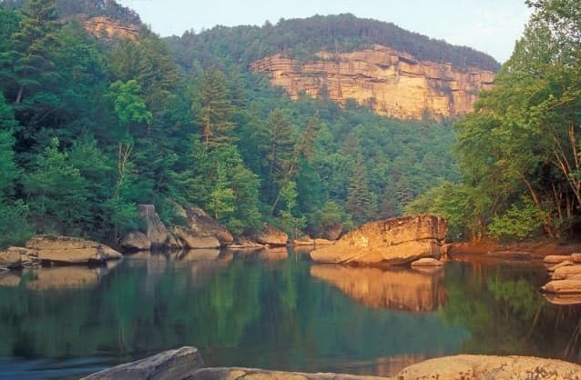
Big South Fork of the Cumberland River
The Big South Fork of the Cumberland River is a significant river system in Tennessee and Kentucky, carved into the Cumberland Plateau. This 76-mile waterway is characterized by rugged terrain with deep gorges, natural arches, and rock shelters, and is the central feature of the Big South Fork National River and Recreation Area. Its formation by river erosion has created a diverse ecosystem and a popular destination for outdoor recreation.

Black Canyon of the Gunnison
The Black Canyon of the Gunnison is a dramatic gorge in western Colorado, carved by the Gunnison River. Its name derives from the fact that its sheer walls receive very little sunlight, often appearing black. The canyon is renowned for its extreme depth, steepness, and narrowness, combining these features into a formidable and awe-inspiring landscape.