
Mississippi Gorge
River Canyon·North America·Mississippi River·Sandstone, Limestone, Shale
Mississippi Gorge is a unique river gorge located along the Mississippi River in Minneapolis and Saint Paul, Minnesota, representing the only true gorge along the entire river's length. Formed over thousands of years by the retreat of St. Anthony Falls, it features bluffs rising up to 150 feet and is a vital natural area within an urban setting, appreciated for its semi-wild character and recreational opportunities.
Key Facts
- ›The only true gorge along the entire 2,320-mile length of the Mississippi River.
- ›Bluffs within the gorge can rise as high as 150 feet (46 M).
- ›Formed by the gradual retreat of St. Anthony Falls (formerly River Warren Falls).
- ›The gorge area is part of the Mississippi National River and Recreation Area.
- ›Popular for hiking, biking, birdwatching, and photography.
- ›Protected land is managed by Minneapolis Park and Recreation Board and Saint Paul Park and Recreation Department.

River Erosion, Waterfall Retreat
- St. Anthony Falls
- Mississippi National River and Recreation Area
- Bluffs Up To 150 Feet High
- Oak Savanna Restoration
- Works Progress Administration Structures
- East River Parkway
- West River Parkway
- Winchell Trail
Migratory Birds, Bald Eagles
Oak Savanna, Floodplain Forest, Sugar Maples
About Mississippi Gorge
Mississippi Gorge is a significant natural landmark situated along the Mississippi River, spanning parts of both Minneapolis and Saint Paul in Minnesota. It is distinguished as the only true gorge found along the entire 2,320-mile length of the Mississippi River. The gorge's formation is attributed to the slow, persistent retreat of the St. Anthony Falls (formerly River Warren Falls) over thousands of years, a process that eroded softer sandstone and caused harder limestone and shale layers to collapse into the valley. This geological history has sculpted bluffs that can rise as high as 150 feet.
Formation and Geology
The unique topography of Mississippi Gorge is a direct result of the waterfall's retreat. As the falls moved upstream, the river carved deeper into the bedrock. The differential erosion of rock layers—softer sandstone giving way while harder limestone and shale collapsed—created the steep walls characteristic of a gorge. The river through this segment was historically a series of rapids until the early 1900s when commercial navigation led to the installation of locks and dams.
Conservation and Designation
Recognizing its natural value, a 72-mile corridor of the Mississippi through the Twin Cities was designated a critical natural resource area in 1972. This designation was further bolstered in 1998 when the United States Congress established the Mississippi National River and Recreation Area, encompassing the gorge and bringing federal recognition and support. The land within the gorge is managed as public parkland by the respective city park departments, with ongoing efforts to enhance its ecological health through partnerships and restoration projects, such as the oak savanna restoration near East 36th Street.
Recreation and Accessibility
Mississippi Gorge Regional Park is a highly visited area, drawing millions of visitors annually. It is a popular destination for outdoor recreation, offering extensive hiking and biking paths along the bluffs and riverbanks, including the East River and West River parkways, which are part of the Grand Rounds National Scenic Byway. The park provides access to the river for activities like fishing and boating, with canoe and kayak launch points available. The Winchell Trail offers a more rustic hiking experience through floodplain forest and oak savanna. In winter, the trails are used for snowshoeing and cross-country skiing. The gorge's abundance of sugar maples contribute to scenic fall foliage, and it serves as a habitat for numerous bird species, including bald eagles. While mountain biking is restricted on natural surface trails to prevent erosion, the park offers a rich natural experience within an urban environment.
Source: Wikipedia ↗
Frequently Asked Questions
How was Mississippi Gorge formed?
Mississippi Gorge was formed over thousands of years as the St. Anthony Falls, also known as River Warren Falls, gradually retreated. This process caused softer sandstone layers to erode, leading to the collapse of harder limestone and shale layers into the valley.
What are the main activities available in Mississippi Gorge Regional Park?
The park is popular for hiking and biking on paths along the bluffs and riverbanks. Visitors also enjoy birdwatching, photography, and in winter, snowshoeing and cross-country skiing. Boating and kayaking are also possible on the Mississippi River segment that flows through the gorge.
Is Mississippi Gorge accessible to the public?
Yes, Mississippi Gorge Regional Park is a publicly accessible area managed by the cities of Minneapolis and Saint Paul. It features numerous trails, parkways, and access points for visitors to enjoy the natural scenery and recreational opportunities.
What is significant about Mississippi Gorge compared to the rest of the Mississippi River?
Mississippi Gorge is significant because it is the only true gorge found along the entire 2,320-mile length of the Mississippi River. This unique geological feature creates steep bluffs and a distinct natural environment within an urban setting.
What kind of wildlife can be found in Mississippi Gorge?
The gorge provides habitat for a variety of wildlife, including at least 150 species of migratory birds and a growing population of bald eagles. The floodplain forest and oak savanna areas also support diverse ecosystems.
Related Canyons

Bad Rock Canyon
Bad Rock Canyon is a river canyon located east of Columbia Falls, Montana, through which the Flathead River flows. Historically, it served as a significant buffalo trail for various indigenous tribes and later became a gateway to wilderness areas like the Bob Marshall Wilderness and Glacier National Park. The canyon is also known for frequent rock slides that impact the adjacent BNSF Railway tracks.

Big Bend National Park
Big Bend National Park is a vast protected area in West Texas, notable for its extensive Chihuahuan Desert topography and ecology. Formed by the erosive power of the Rio Grande and significant geological uplift, the park preserves a rich tapestry of life, including over 1,200 plant species and hundreds of animal species, as well as ancient fossils and diverse rock formations. Its remote location and dramatic landscapes, including the Chisos Mountains and deep river canyons, make it a significant destination for naturalists and adventurers.
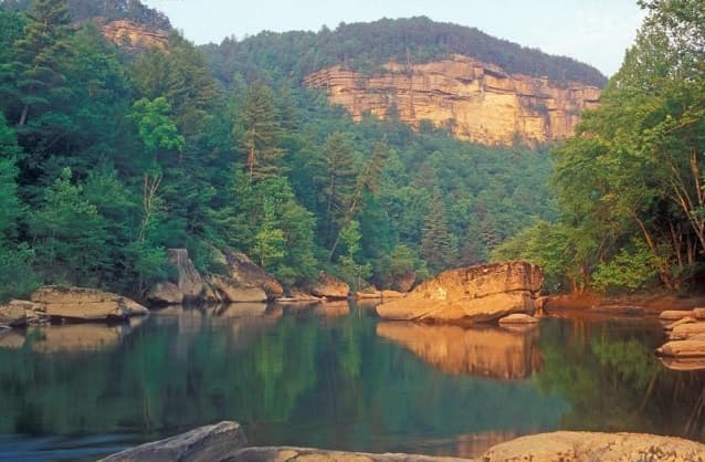
Big South Fork of the Cumberland River
The Big South Fork of the Cumberland River is a significant river system in Tennessee and Kentucky, carved into the Cumberland Plateau. This 76-mile waterway is characterized by rugged terrain with deep gorges, natural arches, and rock shelters, and is the central feature of the Big South Fork National River and Recreation Area. Its formation by river erosion has created a diverse ecosystem and a popular destination for outdoor recreation.