
Mistaya Canyon
River Canyon·Canada·Paleozoic·Mistaya River
Mistaya Canyon is a narrow, deep canyon carved by the Mistaya River in Banff National Park, Alberta, Canada. Located along the Icefields Parkway, it is a roadside attraction showcasing post-glacial river erosion through Paleozoic carbonate rocks. The canyon is known for its steep walls and the potholes formed by the powerful river flow.
Key Facts
- ›Carved by the Mistaya River in Banff National Park.
- ›Located along the Icefields Parkway (Highway 93 North).
- ›Incised into Paleozoic carbonate rocks, primarily limestone and dolostone.
- ›Features a deep, narrow channel with steep walls and potholes.
- ›Accessible via a short walking trail from a parking area.
- ›Part of a glacially modified valley system re-incised by modern river flow.

River Erosion, Glacial Erosion
Deep, Narrow Channel, Steep Walls, Potholes
About Mistaya Canyon
Mistaya Canyon is a striking natural feature located within Banff National Park in Alberta, Canada. Carved by the persistent flow of the Mistaya River, this canyon is renowned for its deep, narrow gorge and steep walls, showcasing the power of post-glacial river erosion.
Geography and Formation
The canyon lies along the scenic Icefields Parkway (Highway 93 North), near where the Mistaya River joins the North Saskatchewan River. The surrounding mountainous terrain bears the distinct marks of past glaciation. Mistaya Canyon itself was incised into the landscape following the retreat of glaciers, as the Mistaya River re-established its course through the glacially modified valley system.
Geology
The geological composition of Mistaya Canyon is primarily Paleozoic carbonate rocks, including limestone and dolostone units native to Alberta's Rockies and the Western Canadian Sedimentary Basin. Erosion has been guided by natural structural features like fractures and bedding planes within these rocks. This process has sculpted the canyon's characteristic narrow profile, sheer walls, and the formation of intriguing potholes, which are hollows worn into the rock by the swirling action of water and debris.
Accessibility and Significance
Mistaya Canyon serves as a popular roadside attraction, drawing visitors with its dramatic scenery. A short walking trail from a dedicated parking area provides convenient access to viewpoints overlooking the canyon, making it a readily explorable natural wonder for travelers along the Icefields Parkway.
Source: Wikipedia ↗
Frequently Asked Questions
Where is Mistaya Canyon located?
Mistaya Canyon is situated in Banff National Park, in the province of Alberta, Canada. It is accessible from the Icefields Parkway (Highway 93 North) near the confluence of the Mistaya and North Saskatchewan rivers.
How was Mistaya Canyon formed?
The canyon was primarily formed by post-glacial river erosion from the Mistaya River. It is incised into Paleozoic carbonate rocks within a valley system that was previously shaped by glaciation.
What kind of rocks are found in Mistaya Canyon?
Mistaya Canyon's walls are composed mainly of Paleozoic carbonate rocks, specifically limestone and dolostone units. These rocks have been influenced by regional geological processes.
What are the notable geological features of Mistaya Canyon?
The canyon is characterized by its deep, narrow channel and steep walls. Structural features like fractures and bedding planes guide the erosion, leading to the formation of potholes.
Is Mistaya Canyon easy to access?
Yes, Mistaya Canyon is a roadside attraction that is easily accessible via a short walking trail leading from a nearby parking area off the Icefields Parkway.
Related Canyons

Despeñaperros
Despeñaperros is a significant gorge in Jaén, Spain, carved by the Despeñaperros river. Its steep walls, some over 500 meters high, are composed of ancient Armorican quartzite, revealing millions of years of geological history. Historically, it has served as a crucial natural pass connecting Andalusia with the rest of Spain, a role it continues to fulfill today as a major transportation route.
Titus Canyon
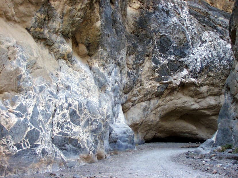
Titus Canyon is a deep, narrow gorge situated in the Grapevine Mountains within Death Valley National Park, straddling the border of California and Nevada. Its formation is a result of geological processes that uplifted ancient limestone layers, which were subsequently carved by erosion. The canyon is significant for its unique geological formations, ancient petroglyphs left by indigenous peoples, and its desert ecosystem, making it a notable natural and historical site.

Gulf Hagas
Gulf Hagas is a significant gorge in the northern Maine woods, often called the "Grand Canyon of Maine." Carved by the West Branch of the Pleasant River, its three-mile length features vertically walled slate and numerous waterfalls, with walls reaching up to 130 feet. Designated a National Natural Landmark, it is a popular destination for hiking and challenging whitewater kayaking.